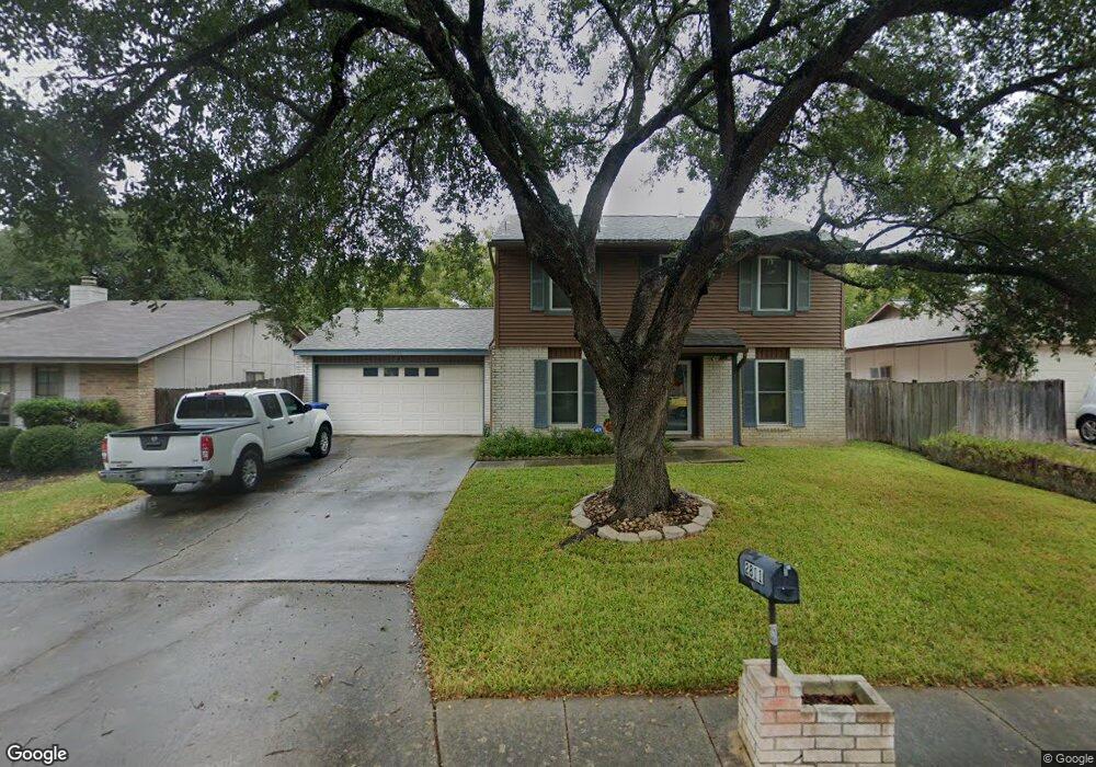
2811 Burning Log St San Antonio, TX 78247
Thousand Oaks NeighborhoodEstimated Value: $298,000 - $323,000
3
Beds
3
Baths
1,814
Sq Ft
$171/Sq Ft
Est. Value
About This Home
This home is located at 2811 Burning Log St, San Antonio, TX 78247 and is currently estimated at $310,690, approximately $171 per square foot. 2811 Burning Log St is a home located in Bexar County with nearby schools including Wetmore Elementary School, Driscoll Middle School, and MacArthur High School.
Create a Home Valuation Report for This Property
The Home Valuation Report is an in-depth analysis detailing your home's value as well as a comparison with similar homes in the area
Home Values in the Area
Average Home Value in this Area
Tax History Compared to Growth
Tax History
| Year | Tax Paid | Tax Assessment Tax Assessment Total Assessment is a certain percentage of the fair market value that is determined by local assessors to be the total taxable value of land and additions on the property. | Land | Improvement |
|---|---|---|---|---|
| 2025 | $2,422 | $308,881 | $68,110 | $242,990 |
| 2024 | $2,422 | $280,801 | $68,110 | $236,280 |
| 2023 | $2,422 | $255,274 | $68,110 | $226,890 |
| 2022 | $5,726 | $232,067 | $54,790 | $201,740 |
| 2021 | $5,390 | $210,970 | $44,640 | $166,330 |
| 2020 | $5,335 | $205,720 | $42,340 | $163,380 |
| 2019 | $5,246 | $196,980 | $29,340 | $167,640 |
| 2018 | $4,952 | $185,460 | $29,340 | $156,120 |
| 2017 | $4,723 | $175,266 | $29,340 | $145,930 |
| 2016 | $4,294 | $159,333 | $29,340 | $130,990 |
| 2015 | $3,421 | $144,848 | $22,780 | $129,970 |
| 2014 | $3,421 | $131,680 | $0 | $0 |
Source: Public Records
Map
Nearby Homes
- 2806 Burning Trail St
- 2818 Burning Rock St
- 2843 Burning Hill St
- 14102 Red Maple St
- 2822 Old Field Dr
- 2919 Abercorn Dr
- 14201 Modesta Place
- 2718 Old Field Dr Unit 502
- 14322 Pembridge Dr
- 2675 Chestnut Bend
- 2658 Chestnut Bend
- 15202 Rompel Trail Dr
- 13323 Magnolia Brook
- 1802 Shoal Run St
- 14714 Bending Point
- 11 Viking Oak
- 12206 Stoney Pond
- 3003 Cassowary Hill
- 14318 Markham Ln
- 3043 Solitaire Hill
- 2807 Burning Log St
- 2815 Burning Log St
- 2819 Burning Log St
- 2810 Burning Hill St
- 2803 Burning Log St
- 2814 Burning Hill St
- 2810 Burning Log St
- 2806 Burning Log St
- 2814 Burning Log St
- 2818 Burning Hill St
- 2802 Burning Hill St
- 2823 Burning Log St
- 2818 Burning Log St
- 2802 Burning Log St
- 2822 Burning Hill St
- 2827 Burning Log St
- 13943 Little Leaf Dr
- 13939 Little Leaf Dr
- 13947 Little Leaf Dr
- 2811 Burning Rock St