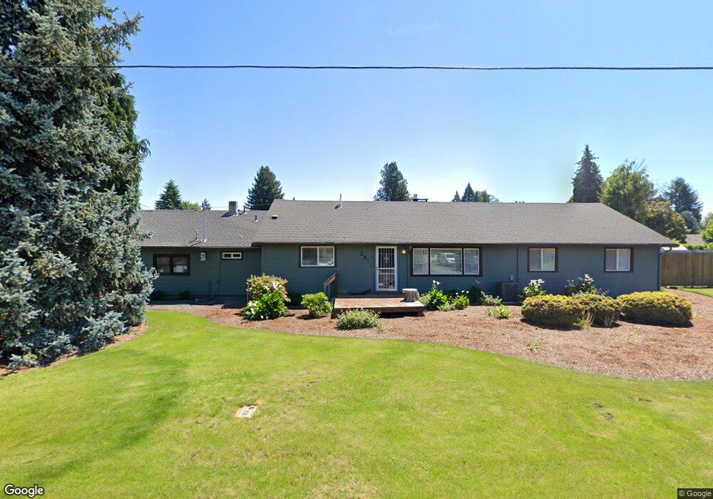
2811 La Darrah St Eugene, OR 97404
Santa Clara NeighborhoodEstimated Value: $506,000 - $608,000
3
Beds
2
Baths
1,759
Sq Ft
$316/Sq Ft
Est. Value
About This Home
This home is located at 2811 La Darrah St, Eugene, OR 97404 and is currently estimated at $555,744, approximately $315 per square foot. 2811 La Darrah St is a home located in Lane County with nearby schools including Spring Creek Elementary School, Madison Middle School, and North Eugene High School.
Ownership History
Date
Name
Owned For
Owner Type
Purchase Details
Closed on
Nov 16, 2022
Sold by
Olson Family Trust
Bought by
Donovan Wayne and Donovan Teresa L
Current Estimated Value
Home Financials for this Owner
Home Financials are based on the most recent Mortgage that was taken out on this home.
Original Mortgage
$255,000
Outstanding Balance
$247,093
Interest Rate
6.95%
Mortgage Type
New Conventional
Estimated Equity
$308,651
Purchase Details
Closed on
Mar 9, 2020
Sold by
Olson Michael F and Olson Connie J
Bought by
Olson Michael F and Olson Connie J
Home Financials for this Owner
Home Financials are based on the most recent Mortgage that was taken out on this home.
Original Mortgage
$255,000
Interest Rate
3.5%
Mortgage Type
New Conventional
Purchase Details
Closed on
Sep 1, 2016
Sold by
Graves Virginia M
Bought by
Olson Michael F and Olson Connie J
Create a Home Valuation Report for This Property
The Home Valuation Report is an in-depth analysis detailing your home's value as well as a comparison with similar homes in the area
Home Values in the Area
Average Home Value in this Area
Purchase History
| Date | Buyer | Sale Price | Title Company |
|---|---|---|---|
| Donovan Wayne | $580,000 | Cascade Title | |
| Olson Michael F | -- | Western Title & Escrow | |
| Olson Michael F | $242,000 | Western Title & Escrow Co |
Source: Public Records
Mortgage History
| Date | Status | Borrower | Loan Amount |
|---|---|---|---|
| Open | Donovan Wayne | $255,000 | |
| Previous Owner | Olson Michael F | $255,000 |
Source: Public Records
Tax History
| Year | Tax Paid | Tax Assessment Tax Assessment Total Assessment is a certain percentage of the fair market value that is determined by local assessors to be the total taxable value of land and additions on the property. | Land | Improvement |
|---|---|---|---|---|
| 2025 | $3,629 | $283,570 | -- | -- |
| 2024 | $3,611 | $275,311 | -- | -- |
| 2023 | $3,611 | $267,293 | -- | -- |
| 2022 | $3,393 | $259,508 | $0 | $0 |
| 2021 | $3,114 | $251,950 | $0 | $0 |
| 2020 | $3,172 | $244,612 | $0 | $0 |
| 2019 | $3,054 | $237,488 | $0 | $0 |
| 2018 | $2,779 | $206,098 | $0 | $0 |
| 2017 | $2,487 | $206,098 | $0 | $0 |
| 2016 | $2,094 | $200,095 | $0 | $0 |
| 2015 | $1,972 | $194,267 | $0 | $0 |
| 2014 | $1,863 | $188,609 | $0 | $0 |
Source: Public Records
Map
Nearby Homes
- 2721 La Darrah St
- 2563 York St
- 349 Irving Rd
- 805 Impala Ave
- 541 Durham Ave
- 3256 Marvin Dr
- 200 Irving Rd
- 303 Lenore Loop
- 215 Jonquil Ave
- 374 Blackfoot Ave
- 2488 Northampton
- 2987 Dry Creek Rd
- 2418 Kalmia St
- 193 Santa Clara Ave
- 2965 Teal Place
- 2439 Quince St
- 2931 Shelby Way
- 401 Sterling Dr
- 190 River Loop 1
- 2610 Crowther Dr
- 2789 La Darrah St
- 2800 Shirley St
- 2810 Shirley St
- 535 Loy Ave
- 2796 La Darrah St
- 2780 La Darrah St
- 2784 Shirley St
- 525 Loy Ave
- 2752 La Darrah St
- 2749 La Darrah St
- 2820 Shirley St
- 2750 Shirley St
- 575 Loy Ave
- 2842 Shirley St
- 2750 La Darrah St
- 2838 Shirley St
- 2854 Shirley St
- 2809 Crocker Rd
- 683 Loy Ave
- 2745 La Darrah St
Your Personal Tour Guide
Ask me questions while you tour the home.