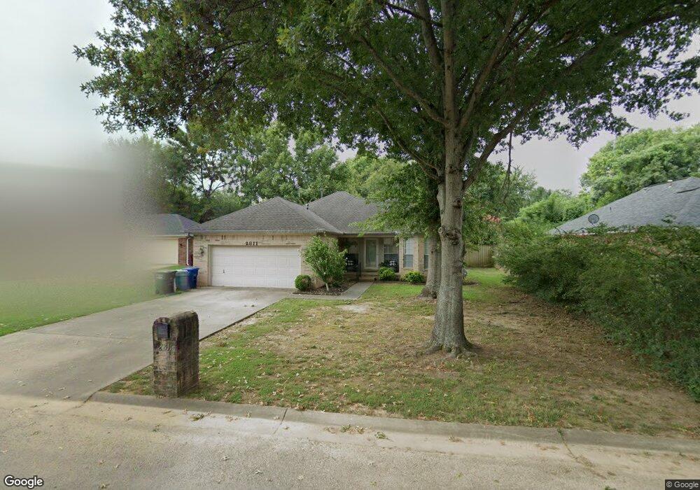
2811 Westport Cir Conway, AR 72034
Southwest Conway NeighborhoodEstimated Value: $211,000 - $222,000
3
Beds
2
Baths
1,372
Sq Ft
$157/Sq Ft
Est. Value
About This Home
This home is located at 2811 Westport Cir, Conway, AR 72034 and is currently estimated at $215,407, approximately $157 per square foot. 2811 Westport Cir is a home located in Faulkner County with nearby schools including Marguerite Vann Elementary School, Carl Stuart Middle School, and Conway Junior High School.
Ownership History
Date
Name
Owned For
Owner Type
Purchase Details
Closed on
Mar 27, 2017
Sold by
Korynta Chris and Korynta Carmen
Bought by
Windsor James and Windsor Eva
Current Estimated Value
Home Financials for this Owner
Home Financials are based on the most recent Mortgage that was taken out on this home.
Original Mortgage
$132,000
Outstanding Balance
$109,461
Interest Rate
4.17%
Mortgage Type
Future Advance Clause Open End Mortgage
Estimated Equity
$105,946
Purchase Details
Closed on
Jan 7, 2012
Sold by
Flory Michael J and Flory Colleen E
Bought by
Korynta Chirs and Korynta Carmen
Purchase Details
Closed on
Apr 10, 2008
Bought by
Flory
Purchase Details
Closed on
Sep 16, 1997
Bought by
Monroe
Purchase Details
Closed on
Nov 14, 1990
Purchase Details
Closed on
Aug 9, 1990
Purchase Details
Closed on
Mar 28, 1990
Bought by
Jones
Create a Home Valuation Report for This Property
The Home Valuation Report is an in-depth analysis detailing your home's value as well as a comparison with similar homes in the area
Home Values in the Area
Average Home Value in this Area
Purchase History
| Date | Buyer | Sale Price | Title Company |
|---|---|---|---|
| Windsor James | $122,500 | Waco Title Company Conway | |
| Korynta Chirs | $118,242 | None Available | |
| Flory | $118,000 | -- | |
| Flory Michael J | $118,121 | Conway Title Svcs & Escrow I | |
| Monroe | $78,000 | -- | |
| -- | $65,000 | -- | |
| -- | -- | -- | |
| Jones | -- | -- |
Source: Public Records
Mortgage History
| Date | Status | Borrower | Loan Amount |
|---|---|---|---|
| Open | Windsor James | $132,000 |
Source: Public Records
Tax History Compared to Growth
Tax History
| Year | Tax Paid | Tax Assessment Tax Assessment Total Assessment is a certain percentage of the fair market value that is determined by local assessors to be the total taxable value of land and additions on the property. | Land | Improvement |
|---|---|---|---|---|
| 2025 | $1,511 | $34,590 | $3,600 | $30,990 |
| 2024 | $1,385 | $34,590 | $3,600 | $30,990 |
| 2023 | $1,259 | $24,890 | $3,600 | $21,290 |
| 2022 | $1,259 | $24,890 | $3,600 | $21,290 |
| 2021 | $1,157 | $24,890 | $3,600 | $21,290 |
| 2020 | $1,051 | $20,780 | $3,600 | $17,180 |
| 2019 | $1,051 | $20,780 | $3,600 | $17,180 |
| 2018 | $1,051 | $20,780 | $3,600 | $17,180 |
| 2017 | $1,051 | $20,780 | $3,600 | $17,180 |
| 2016 | $701 | $20,780 | $3,600 | $17,180 |
| 2015 | $1,159 | $22,900 | $3,600 | $19,300 |
| 2014 | $809 | $22,900 | $3,600 | $19,300 |
Source: Public Records
Map
Nearby Homes
- 2759 Carl Stuart St
- 2765 Carl Stuart St
- 2700 Stonebrook Cove
- 13 Oakdale Dr
- Lot 6 Orchard Hill Ph 4
- 7 Red Bud Dr
- 297 Southwick Cove
- 387 Pippinpost Dr
- 207 Fairway Dr
- 3065 Cottontop Rd
- 3107 Stermer Rd
- 1 Manchester Dr
- 00 College Ave
- 3955 College Ave
- 905 Wineberry
- 4690 College Ave
- 12 Chester Cove
- 925 Wineberry
- 3237 College Ave
- 2585 Adamsbrooke Dr
- 2813 Westport Cir
- 2809 Westport Cir
- 2810 Westport Cir
- 2815 Westport Cir
- 2807 Westport Cir
- 2812 Westport Cir
- 0 Westport Cir
- 2808 Westport Cir
- 2880 Carl Stuart St
- 2806 Westport Cir
- 2882 Carl Stuart St
- 2882 Carl Stuart St
- 2814 Westport Cir
- 2817 Westport Cir
- 2816 Westport Cir
- 2819 Westport Cir
- 2765 Eastport Cir
- 2801 Wills Ct
- 2764 Eastport Cir
- 2818 Westport Cir