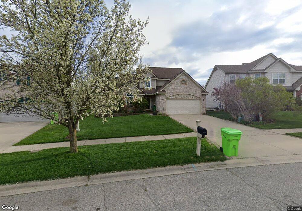
2811 Windside Ct Ann Arbor, MI 48103
Estimated Value: $537,896 - $634,000
3
Beds
3
Baths
2,423
Sq Ft
$242/Sq Ft
Est. Value
About This Home
This home is located at 2811 Windside Ct, Ann Arbor, MI 48103 and is currently estimated at $586,724, approximately $242 per square foot. 2811 Windside Ct is a home located in Washtenaw County with nearby schools including Dicken Elementary School, Slauson Middle School, and Pioneer High School.
Ownership History
Date
Name
Owned For
Owner Type
Purchase Details
Closed on
Mar 31, 2015
Sold by
Bahr Dale C
Bought by
Bahr Dale C and Dale Bahr Revocable Trust
Current Estimated Value
Purchase Details
Closed on
Jul 10, 2014
Sold by
Locher Christopher J and Bahr Michael P
Bought by
Bahr Dale C
Purchase Details
Closed on
Mar 4, 2008
Sold by
Bahr Dale C and Bahr Trudy T
Bought by
Bahr Dale C and Bahr Trudy T
Create a Home Valuation Report for This Property
The Home Valuation Report is an in-depth analysis detailing your home's value as well as a comparison with similar homes in the area
Home Values in the Area
Average Home Value in this Area
Purchase History
| Date | Buyer | Sale Price | Title Company |
|---|---|---|---|
| Bahr Dale C | -- | None Available | |
| Bahr Dale C | -- | None Available | |
| Bahr Dale C | -- | None Available |
Source: Public Records
Tax History
| Year | Tax Paid | Tax Assessment Tax Assessment Total Assessment is a certain percentage of the fair market value that is determined by local assessors to be the total taxable value of land and additions on the property. | Land | Improvement |
|---|---|---|---|---|
| 2025 | $4,591 | $247,800 | $0 | $0 |
| 2024 | $4,481 | $265,000 | $0 | $0 |
| 2023 | $4,306 | $237,200 | $0 | $0 |
| 2022 | $6,035 | $211,800 | $0 | $0 |
| 2021 | $5,739 | $207,400 | $0 | $0 |
| 2020 | $5,876 | $204,000 | $0 | $0 |
| 2019 | $5,429 | $194,900 | $194,900 | $0 |
| 2018 | $5,286 | $182,800 | $0 | $0 |
| 2017 | $5,096 | $184,900 | $0 | $0 |
| 2016 | $3,579 | $140,739 | $0 | $0 |
| 2015 | -- | $140,319 | $0 | $0 |
| 2014 | -- | $135,936 | $0 | $0 |
| 2013 | -- | $135,936 | $0 | $0 |
Source: Public Records
Map
Nearby Homes
- 1968 Harley Ct
- 2667 Oxford Cir
- 1879 Kensington Blvd
- 1649 Chapleau Dr
- 2521 Country Village Ct Unit 8
- 1548 Chapleau Dr Unit 33
- 1631 Dicken Dr
- 1419 N Bay Dr Unit 73
- 1343 Timmins Dr Unit 8
- 1227 Joyce Ln
- 2124 Pauline Blvd Unit 307
- 2205 Runnymede Blvd
- 2132 Pauline Blvd Unit 308
- 1225 S Maple Rd Unit 307
- 2157 Pauline Ct Unit 1
- 2025 Rugby Ct
- 1215 S Maple Rd Unit 202
- 1235 S Maple Rd Unit 101
- 1235 S Maple Rd Unit 302
- 1265 S Maple Rd Unit 206
- 2817 Windside Ct
- 2805 Windside Ct
- 2823 Windside Ct
- 0 Windside Ct
- 1842 Harley Dr
- 1848 Harley Dr
- 2814 Windside Ct
- 1924 Harley Dr
- 1930 Harley Dr
- 2829 Windside Ct
- 1860 Harley Dr
- 2826 Windside Ct
- 1936 Harley Dr
- 1918 Harley Dr
- 1824 Harley Dr
- 1872 Harley Dr
- 1912 Harley Dr
- 1942 Harley Ct
- 1884 Harley Dr
- 1898 Harley Dr
Your Personal Tour Guide
Ask me questions while you tour the home.