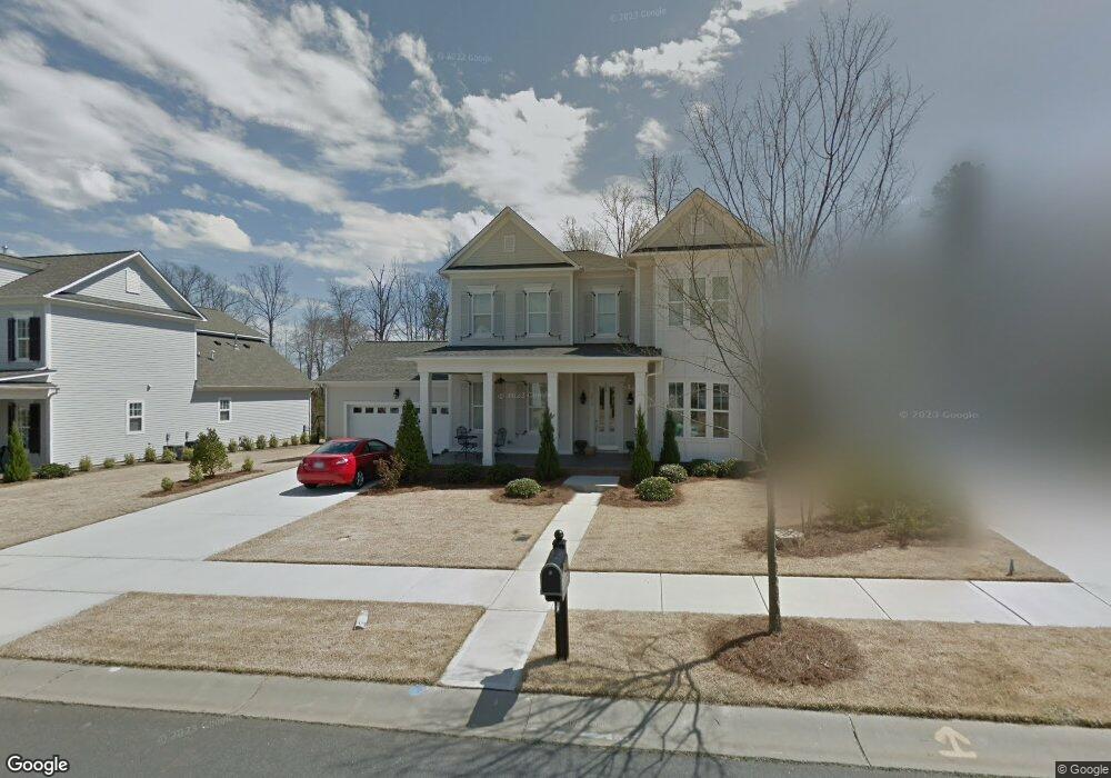
2812 Arsdale Rd Unit 10 Waxhaw, NC 28173
Estimated Value: $789,003 - $887,000
5
Beds
4
Baths
3,421
Sq Ft
$247/Sq Ft
Est. Value
About This Home
This home is located at 2812 Arsdale Rd Unit 10, Waxhaw, NC 28173 and is currently estimated at $844,001, approximately $246 per square foot. 2812 Arsdale Rd Unit 10 is a home located in Union County with nearby schools including Kensington Elementary School, Cuthbertson Middle School, and Cuthbertson High School.
Ownership History
Date
Name
Owned For
Owner Type
Purchase Details
Closed on
Dec 1, 2022
Sold by
Orrell F Randall F and Orrell Diana B
Bought by
Orrell Living Trust
Current Estimated Value
Purchase Details
Closed on
Oct 18, 2012
Sold by
Cunnane Group Inc
Bought by
Orrell F Randall and Orrell Diana B
Home Financials for this Owner
Home Financials are based on the most recent Mortgage that was taken out on this home.
Original Mortgage
$285,600
Interest Rate
3.58%
Mortgage Type
New Conventional
Create a Home Valuation Report for This Property
The Home Valuation Report is an in-depth analysis detailing your home's value as well as a comparison with similar homes in the area
Home Values in the Area
Average Home Value in this Area
Purchase History
| Date | Buyer | Sale Price | Title Company |
|---|---|---|---|
| Orrell Living Trust | -- | -- | |
| Orrell F Randall | $357,000 | None Available |
Source: Public Records
Mortgage History
| Date | Status | Borrower | Loan Amount |
|---|---|---|---|
| Previous Owner | Orrell F Randall | $285,600 |
Source: Public Records
Tax History Compared to Growth
Tax History
| Year | Tax Paid | Tax Assessment Tax Assessment Total Assessment is a certain percentage of the fair market value that is determined by local assessors to be the total taxable value of land and additions on the property. | Land | Improvement |
|---|---|---|---|---|
| 2024 | $5,145 | $501,800 | $88,900 | $412,900 |
| 2023 | $5,093 | $501,800 | $88,900 | $412,900 |
| 2022 | $5,093 | $501,800 | $88,900 | $412,900 |
| 2021 | $5,085 | $501,800 | $88,900 | $412,900 |
| 2020 | $2,893 | $369,300 | $44,500 | $324,800 |
| 2019 | $4,322 | $369,300 | $44,500 | $324,800 |
| 2018 | $0 | $369,300 | $44,500 | $324,800 |
| 2017 | $4,366 | $369,300 | $44,500 | $324,800 |
| 2016 | $4,292 | $369,300 | $44,500 | $324,800 |
| 2015 | $3,008 | $369,300 | $44,500 | $324,800 |
| 2014 | $421 | $359,640 | $60,000 | $299,640 |
Source: Public Records
Map
Nearby Homes
- 2702 Arsdale Rd
- 3301 Mcpherson St
- 000 Marvin Waxhaw Rd
- 8712 Soaring Eagle Ln
- 2907 Thayer Dr
- 8700 Whitehawk Hill Rd
- 4020 Lingen Ln
- 8504 Viking Dr
- 3401 Collaroy Rd
- 3005 Misty Moss Ct
- 4113 Hoffmeister Dr
- 8500 Fairgreen Ave
- 2751 Collaroy Rd
- 2721 Twinberry Ln
- 9128 Kensington Dr Unit 3
- 3029 Scottcrest Way
- 4909 Helmsworth Dr Unit 100
- 2504 River Oaks Dr
- 1305 Archer Loop St E Unit 64
- 2416 River Oaks Dr
- 2814 Arsdale Rd Unit 11
- 2814 Arsdale Rd
- 2810 Arsdale Rd Unit 9
- 2810 Arsdale Rd
- 2816 Arsdale Rd
- 2813 Arsdale Rd
- 2813 Arsdale Rd Unit 19
- 2807 Arsdale Rd
- 2808 Arsdale Rd Unit 8
- 2808 Arsdale Rd
- 2815 Arsdale Rd
- 2815 Arsdale Rd Unit 20
- 2902 Mcpherson St Unit 80
- 2904 Mcpherson St
- 2820 Arsdale Rd
- 2803 Arsdale Rd
- 2803 Arsdale Rd Unit 17
- 2806 Arsdale Rd
- 2817 Arsdale Rd
- 2900 Mcpherson St