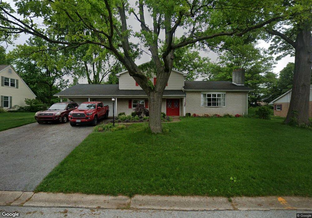
2813 Bradley Ave Dallastown, PA 17313
Estimated Value: $352,000 - $445,000
3
Beds
3
Baths
2,205
Sq Ft
$174/Sq Ft
Est. Value
About This Home
This home is located at 2813 Bradley Ave, Dallastown, PA 17313 and is currently estimated at $384,397, approximately $174 per square foot. 2813 Bradley Ave is a home located in York County with nearby schools including York Township Elementary School, Dallastown Area Middle School, and Dallastown Area High School.
Ownership History
Date
Name
Owned For
Owner Type
Purchase Details
Closed on
Mar 30, 2006
Sold by
Harrold Troy R and Harrold Faye F
Bought by
Rogers Phillip G and Rogers Donna L
Current Estimated Value
Home Financials for this Owner
Home Financials are based on the most recent Mortgage that was taken out on this home.
Original Mortgage
$189,000
Outstanding Balance
$108,361
Interest Rate
6.32%
Mortgage Type
Purchase Money Mortgage
Estimated Equity
$276,036
Purchase Details
Closed on
Jan 20, 1995
Bought by
Harrold Troy R and Harrold Faye F
Create a Home Valuation Report for This Property
The Home Valuation Report is an in-depth analysis detailing your home's value as well as a comparison with similar homes in the area
Home Values in the Area
Average Home Value in this Area
Purchase History
| Date | Buyer | Sale Price | Title Company |
|---|---|---|---|
| Rogers Phillip G | $236,900 | None Available | |
| Harrold Troy R | $136,900 | -- |
Source: Public Records
Mortgage History
| Date | Status | Borrower | Loan Amount |
|---|---|---|---|
| Open | Rogers Phillip G | $189,000 |
Source: Public Records
Tax History Compared to Growth
Tax History
| Year | Tax Paid | Tax Assessment Tax Assessment Total Assessment is a certain percentage of the fair market value that is determined by local assessors to be the total taxable value of land and additions on the property. | Land | Improvement |
|---|---|---|---|---|
| 2025 | $5,144 | $149,860 | $32,150 | $117,710 |
| 2024 | $5,069 | $149,860 | $32,150 | $117,710 |
| 2023 | $5,069 | $149,860 | $32,150 | $117,710 |
| 2022 | $4,903 | $149,860 | $32,150 | $117,710 |
| 2021 | $4,671 | $149,860 | $32,150 | $117,710 |
| 2020 | $4,671 | $149,860 | $32,150 | $117,710 |
| 2019 | $4,656 | $149,860 | $32,150 | $117,710 |
| 2018 | $4,625 | $149,860 | $32,150 | $117,710 |
| 2017 | $4,440 | $149,860 | $32,150 | $117,710 |
| 2016 | $0 | $149,860 | $32,150 | $117,710 |
| 2015 | -- | $149,860 | $32,150 | $117,710 |
| 2014 | -- | $149,860 | $32,150 | $117,710 |
Source: Public Records
Map
Nearby Homes
- 680 Hampstead Ct
- 2933 Exeter Dr S
- 2925 Starfire Dr
- 125 Verna Dr
- 2960 Starfire Dr
- 2723 S Queen St Unit 96
- 519 Middleview Dr
- 428 W Main St
- 0 Gary Dr
- 110 Oak Ridge Ln Unit 110
- 355 W Main St
- 732 Blossom Hill Ln
- 0 S Franklin St
- 106 Teila Dr
- 424 Dartha Dr
- 136 Teila Dr
- 774 Blossom Hill Ln
- 435 Frederick Dr
- 362 Allegheny Dr
- 300 Holyoke Dr
- 2819 Bradley Ave
- 2807 Bradley Ave
- 2816 Sunset Dr
- 2820 Bradley Ave
- 2810 Bradley Ave
- 2825 Bradley Ave
- 2801 Bradley Ave
- 2832 Sunset Dr
- 2800 Sunset Dr
- 2832 Bradley Ave
- 2841 Honey Valley Rd
- 2840 Sunset Dr
- 2831 Bradley Ave
- 2838 Bradley Ave
- 2821 Sunset Dr
- 2848 Sunset Dr
- 2817 Sunset Dr
- 2837 Honey Valley Rd Unit 74
- 2837 Honey Valley Rd
- 2849 Honey Valley Rd