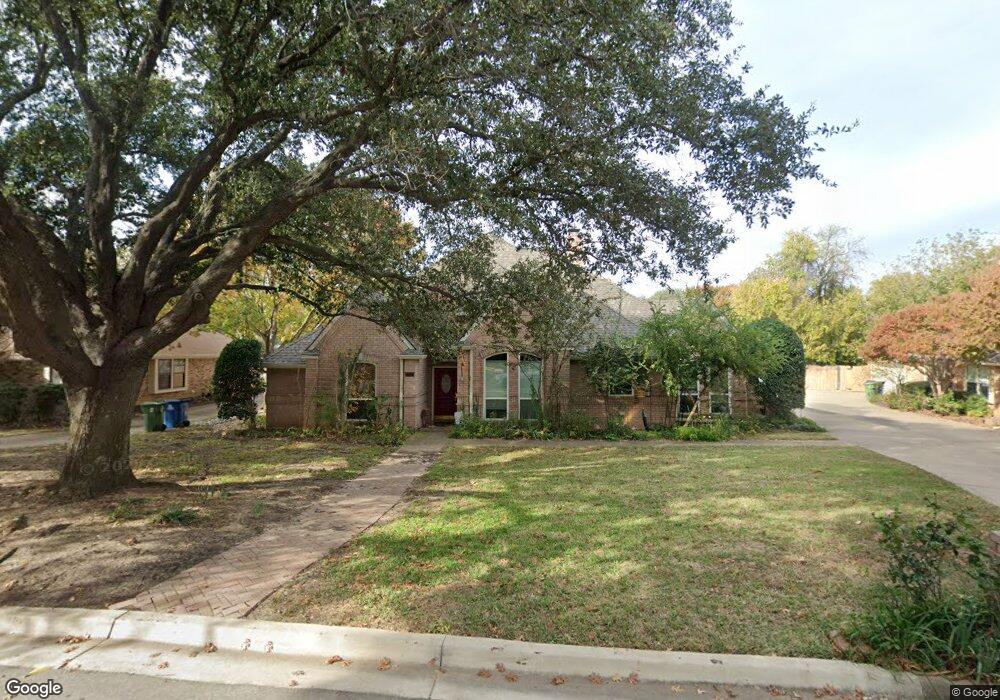
2813 Rock Port Cove Grapevine, TX 76051
Estimated Value: $665,200 - $762,000
3
Beds
2
Baths
2,517
Sq Ft
$283/Sq Ft
Est. Value
About This Home
This home is located at 2813 Rock Port Cove, Grapevine, TX 76051 and is currently estimated at $713,550, approximately $283 per square foot. 2813 Rock Port Cove is a home located in Tarrant County with nearby schools including Jack D. Johnson Elementary, Don T. Durham Intermediate School, and Carroll Middle School.
Ownership History
Date
Name
Owned For
Owner Type
Purchase Details
Closed on
Apr 29, 1999
Sold by
Wingrove Eddie C and Wingrove Myrna R
Bought by
Burkhardt Charles A and Herndon Betty K
Current Estimated Value
Home Financials for this Owner
Home Financials are based on the most recent Mortgage that was taken out on this home.
Original Mortgage
$134,400
Outstanding Balance
$34,583
Interest Rate
6.99%
Estimated Equity
$678,967
Create a Home Valuation Report for This Property
The Home Valuation Report is an in-depth analysis detailing your home's value as well as a comparison with similar homes in the area
Home Values in the Area
Average Home Value in this Area
Purchase History
| Date | Buyer | Sale Price | Title Company |
|---|---|---|---|
| Burkhardt Charles A | -- | American Title Co |
Source: Public Records
Mortgage History
| Date | Status | Borrower | Loan Amount |
|---|---|---|---|
| Open | Burkhardt Charles A | $134,400 |
Source: Public Records
Tax History Compared to Growth
Tax History
| Year | Tax Paid | Tax Assessment Tax Assessment Total Assessment is a certain percentage of the fair market value that is determined by local assessors to be the total taxable value of land and additions on the property. | Land | Improvement |
|---|---|---|---|---|
| 2025 | $2,669 | $660,020 | $208,350 | $451,670 |
| 2024 | $2,669 | $660,020 | $208,350 | $451,670 |
| 2023 | $9,625 | $639,852 | $208,350 | $431,502 |
| 2022 | $10,321 | $548,450 | $138,900 | $409,550 |
| 2021 | $9,784 | $475,011 | $138,900 | $336,111 |
| 2020 | $8,957 | $412,238 | $125,010 | $287,228 |
| 2019 | $9,620 | $442,175 | $85,000 | $357,175 |
| 2018 | $4,889 | $386,312 | $75,000 | $311,312 |
| 2017 | $8,347 | $361,968 | $50,000 | $311,968 |
| 2016 | $7,795 | $338,512 | $50,000 | $288,512 |
| 2015 | $5,407 | $307,299 | $50,000 | $257,299 |
| 2014 | $5,407 | $293,300 | $30,000 | $263,300 |
Source: Public Records
Map
Nearby Homes
- 2954 Trail Lake Dr
- 2900 W Kimball Ave
- 2944 Chris Ln
- 2821 Dove Pond Dr
- 2023 Harwell St
- 2709 Cobblestone Dr
- 2040 E Dove Rd
- 2811 Northwood St
- 1963 E Dove Rd
- 2804 Stonehurst Dr
- 2002 Harwell St
- 1480 N Kimball Ave
- 2080 E Dove Rd Unit Lot 4
- 2080 E Dove Rd Unit Lots 1, 2, 4, 5, 6
- 2080 E Dove Rd Unit Lot 2
- 2080 E (Lot 1) Dove Rd
- 2080 E Dove Rd Unit Lot 6
- 2941 Kosse Ct
- Walker Plan at Dove Station
- Florence Plan at Dove Station
- 2807 Rock Port Cove
- 2819 Rock Port Cove
- 2814 Cliffside St
- 2806 Cliffside St
- 2814 Rock Port Cove
- 2825 Rock Port Cove
- 2801 Rock Port Cove
- 2808 Rock Port Cove
- 2802 Cliffside St
- 2802 Rock Port Cove
- 2832 Rock Port Cove
- 2820 Rock Port Cove
- 2813 Cliffside St
- 2830 Cliffside St
- 2819 Cliffside St
- 2828 Rock Port Cove
- 3026 Trail Lake Dr
- 2807 Cliffside St
- 2801 Cliffside St
- 3101 Trail Lake Dr