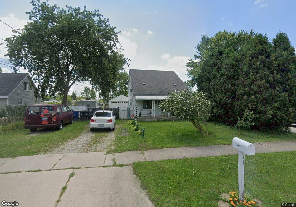
28137 Hanover Blvd Westland, MI 48186
Estimated Value: $82,000 - $203,000
--
Bed
1
Bath
1,848
Sq Ft
$89/Sq Ft
Est. Value
About This Home
This home is located at 28137 Hanover Blvd, Westland, MI 48186 and is currently estimated at $165,157, approximately $89 per square foot. 28137 Hanover Blvd is a home located in Wayne County with nearby schools including Taylor Parks Elementary School, Hoover Middle School, and Taylor High School.
Ownership History
Date
Name
Owned For
Owner Type
Purchase Details
Closed on
Jun 9, 2006
Sold by
Fay Brian E
Bought by
Fay Brian E
Current Estimated Value
Home Financials for this Owner
Home Financials are based on the most recent Mortgage that was taken out on this home.
Original Mortgage
$198,000
Outstanding Balance
$135,654
Interest Rate
9.75%
Mortgage Type
New Conventional
Estimated Equity
$29,503
Purchase Details
Closed on
May 23, 1997
Sold by
Gamber Danny C and Gamber Marie G
Bought by
Brian E Fay
Purchase Details
Closed on
Nov 30, 1994
Sold by
Kathy M Justice
Bought by
Gamber Danny C and Gamber Marie G
Create a Home Valuation Report for This Property
The Home Valuation Report is an in-depth analysis detailing your home's value as well as a comparison with similar homes in the area
Home Values in the Area
Average Home Value in this Area
Purchase History
| Date | Buyer | Sale Price | Title Company |
|---|---|---|---|
| Fay Brian E | -- | None Available | |
| Brian E Fay | $45,000 | -- | |
| Gamber Danny C | $30,000 | -- |
Source: Public Records
Mortgage History
| Date | Status | Borrower | Loan Amount |
|---|---|---|---|
| Open | Fay Brian E | $198,000 |
Source: Public Records
Tax History Compared to Growth
Tax History
| Year | Tax Paid | Tax Assessment Tax Assessment Total Assessment is a certain percentage of the fair market value that is determined by local assessors to be the total taxable value of land and additions on the property. | Land | Improvement |
|---|---|---|---|---|
| 2025 | $1,055 | $78,800 | $0 | $0 |
| 2024 | $1,055 | $76,000 | $0 | $0 |
| 2023 | $1,085 | $61,300 | $0 | $0 |
| 2022 | $1,292 | $49,600 | $0 | $0 |
| 2021 | $1,217 | $41,300 | $0 | $0 |
| 2020 | $1,201 | $31,500 | $0 | $0 |
| 2019 | $1,153 | $26,800 | $0 | $0 |
| 2018 | $868 | $23,900 | $0 | $0 |
| 2017 | $518 | $23,700 | $0 | $0 |
| 2016 | $1,081 | $24,000 | $0 | $0 |
| 2015 | $2,328 | $23,280 | $0 | $0 |
| 2013 | $2,442 | $25,380 | $0 | $0 |
| 2012 | $1,179 | $25,490 | $0 | $0 |
Source: Public Records
Map
Nearby Homes
- POWERS Powers St
- 27523 Powers St
- 6002 Frederick St Unit 81
- 6018 Frederick St Unit 83
- 28654 N Maple St Unit 131
- 5926 Esther St
- 5898 W Maple St Unit 177
- 6041 W Maple St Unit 144
- 28919 Powers St
- 5912 Georgia Unit 212
- 28951 Powers St
- 6040 Georgia Unit 225
- 29025 Powers St
- 29120 van Born Rd
- 5526 Sylvia St
- 6155 Cordell St
- 6211 Inkster Rd
- 6221 Inkster Rd
- 29006 Eton St
- 4315 Isabelle St
- 28147 Hanover Blvd
- 28125 Hanover Blvd
- 28171 Hanover Blvd
- 28183 Hanover Blvd
- 28126 Hanover Blvd
- 28170 Hanover Blvd
- 28087 Hanover Blvd
- 28110 Hanover Blvd
- 28057 Hanover Blvd
- 28182 Hanover Blvd
- 28203 Hanover Blvd
- 28064 Hanover Blvd
- 28202 Hanover Blvd
- 28086 Hanover Blvd
- 28138 van Born Rd
- 28054 Hanover Blvd
- 28114 van Born Rd
- 28180 van Born Rd
- 28212 Hanover Blvd
- 28084 van Born Rd