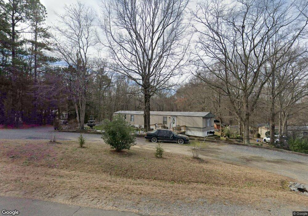
2814 Lesslie Dale Rd Rock Hill, SC 29730
Estimated Value: $99,854 - $219,000
--
Bed
--
Bath
1,064
Sq Ft
$136/Sq Ft
Est. Value
About This Home
This home is located at 2814 Lesslie Dale Rd, Rock Hill, SC 29730 and is currently estimated at $144,964, approximately $136 per square foot. 2814 Lesslie Dale Rd is a home with nearby schools including Independence Elementary School, Castle Heights Middle School, and Rock Hill High School.
Ownership History
Date
Name
Owned For
Owner Type
Purchase Details
Closed on
Feb 4, 2021
Sold by
Lane Scott Andrew
Bought by
Lozano Omar Visoso and Padilla Viviana Quiroz
Current Estimated Value
Purchase Details
Closed on
Dec 11, 2014
Sold by
Lane Sandra B
Bought by
Lane Scott Andrew
Purchase Details
Closed on
Apr 1, 2006
Sold by
Straub Jason A and Coyne Jeanette A
Bought by
Lane Sandra B
Purchase Details
Closed on
Feb 6, 2002
Sold by
Atherton Steve A
Bought by
Coyne Jeanette A and Straub Jason A
Purchase Details
Closed on
Nov 2, 1998
Sold by
The Matherson Co Inc
Bought by
Atherton Steve A
Create a Home Valuation Report for This Property
The Home Valuation Report is an in-depth analysis detailing your home's value as well as a comparison with similar homes in the area
Home Values in the Area
Average Home Value in this Area
Purchase History
| Date | Buyer | Sale Price | Title Company |
|---|---|---|---|
| Lozano Omar Visoso | $1,500 | None Available | |
| Lane Scott Andrew | -- | -- | |
| Lane Sandra B | $28,500 | None Available | |
| Coyne Jeanette A | $30,000 | -- | |
| Atherton Steve A | $15,900 | -- |
Source: Public Records
Tax History Compared to Growth
Tax History
| Year | Tax Paid | Tax Assessment Tax Assessment Total Assessment is a certain percentage of the fair market value that is determined by local assessors to be the total taxable value of land and additions on the property. | Land | Improvement |
|---|---|---|---|---|
| 2024 | $829 | $2,280 | $1,680 | $600 |
| 2023 | $837 | $2,280 | $1,680 | $600 |
| 2022 | $788 | $2,280 | $1,680 | $600 |
| 2021 | -- | $2,280 | $1,680 | $600 |
| 2020 | $766 | $2,280 | $0 | $0 |
| 2019 | $748 | $2,160 | $0 | $0 |
| 2018 | $733 | $2,160 | $0 | $0 |
| 2017 | $701 | $2,160 | $0 | $0 |
| 2016 | $679 | $2,160 | $0 | $0 |
| 2014 | $668 | $2,160 | $1,500 | $660 |
| 2013 | $668 | $2,250 | $1,500 | $750 |
Source: Public Records
Map
Nearby Homes
- 281 Schoolside Dr
- 161 Billy Claude Cir
- 141 Edenvale Rd
- 172 Neely Store Rd
- 1580 Anderson Rd S
- 2003 Capel Ct
- 2510 Firetower Rd
- 508 Bridgestone Ln
- 3339 Lesslie Hwy Unit 2
- 611 Pondway Downs
- 111 Emily Crest Ln
- 623 Neelys Creek Rd
- 1903 Manning Place
- 356 Emma Wood Ln
- 2488 Catawba Church Rd
- 631 Anderson Rd S
- 3943 Walker Rd
- 3943 Walker Rd Unit LOT ONLY
- 3943 Walker Road (Land Only)
- 1034 Neely Store Rd
- 2798 Lesslie Dale Rd
- 2828 Lesslie Dale Rd
- 2784 Lesslie Dale Rd
- 2799 Lesslie Dale Rd
- 2835 Lesslie Dale Rd
- 2770 Lesslie Dale Rd
- 2856 Lesslie Dale Rd
- 2775 Lesslie Dale Rd
- 2849 Lesslie Dale Rd
- 2756 Lesslie Dale Rd
- 2898 Lesslie Dale Rd
- 2811 Lesslie Dale Rd
- 2870 Lesslie Dale Rd
- 2759 Lesslie Dale Rd
- 2875 Lesslie Dale Rd
- 2747 Fire Tower Rd
- 2742 Lesslie Dale Rd
- 2745 Lesslie Dale Rd
- 2884 Lesslie Dale Rd
- 153 Schoolside Dr