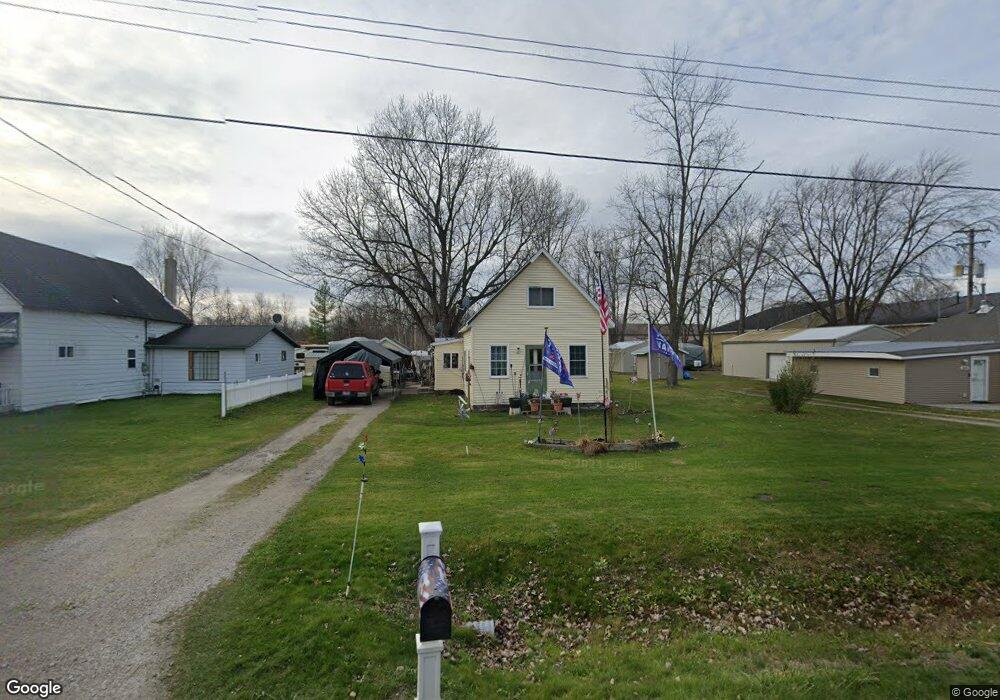
2815 32nd St Port Huron, MI 48060
Estimated Value: $82,000 - $119,728
2
Beds
1
Bath
819
Sq Ft
$123/Sq Ft
Est. Value
About This Home
This home is located at 2815 32nd St, Port Huron, MI 48060 and is currently estimated at $100,682, approximately $122 per square foot. 2815 32nd St is a home located in St. Clair County with nearby schools including Cleveland Elementary School, Central Middle School, and Port Huron High School.
Ownership History
Date
Name
Owned For
Owner Type
Purchase Details
Closed on
Mar 13, 2006
Sold by
Campbell Stephanie L
Bought by
Campbell James and Campbell Stephanie
Current Estimated Value
Purchase Details
Closed on
Feb 18, 2006
Sold by
Osborn Robert D
Bought by
Campbell Stephanie L
Purchase Details
Closed on
Dec 9, 2005
Sold by
Campbell Stephanie
Bought by
Campbell Stephanie and Osborn Robert D
Create a Home Valuation Report for This Property
The Home Valuation Report is an in-depth analysis detailing your home's value as well as a comparison with similar homes in the area
Home Values in the Area
Average Home Value in this Area
Purchase History
| Date | Buyer | Sale Price | Title Company |
|---|---|---|---|
| Campbell James | -- | Lawyers Title Insurance Corp | |
| Campbell Stephanie L | $9,000 | None Available | |
| Campbell Stephanie | -- | None Available |
Source: Public Records
Tax History Compared to Growth
Tax History
| Year | Tax Paid | Tax Assessment Tax Assessment Total Assessment is a certain percentage of the fair market value that is determined by local assessors to be the total taxable value of land and additions on the property. | Land | Improvement |
|---|---|---|---|---|
| 2025 | $1,279 | $44,500 | $0 | $0 |
| 2024 | $879 | $38,000 | $0 | $0 |
| 2023 | $824 | $33,100 | $0 | $0 |
| 2022 | $1,152 | $29,600 | $0 | $0 |
| 2021 | $1,070 | $29,700 | $0 | $0 |
| 2020 | $1,070 | $24,900 | $24,900 | $0 |
| 2019 | $1,050 | $23,300 | $0 | $0 |
| 2018 | $1,025 | $23,300 | $0 | $0 |
| 2017 | $1,003 | $23,100 | $0 | $0 |
| 2016 | $687 | $23,100 | $0 | $0 |
| 2015 | -- | $19,600 | $19,600 | $0 |
| 2014 | -- | $19,400 | $19,400 | $0 |
| 2013 | -- | $18,800 | $0 | $0 |
Source: Public Records
Map
Nearby Homes
- 0 Dove Rd Unit G31368528
- 3369 Dove Rd
- 3548 Cleveland St
- 2702 Vanness St
- 2600 Vanness St
- 2513 Vanness St
- 2511 Vanness St
- 2506 Vanness St
- 2627 24th St
- 2411 26th St
- 9999 Cleveland Ave
- 3230 Ashland Ct
- Lot 3 24th St
- 00 Moak St
- 2203 VL Railroad St
- 2200 VL Railroad St
- 2023 23rd St
- 3830 Military St
- 3333 Ravenswood Rd Unit 4A
- 3333 Ravenswood Rd
- 2817 32nd St
- 2809 32nd St
- 0 Dove Rd Unit 215001021
- 0 Dove Rd
- 0 Dove Rd Unit 50106734
- 0 Dove Rd Unit R214018681
- 0 Dove Rd Unit R213002712
- 0 Dove Rd Unit R214018685
- 0 Dove Rd Unit R213022272
- 0 Dove Rd Unit R214027013
- 0 Dove Rd Unit G31332655
- 0 Dove Rd Unit G31341021
- 0 Dove Rd Unit R2200081457
- 0 Dove Rd Unit R2210049013
- 0 Dove Rd Unit R2210040793
- 0 Dove Rd Unit R2210054906
- 0 Dove Rd Unit R2210054898
- 0 Dove Rd Unit 2210056198
- 3350 Cleveland St
- 9999 Cleveland St