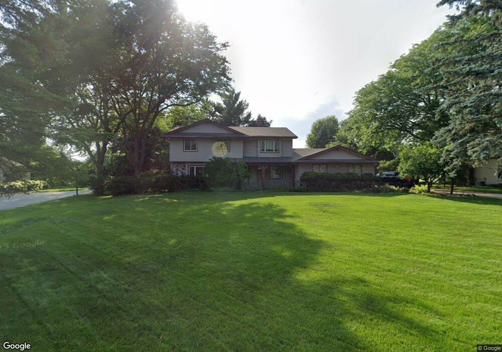
2815 Almesbury Ave Brookfield, WI 53045
Estimated Value: $608,000 - $670,000
4
Beds
4
Baths
2,598
Sq Ft
$246/Sq Ft
Est. Value
About This Home
This home is located at 2815 Almesbury Ave, Brookfield, WI 53045 and is currently estimated at $639,119, approximately $246 per square foot. 2815 Almesbury Ave is a home located in Waukesha County with nearby schools including Brookfield Elementary School, Wisconsin Hills Middle School, and Brookfield Central High School.
Ownership History
Date
Name
Owned For
Owner Type
Purchase Details
Closed on
Jul 25, 2025
Sold by
Joseph And Sharon Pottebaum Living Trust
Bought by
Stiles Pamela N and Voskuil Peter R
Current Estimated Value
Home Financials for this Owner
Home Financials are based on the most recent Mortgage that was taken out on this home.
Original Mortgage
$200,000
Outstanding Balance
$199,661
Interest Rate
6.84%
Mortgage Type
New Conventional
Estimated Equity
$439,458
Purchase Details
Closed on
Jan 21, 2004
Sold by
Pottebaum Joseph Raymond and Pottebaum Sharon R
Bought by
Joseph & Sharon Pottebaum Living Trust
Create a Home Valuation Report for This Property
The Home Valuation Report is an in-depth analysis detailing your home's value as well as a comparison with similar homes in the area
Home Values in the Area
Average Home Value in this Area
Purchase History
| Date | Buyer | Sale Price | Title Company |
|---|---|---|---|
| Stiles Pamela N | $620,000 | Executive Title Llc | |
| Joseph & Sharon Pottebaum Living Trust | -- | -- |
Source: Public Records
Mortgage History
| Date | Status | Borrower | Loan Amount |
|---|---|---|---|
| Open | Stiles Pamela N | $200,000 |
Source: Public Records
Tax History Compared to Growth
Tax History
| Year | Tax Paid | Tax Assessment Tax Assessment Total Assessment is a certain percentage of the fair market value that is determined by local assessors to be the total taxable value of land and additions on the property. | Land | Improvement |
|---|---|---|---|---|
| 2024 | $6,762 | $584,300 | $135,000 | $449,300 |
| 2023 | $6,797 | $584,300 | $135,000 | $449,300 |
| 2022 | $6,633 | $461,000 | $130,000 | $331,000 |
| 2021 | $7,028 | $461,000 | $130,000 | $331,000 |
| 2020 | $7,317 | $461,000 | $130,000 | $331,000 |
| 2019 | $7,034 | $461,000 | $130,000 | $331,000 |
| 2018 | $6,416 | $410,100 | $140,000 | $270,100 |
| 2017 | $7,338 | $410,100 | $140,000 | $270,100 |
| 2016 | $6,504 | $410,100 | $140,000 | $270,100 |
| 2015 | $6,466 | $410,100 | $140,000 | $270,100 |
| 2014 | $6,447 | $394,600 | $140,000 | $254,600 |
| 2013 | $6,447 | $394,600 | $140,000 | $254,600 |
Source: Public Records
Map
Nearby Homes
- 21330 Hollycrest Ct
- W222N2872 Timberwood Ct
- N31W22134 Green Rd
- 21300 Astolat Dr
- 2410 Talbots Ln
- 20780 Tennyson Dr
- 7034 Stonewood Ln
- 7038 Stonewood Ln
- 7018 Stonewood Ln
- 7022 Stonewood Ln
- Lt119 Berwick Ct
- Lt117 Berwick Ct
- Lt115 Berwick Ct
- Lt120 Berwick Ct
- Lt116 Berwick Ct
- Lt114 Berwick Ct
- Lt118 Berwick Ct
- 21965 Valiant Dr
- 21380 Woodchuck Ln
- W225N2549 Alderwood Ln
- 2835 Almesbury Ave
- 2795 Almesbury Ave
- 2830 Harmony Cir
- 21440 Hollycrest Ct
- 2810 Harmony Cir
- 21505 Hollycrest Dr
- 2775 Almesbury Ave
- 2850 Harmony Cir
- 2840 Almesbury Ave
- 2780 Almesbury Ave
- 21615 Hollycrest Dr
- 21615 Holly Crest Dr
- 21455 Cambridge Circle Upper
- 2780 Harmony Cir
- 21400 Hollycrest Ct
- 2765 Almesbury Ave
- 2870 Harmony Cir
- 21405 Hollycrest Ct
- 2805 Harmony Cir
- 2835 Harmony Cir