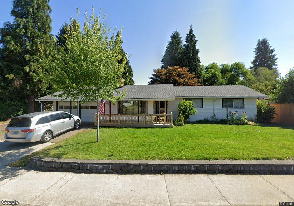
2815 B St Forest Grove, OR 97116
Estimated Value: $509,055 - $543,000
4
Beds
2
Baths
1,957
Sq Ft
$271/Sq Ft
Est. Value
About This Home
This home is located at 2815 B St, Forest Grove, OR 97116 and is currently estimated at $529,764, approximately $270 per square foot. 2815 B St is a home located in Washington County with nearby schools including Harvey Clarke Elementary School, Tom McCall Upper Elementary School, and Neil Armstrong Middle School.
Ownership History
Date
Name
Owned For
Owner Type
Purchase Details
Closed on
Dec 4, 2017
Sold by
Freeman Richard
Bought by
Freeman Richard James and Freeman Paula J
Current Estimated Value
Home Financials for this Owner
Home Financials are based on the most recent Mortgage that was taken out on this home.
Original Mortgage
$292,850
Outstanding Balance
$159,785
Interest Rate
3.94%
Mortgage Type
VA
Estimated Equity
$369,979
Purchase Details
Closed on
Sep 21, 2009
Sold by
Roberts Sharon and Roberts Larry
Bought by
Freeman Richard
Home Financials for this Owner
Home Financials are based on the most recent Mortgage that was taken out on this home.
Original Mortgage
$245,057
Interest Rate
5.18%
Mortgage Type
VA
Purchase Details
Closed on
Apr 29, 2009
Sold by
Smith Sharon A
Bought by
Roberts Sharon and Roberts Larry
Create a Home Valuation Report for This Property
The Home Valuation Report is an in-depth analysis detailing your home's value as well as a comparison with similar homes in the area
Home Values in the Area
Average Home Value in this Area
Purchase History
| Date | Buyer | Sale Price | Title Company |
|---|---|---|---|
| Freeman Richard James | -- | First American Title | |
| Freeman Richard | $239,900 | First American | |
| Roberts Sharon | -- | None Available |
Source: Public Records
Mortgage History
| Date | Status | Borrower | Loan Amount |
|---|---|---|---|
| Open | Freeman Richard James | $292,850 | |
| Closed | Freeman Richard | $245,057 |
Source: Public Records
Tax History Compared to Growth
Tax History
| Year | Tax Paid | Tax Assessment Tax Assessment Total Assessment is a certain percentage of the fair market value that is determined by local assessors to be the total taxable value of land and additions on the property. | Land | Improvement |
|---|---|---|---|---|
| 2026 | $3,798 | $213,280 | -- | -- |
| 2025 | $3,798 | $207,080 | -- | -- |
| 2024 | $4,223 | $201,050 | -- | -- |
| 2023 | $4,223 | $224,960 | $0 | $0 |
| 2022 | $3,692 | $224,960 | $0 | $0 |
| 2021 | $3,645 | $212,050 | $0 | $0 |
| 2020 | $3,625 | $205,880 | $0 | $0 |
| 2019 | $3,544 | $199,890 | $0 | $0 |
| 2018 | $3,436 | $194,070 | $0 | $0 |
| 2017 | $3,329 | $188,420 | $0 | $0 |
| 2016 | $3,236 | $182,940 | $0 | $0 |
| 2015 | $3,111 | $177,620 | $0 | $0 |
| 2014 | $3,096 | $172,450 | $0 | $0 |
Source: Public Records
Map
Nearby Homes
- 1611 Camino Dr
- 1609 Camino Dr
- 2106 Charlie Ct
- 1425 Willamina Ave
- 2327 Turnbull Ct
- 2341 Turnbull Ct
- 1718 23rd Ave
- 3300 N Main St Unit 110
- 2251 27th Ave
- 1315 Begonia Ave
- 1224 Alyssum Ave
- 904 Rosebud Ct
- Alder Plan at Parkview Terrace - Single-Family Homes
- Mattingly Plan at Parkview Terrace - Single-Family Homes
- Arleta Plan at Parkview Terrace - Paired Villas
- Moreland Plan at Parkview Terrace - Paired Villas
- Eason Plan at Parkview Terrace - Single-Family Homes
- Marivue Plan at Parkview Terrace - Paired Villas
- Albin Plan at Parkview Terrace - Single-Family Homes
- 916 Rosebud Ct