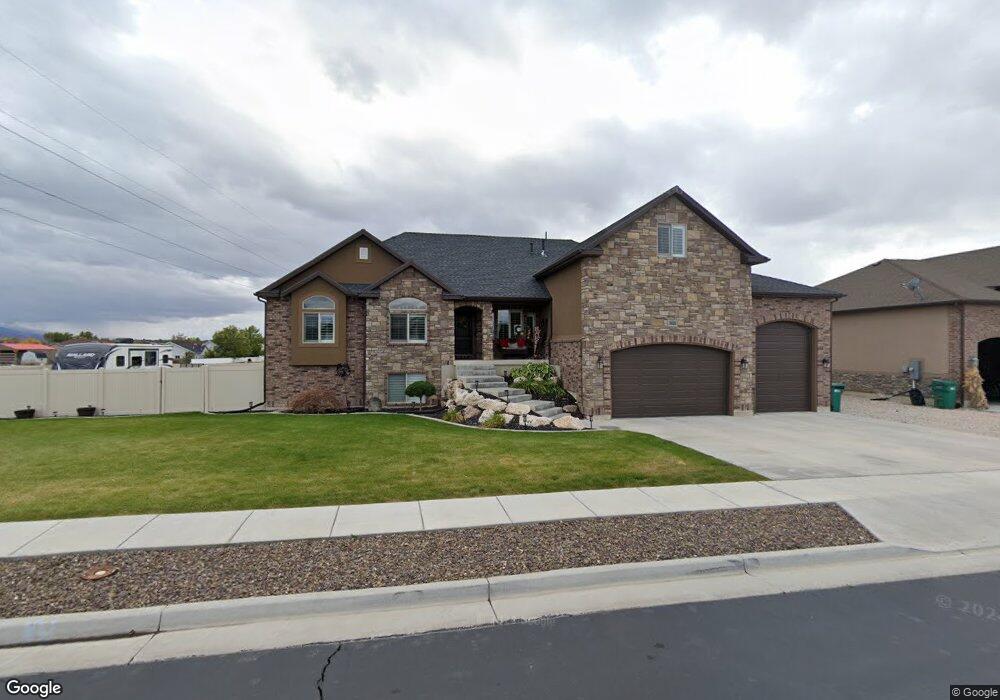
2815 W 2050 S West Haven, UT 84401
Estimated Value: $752,000 - $823,733
6
Beds
4
Baths
4,008
Sq Ft
$201/Sq Ft
Est. Value
About This Home
This home is located at 2815 W 2050 S, West Haven, UT 84401 and is currently estimated at $803,933, approximately $200 per square foot. 2815 W 2050 S is a home located in Weber County with nearby schools including Deamude Adventist Christian School.
Ownership History
Date
Name
Owned For
Owner Type
Purchase Details
Closed on
Jun 18, 2015
Sold by
Stillwater Investments Llc
Bought by
Stillwater Development Group Llc
Current Estimated Value
Create a Home Valuation Report for This Property
The Home Valuation Report is an in-depth analysis detailing your home's value as well as a comparison with similar homes in the area
Home Values in the Area
Average Home Value in this Area
Purchase History
| Date | Buyer | Sale Price | Title Company |
|---|---|---|---|
| Stillwater Development Group Llc | -- | Intermountain Title |
Source: Public Records
Tax History Compared to Growth
Tax History
| Year | Tax Paid | Tax Assessment Tax Assessment Total Assessment is a certain percentage of the fair market value that is determined by local assessors to be the total taxable value of land and additions on the property. | Land | Improvement |
|---|---|---|---|---|
| 2025 | $4,852 | $821,882 | $221,286 | $600,596 |
| 2024 | $4,648 | $443,849 | $121,579 | $322,270 |
| 2023 | $4,884 | $466,950 | $121,371 | $345,579 |
| 2022 | $5,038 | $494,450 | $110,405 | $384,045 |
| 2021 | $3,827 | $629,000 | $130,691 | $498,309 |
| 2020 | $3,560 | $535,000 | $95,625 | $439,375 |
| 2019 | $3,371 | $478,000 | $95,611 | $382,389 |
| 2018 | $3,455 | $470,000 | $85,546 | $384,454 |
| 2017 | $3,336 | $441,000 | $85,384 | $355,616 |
| 2016 | $2,474 | $173,647 | $42,977 | $130,670 |
| 2015 | $1,207 | $78,140 | $78,140 | $0 |
| 2014 | -- | $0 | $0 | $0 |
Source: Public Records
Map
Nearby Homes
- 2954 W 2325 S
- 3672 3125 W Unit 12
- 2611 W 1850 S
- 1882 S 2475 W
- 2300 Farmhouse Select Plan at Fairhaven
- 1856 S 2425 W
- 1918 S 2475 W
- 1903 S 2425 W
- 1977 S 2425 W
- 2067 S 2425 W
- 2050 Farmhouse Select Plan at Fairhaven
- 1869 S 2425 W
- 1944 S 2425 W
- 3000 Farmhouse Select Plan at Fairhaven
- 3328 W 2100 S
- 2504 W 1725 S
- 2454 W 1775 S
- 2599 S 3075 W
- 1656 S Prevedel Dr
- 1694 S Hayfield Dr