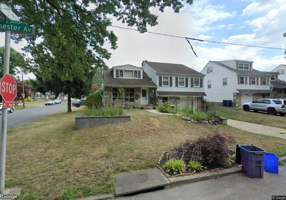
2815 Winchester Ave Philadelphia, PA 19136
Pennypack NeighborhoodEstimated Value: $440,511 - $538,000
--
Bed
--
Bath
2,230
Sq Ft
$228/Sq Ft
Est. Value
About This Home
This home is located at 2815 Winchester Ave, Philadelphia, PA 19136 and is currently estimated at $508,628, approximately $228 per square foot. 2815 Winchester Ave is a home located in Philadelphia County with nearby schools including Lincoln High School, Robert B. Pollock School, and Meehan Austin Middle School.
Ownership History
Date
Name
Owned For
Owner Type
Purchase Details
Closed on
May 19, 2003
Sold by
Meschler Kevin R and Meschler Marla Ann
Bought by
Meschler Kevin R and Meschler Marla Ann
Current Estimated Value
Home Financials for this Owner
Home Financials are based on the most recent Mortgage that was taken out on this home.
Original Mortgage
$135,000
Interest Rate
5.71%
Mortgage Type
Purchase Money Mortgage
Purchase Details
Closed on
Feb 27, 1998
Sold by
Kennedy Thomas J and Heiser Byron
Bought by
Meschler Kevin R and Paletski Marla Ann
Create a Home Valuation Report for This Property
The Home Valuation Report is an in-depth analysis detailing your home's value as well as a comparison with similar homes in the area
Home Values in the Area
Average Home Value in this Area
Purchase History
| Date | Buyer | Sale Price | Title Company |
|---|---|---|---|
| Meschler Kevin R | -- | -- | |
| Meschler Kevin R | $155,000 | -- |
Source: Public Records
Mortgage History
| Date | Status | Borrower | Loan Amount |
|---|---|---|---|
| Closed | Meschler Kevin R | $135,000 |
Source: Public Records
Tax History Compared to Growth
Tax History
| Year | Tax Paid | Tax Assessment Tax Assessment Total Assessment is a certain percentage of the fair market value that is determined by local assessors to be the total taxable value of land and additions on the property. | Land | Improvement |
|---|---|---|---|---|
| 2025 | $5,514 | $454,200 | $90,800 | $363,400 |
| 2024 | $5,514 | $454,200 | $90,800 | $363,400 |
| 2023 | $5,514 | $393,900 | $78,780 | $315,120 |
| 2022 | $3,613 | $348,900 | $78,780 | $270,120 |
| 2021 | $4,243 | $0 | $0 | $0 |
| 2020 | $4,243 | $0 | $0 | $0 |
| 2019 | $4,002 | $0 | $0 | $0 |
| 2018 | $3,856 | $0 | $0 | $0 |
| 2017 | $3,856 | $0 | $0 | $0 |
| 2016 | $3,437 | $0 | $0 | $0 |
| 2015 | $3,290 | $0 | $0 | $0 |
| 2014 | -- | $275,500 | $118,272 | $157,228 |
| 2012 | -- | $36,512 | $8,890 | $27,622 |
Source: Public Records
Map
Nearby Homes
- 8027 Narvon St
- 2934 Walnut Hill St
- 2711 Winchester Ave
- 8142 Lister St
- 2759 Axe Factory Rd
- 2740 Mower St
- 3100 Welsh Rd
- 3165 Weston St
- 2876 Walnut Hill St
- 4R & 6 Old Ashton Rd
- 2803 Rhawn St
- 3170 Weston St
- 2713 Clayton St
- 2755 Rhawn St
- 8200 Colfax St
- 8130 Farnsworth St
- 8718 Hargrave St
- 2727 Rhawn St
- 2727 Rhawn St Unit 7AB
- 8209 Albion St
- 2817 Winchester Ave
- 2800 Hargrave St
- 2802 Hargrave St
- 2813 Winchester Ave
- 2819 Winchester Ave
- 2804 Hargrave St
- 8000 Lenola St
- 2811 Winchester Ave
- 2821 Winchester Ave
- 2806 Hargrave St
- 8002 Lenola St
- 2809 Winchester Ave
- 2801 Hargrave St
- 2823 Winchester Ave
- 2803 Hargrave St
- 2808 Hargrave St
- 2805 Hargrave St
- 8001 Lenola St
- 8004 Lenola St
- 2807 Hargrave St