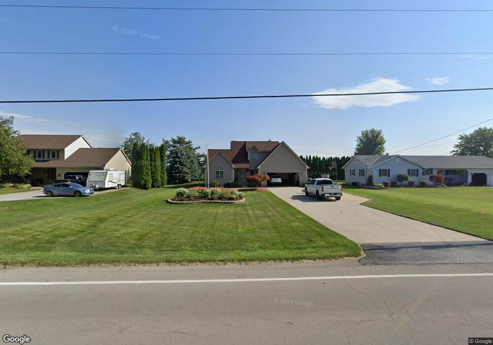
2816 W Bogart Rd Sandusky, OH 44870
Estimated Value: $239,000 - $356,000
3
Beds
3
Baths
2,560
Sq Ft
$120/Sq Ft
Est. Value
About This Home
This home is located at 2816 W Bogart Rd, Sandusky, OH 44870 and is currently estimated at $308,467, approximately $120 per square foot. 2816 W Bogart Rd is a home located in Erie County with nearby schools including Furry Elementary School, Meadowlawn Elementary School, and Briar Middle School.
Ownership History
Date
Name
Owned For
Owner Type
Purchase Details
Closed on
Aug 6, 2012
Sold by
Cooper Travis L
Bought by
Cooper Travis L and Cooper Devonia
Current Estimated Value
Purchase Details
Closed on
Jun 28, 2002
Sold by
Camacho Luis E
Bought by
Perez-Iacobescu Raquel E
Home Financials for this Owner
Home Financials are based on the most recent Mortgage that was taken out on this home.
Original Mortgage
$156,750
Interest Rate
6.93%
Mortgage Type
New Conventional
Create a Home Valuation Report for This Property
The Home Valuation Report is an in-depth analysis detailing your home's value as well as a comparison with similar homes in the area
Home Values in the Area
Average Home Value in this Area
Purchase History
| Date | Buyer | Sale Price | Title Company |
|---|---|---|---|
| Cooper Travis L | -- | None Available | |
| Perez-Iacobescu Raquel E | $165,000 | -- |
Source: Public Records
Mortgage History
| Date | Status | Borrower | Loan Amount |
|---|---|---|---|
| Previous Owner | Perez-Iacobescu Raquel E | $156,750 |
Source: Public Records
Tax History
| Year | Tax Paid | Tax Assessment Tax Assessment Total Assessment is a certain percentage of the fair market value that is determined by local assessors to be the total taxable value of land and additions on the property. | Land | Improvement |
|---|---|---|---|---|
| 2024 | $3,687 | $82,463 | $17,381 | $65,082 |
| 2023 | $3,769 | $65,177 | $14,364 | $50,813 |
| 2022 | $3,652 | $65,177 | $14,364 | $50,813 |
| 2021 | $3,647 | $65,170 | $14,360 | $50,810 |
| 2020 | $2,996 | $54,020 | $14,360 | $39,660 |
| 2019 | $3,084 | $54,020 | $14,360 | $39,660 |
| 2018 | $3,121 | $54,640 | $14,360 | $40,280 |
| 2017 | $3,250 | $55,350 | $11,870 | $43,480 |
| 2016 | $2,838 | $55,350 | $11,870 | $43,480 |
| 2015 | $2,926 | $55,350 | $11,870 | $43,480 |
| 2014 | $2,817 | $55,350 | $11,870 | $43,480 |
| 2013 | $2,626 | $55,350 | $11,870 | $43,480 |
Source: Public Records
Map
Nearby Homes
- 5420 Schenk Rd
- 0 Quarry Lakes Dr Unit 20205329
- 0 Quarry Lakes Dr Unit 20205328
- 1315 S Lake Wilmer Dr Unit 109
- 1305 S Lake Wilmer Dr Unit 207
- 0 Lakeside Unit 20253835
- 612 Helina Dr
- 3712 Matthes Ave
- 301 Schiller Ave
- 3005 Bardshar Rd
- 2614 Tiffin Ave Unit 103
- 0 Hayes Ave
- 1 Perkins Ave
- 2312 Hayes Ave
- 2524 Campbell St
- 34 Anderson St
- 2125 Stahlwood Dr
- 2305 Bardshar Rd
- 116 Lakeland Dr
- 2103 Putnam St
- 2810 W Bogart Rd
- 2820 W Bogart Rd
- 2902 W Bogart Rd
- 2806 W Bogart Rd
- 2813 W Bogart Rd
- 2819 W Bogart Rd
- 2904 W Bogart Rd
- 2805 W Bogart Rd
- 2802 W Bogart Rd
- 2801 W Bogart Rd
- 2906 W Bogart Rd
- 2718 W Bogart Rd
- 2908 W Bogart Rd
- 2715 W Bogart Rd
- 2911 W Bogart Rd
- 2716 W Bogart Rd
- 2709 W Bogart Rd
- 2910 W Bogart Rd
- 2712 W Bogart Rd
- 2705 W Bogart Rd
Your Personal Tour Guide
Ask me questions while you tour the home.