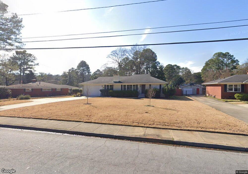
2817 Auburn Ave Columbus, GA 31906
Hilton Heights-Clubview Heights NeighborhoodEstimated Value: $252,893 - $274,000
3
Beds
2
Baths
1,801
Sq Ft
$146/Sq Ft
Est. Value
About This Home
This home is located at 2817 Auburn Ave, Columbus, GA 31906 and is currently estimated at $262,723, approximately $145 per square foot. 2817 Auburn Ave is a home located in Muscogee County with nearby schools including Clubview Elementary School, Richards Middle School, and Hardaway High School.
Ownership History
Date
Name
Owned For
Owner Type
Purchase Details
Closed on
Apr 17, 2020
Sold by
Singh Balwant
Bought by
Bias Benjamin Freeman
Current Estimated Value
Home Financials for this Owner
Home Financials are based on the most recent Mortgage that was taken out on this home.
Original Mortgage
$141,000
Outstanding Balance
$125,376
Interest Rate
3.6%
Mortgage Type
New Conventional
Estimated Equity
$137,347
Purchase Details
Closed on
Nov 23, 2005
Sold by
Bonnot Brooks J and Bonnot Ruth Anne H
Bought by
Averett Fredrick C and Averett Lauren B
Create a Home Valuation Report for This Property
The Home Valuation Report is an in-depth analysis detailing your home's value as well as a comparison with similar homes in the area
Home Values in the Area
Average Home Value in this Area
Purchase History
| Date | Buyer | Sale Price | Title Company |
|---|---|---|---|
| Bias Benjamin Freeman | $171,000 | -- | |
| Averett Fredrick C | -- | None Available |
Source: Public Records
Mortgage History
| Date | Status | Borrower | Loan Amount |
|---|---|---|---|
| Open | Bias Benjamin Freeman | $141,000 |
Source: Public Records
Tax History Compared to Growth
Tax History
| Year | Tax Paid | Tax Assessment Tax Assessment Total Assessment is a certain percentage of the fair market value that is determined by local assessors to be the total taxable value of land and additions on the property. | Land | Improvement |
|---|---|---|---|---|
| 2025 | $2,945 | $88,428 | $17,976 | $70,452 |
| 2024 | $2,944 | $88,428 | $17,976 | $70,452 |
| 2023 | $3,483 | $88,428 | $17,976 | $70,452 |
| 2022 | $3,031 | $74,236 | $17,976 | $56,260 |
| 2021 | $2,777 | $68,008 | $17,976 | $50,032 |
| 2020 | $2,778 | $68,008 | $17,976 | $50,032 |
| 2019 | $2,786 | $68,008 | $17,976 | $50,032 |
| 2018 | $2,157 | $68,008 | $17,976 | $50,032 |
| 2017 | $2,166 | $68,008 | $17,976 | $50,032 |
| 2016 | $2,175 | $66,000 | $12,152 | $53,848 |
| 2015 | $2,178 | $66,000 | $12,152 | $53,848 |
| 2014 | $2,181 | $66,000 | $12,152 | $53,848 |
| 2013 | -- | $66,000 | $12,152 | $53,848 |
Source: Public Records
Map
Nearby Homes
- 2930 Sue MacK Dr
- 2637 Sue MacK Dr
- 2820 Nancy St
- 2604 Sue MacK Dr
- 2917 Edgewood Rd
- 2722 E Lindsay Dr
- 2576 Habersham Ave
- 2817 Carson Dr
- 2940 Birchfield Dr
- 3224 Carden Dr
- 3402 Cambridge Dr
- 2525 Norris Rd Unit 36
- 2525 Norris Rd Unit 73
- 2525 Norris Rd Unit 91
- 2645 Edgewood Rd
- 1903 Marilon Dr
- 3346 Junaluska Dr
- 2010 Wells Dr
- 3335 Junaluska Dr
- 3129 Avon Dr
- 2809 Auburn Ave
- 2825 Auburn Ave
- 0 Auburn Ave
- 2806 Sue MacK Dr
- 2814 Sue MacK Dr
- 2818 Auburn Ave
- 2833 Auburn Ave
- 2822 Sue MacK Dr
- 2808 Auburn Ave
- 2916 Lynda Ln
- 2830 Sue MacK Dr
- 2936 Roswell Ln
- 2836 Auburn Ave
- 2748 Sue MacK Dr
- 2839 Auburn Ave
- 2871 Lynda Ln
- 2745 Auburn Ave
- 2870 Roswell Ln
- 2933 Roswell Ln
- 2933 Lynda Ln