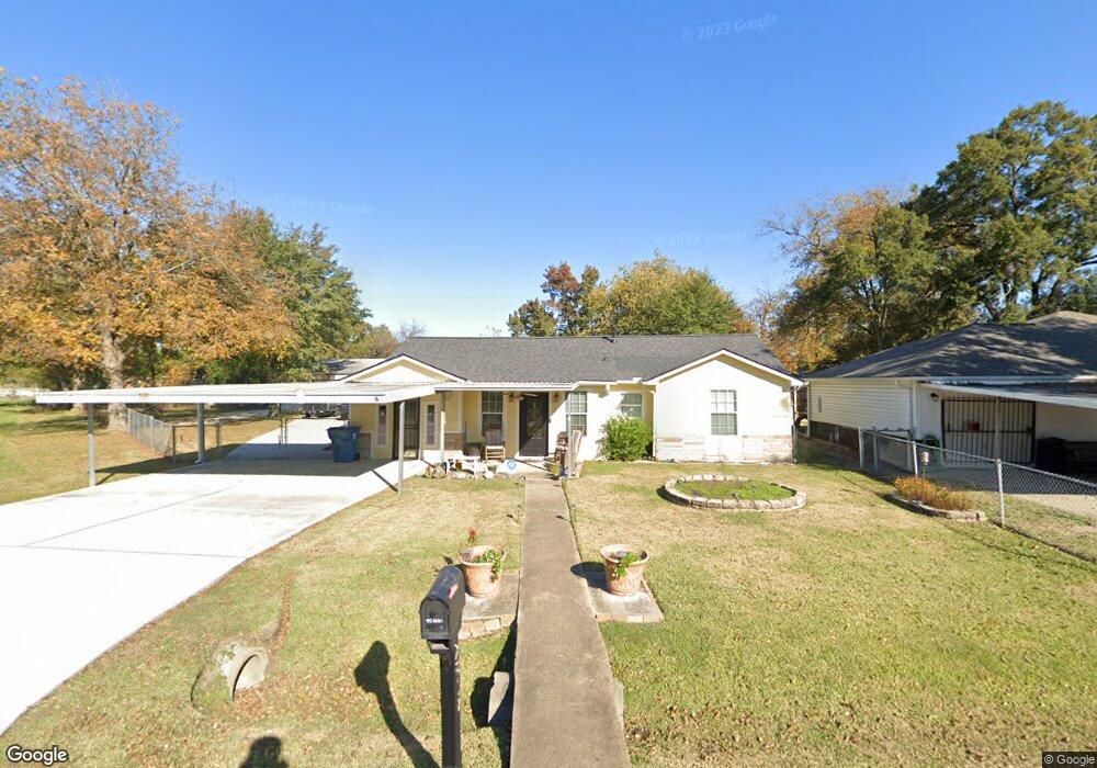
2817 Mohawk St Houston, TX 77093
East Aldine NeighborhoodEstimated Value: $184,000 - $261,871
3
Beds
2
Baths
1,044
Sq Ft
$223/Sq Ft
Est. Value
About This Home
This home is located at 2817 Mohawk St, Houston, TX 77093 and is currently estimated at $232,468, approximately $222 per square foot. 2817 Mohawk St is a home located in Harris County with nearby schools including Scarborough Elementary School, Patrick Henry Middle School, and Sam Houston Math, Science & Technology Center.
Ownership History
Date
Name
Owned For
Owner Type
Purchase Details
Closed on
Oct 20, 2006
Sold by
Stockton Finis C and Stockton Nelda Faye
Bought by
Vega Inez Abel and Vega Yvonne U
Current Estimated Value
Home Financials for this Owner
Home Financials are based on the most recent Mortgage that was taken out on this home.
Original Mortgage
$91,461
Outstanding Balance
$54,426
Interest Rate
6.41%
Mortgage Type
FHA
Estimated Equity
$178,042
Create a Home Valuation Report for This Property
The Home Valuation Report is an in-depth analysis detailing your home's value as well as a comparison with similar homes in the area
Home Values in the Area
Average Home Value in this Area
Purchase History
| Date | Buyer | Sale Price | Title Company |
|---|---|---|---|
| Vega Inez Abel | -- | Stewart Title Houston Divisi |
Source: Public Records
Mortgage History
| Date | Status | Borrower | Loan Amount |
|---|---|---|---|
| Open | Vega Inez Abel | $91,461 |
Source: Public Records
Tax History Compared to Growth
Tax History
| Year | Tax Paid | Tax Assessment Tax Assessment Total Assessment is a certain percentage of the fair market value that is determined by local assessors to be the total taxable value of land and additions on the property. | Land | Improvement |
|---|---|---|---|---|
| 2025 | $797 | $241,492 | $51,299 | $190,193 |
| 2024 | $797 | $269,654 | $51,299 | $218,355 |
| 2023 | $797 | $291,183 | $51,299 | $239,884 |
| 2022 | $1,631 | $246,658 | $39,255 | $207,403 |
| 2021 | $1,574 | $199,420 | $39,255 | $160,165 |
| 2020 | $1,488 | $172,370 | $39,255 | $133,115 |
| 2019 | $1,411 | $112,339 | $39,255 | $73,084 |
| 2018 | $1,283 | $79,800 | $39,255 | $40,545 |
| 2017 | $1,166 | $80,472 | $39,255 | $41,217 |
| 2016 | $1,060 | $80,472 | $39,255 | $41,217 |
| 2015 | -- | $45,000 | $24,535 | $20,465 |
| 2014 | -- | $45,000 | $24,535 | $20,465 |
Source: Public Records
Map
Nearby Homes
- 2817 Cromwell St
- 2629 Kowis St
- 2915 Brea Crest St
- 2311 Warwick Rd
- 11716 Innsbury Dr
- 2636 Lone Oak Rd
- 3214 Brea Crest St
- 2237 Cromwell St
- 2326 Sunny Dr
- 11746 Somerset Ln
- 2723 Castledale Dr
- 2306 Wardmont St
- 3111 Hartwick Rd
- 3418 Hopper Rd
- 1728 Little York Rd
- 2152 William Tell St
- 2922 Bertrand St
- 2930 Bertrand St
- 2131 Cromwell St Unit D
- 2122 Kowis St
- 2821 Mohawk St
- 2814 Hopper Rd
- 2818 Hopper Rd
- 2810 Hopper Rd
- 2822 Hopper Rd
- 2825 Mohawk St
- 2826 Hopper Rd
- 2814 Mohawk St
- 2806 Hopper Rd
- 2901 Mohawk St
- 2801 Mohawk St
- 2902 Hopper Rd
- 2810 Mohawk St
- 2902 Mohawk St
- 2905 Mohawk St
- 2806 Mohawk St
- 2906 Hopper Rd
- 0 Mohawk Unit 94173098
- 2817 Hopper Rd
- 2909 Mohawk St