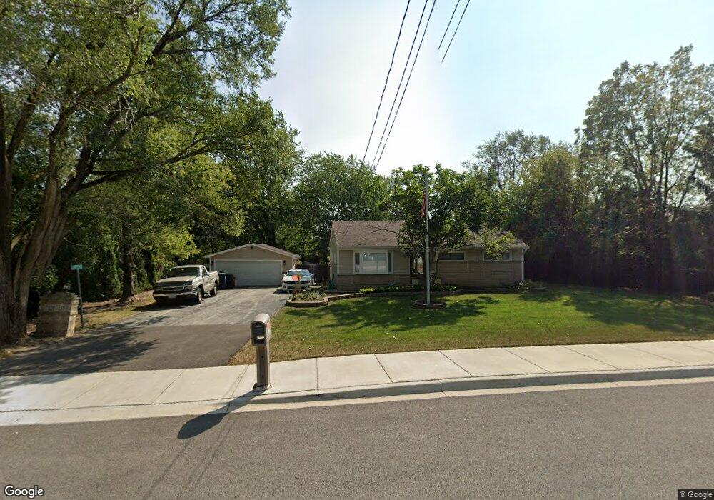
2817 W Nemesis Ave Waukegan, IL 60087
Estimated Value: $262,000 - $356,598
3
Beds
2
Baths
1,364
Sq Ft
$230/Sq Ft
Est. Value
About This Home
This home is located at 2817 W Nemesis Ave, Waukegan, IL 60087 and is currently estimated at $313,900, approximately $230 per square foot. 2817 W Nemesis Ave is a home located in Lake County with nearby schools including Oakdale Elementary School, Jack Benny Middle School, and Waukegan High School.
Ownership History
Date
Name
Owned For
Owner Type
Purchase Details
Closed on
Jan 25, 2007
Sold by
Grace Edgar L
Bought by
Grace Edgar L and Grace Cynthia T
Current Estimated Value
Home Financials for this Owner
Home Financials are based on the most recent Mortgage that was taken out on this home.
Original Mortgage
$206,000
Outstanding Balance
$123,796
Interest Rate
6.22%
Mortgage Type
New Conventional
Estimated Equity
$190,104
Purchase Details
Closed on
Jun 15, 1998
Sold by
Noel Raymond F and Noel Lodze M
Bought by
Grace Edgar L
Home Financials for this Owner
Home Financials are based on the most recent Mortgage that was taken out on this home.
Original Mortgage
$149,940
Interest Rate
7.22%
Mortgage Type
VA
Create a Home Valuation Report for This Property
The Home Valuation Report is an in-depth analysis detailing your home's value as well as a comparison with similar homes in the area
Home Values in the Area
Average Home Value in this Area
Purchase History
| Date | Buyer | Sale Price | Title Company |
|---|---|---|---|
| Grace Edgar L | -- | None Available | |
| Grace Edgar L | $147,000 | Standard Title |
Source: Public Records
Mortgage History
| Date | Status | Borrower | Loan Amount |
|---|---|---|---|
| Open | Grace Edgar L | $206,000 | |
| Closed | Grace Edgar L | $149,940 |
Source: Public Records
Tax History Compared to Growth
Tax History
| Year | Tax Paid | Tax Assessment Tax Assessment Total Assessment is a certain percentage of the fair market value that is determined by local assessors to be the total taxable value of land and additions on the property. | Land | Improvement |
|---|---|---|---|---|
| 2024 | -- | $125,359 | $13,187 | $112,172 |
| 2023 | -- | $112,970 | $11,806 | $101,164 |
| 2022 | $0 | $98,706 | $15,447 | $83,259 |
| 2021 | $0 | $89,424 | $13,778 | $75,646 |
| 2020 | $0 | $83,309 | $12,836 | $70,473 |
| 2019 | $0 | $76,339 | $11,762 | $64,577 |
| 2018 | $0 | $70,513 | $15,214 | $55,299 |
| 2017 | $0 | $62,384 | $13,460 | $48,924 |
| 2016 | $0 | $50,195 | $10,830 | $39,365 |
| 2015 | $0 | $44,925 | $9,693 | $35,232 |
| 2014 | $4,216 | $36,515 | $9,712 | $26,803 |
| 2012 | $5,367 | $39,560 | $10,521 | $29,039 |
Source: Public Records
Map
Nearby Homes
- 2705 Dana Ave
- 2708 Dana Ave
- 2713 Varonen Ave
- 3032 W Vermont Ave
- 36955 N Garrick Ave
- 12312 W Audrey Ave
- 3320 Sunset Ave
- 2928 W Country Club Ave
- 3000 W Country Club Ave
- 2946 W Country Club Ave
- 36245 N Green Bay Rd
- 12535 W Blanchard Rd
- 2715 W Greenwood Ave
- 1913 Chippewa Rd
- 2440 W Cheyenne Rd
- 2350 N Lewis Ave
- 12933 W Polo Ave
- 3101 Country Club Ln
- 2613 N Lewis Ave
- 3436 Florida Ave
- 2825 W Nemesis Ave
- 2819 W Nemesis Ave
- 2835 W Nemesis Ave
- 2409 N Frolic Ave
- 2820 W Nemesis Ave
- 2805 W Nemesis Ave
- 2816 W Nemesis Ave
- 2824 W Nemesis Ave
- 2812 W Nemesis Ave
- 2405 N Frolic Ave
- 2421 N Frolic Ave
- 2808 W Nemesis Ave
- 2401 N Frolic Ave
- 2425 N Frolic Ave
- 2804 W Nemesis Ave
- 2412 Metropolitan Ave
- 2408 Metropolitan Ave
- 2816 Shoshone Rd
- 2414 N Frolic Ave
- 2402 Metropolitan Ave