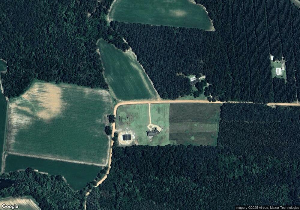
2818 Js Nesmith Rd Statesboro, GA 30458
Estimated Value: $590,000 - $1,420,890
4
Beds
3
Baths
3,543
Sq Ft
$284/Sq Ft
Est. Value
About This Home
This home is located at 2818 Js Nesmith Rd, Statesboro, GA 30458 and is currently estimated at $1,005,445, approximately $283 per square foot. 2818 Js Nesmith Rd is a home with nearby schools including Nevils Elementary School, Southeast Bulloch High School, and Southeast Bulloch Middle School.
Ownership History
Date
Name
Owned For
Owner Type
Purchase Details
Closed on
Sep 28, 2012
Sold by
Mcnure William Fletcher
Bought by
Thigpen Stewart A and Thigpen Karen E
Current Estimated Value
Home Financials for this Owner
Home Financials are based on the most recent Mortgage that was taken out on this home.
Original Mortgage
$130,000
Interest Rate
3.64%
Mortgage Type
New Conventional
Purchase Details
Closed on
Feb 7, 2008
Sold by
Not Provided
Bought by
Mcnure William Fletcher
Create a Home Valuation Report for This Property
The Home Valuation Report is an in-depth analysis detailing your home's value as well as a comparison with similar homes in the area
Home Values in the Area
Average Home Value in this Area
Purchase History
| Date | Buyer | Sale Price | Title Company |
|---|---|---|---|
| Thigpen Stewart A | $162,500 | -- | |
| Mcnure William Fletcher | -- | -- |
Source: Public Records
Mortgage History
| Date | Status | Borrower | Loan Amount |
|---|---|---|---|
| Closed | Thigpen Stewart A | $130,000 |
Source: Public Records
Tax History Compared to Growth
Tax History
| Year | Tax Paid | Tax Assessment Tax Assessment Total Assessment is a certain percentage of the fair market value that is determined by local assessors to be the total taxable value of land and additions on the property. | Land | Improvement |
|---|---|---|---|---|
| 2024 | $7,731 | $440,760 | $113,960 | $326,800 |
| 2023 | $5,768 | $311,644 | $93,120 | $218,524 |
| 2022 | $4,402 | $264,251 | $77,655 | $186,596 |
| 2021 | $3,878 | $235,927 | $77,655 | $158,272 |
| 2020 | $3,823 | $217,181 | $64,709 | $152,472 |
| 2019 | $3,835 | $217,218 | $64,709 | $152,509 |
| 2018 | $3,619 | $203,828 | $54,420 | $149,408 |
| 2017 | $3,514 | $197,500 | $54,420 | $143,080 |
| 2016 | $4,374 | $191,224 | $54,420 | $136,804 |
| 2015 | $4,214 | $183,384 | $54,420 | $128,963 |
| 2014 | $1,134 | $54,420 | $54,420 | $0 |
Source: Public Records
Map
Nearby Homes
- 0 G W Oliver Rd
- 1139 Groover Old Mill Rd
- 2010 Polk Rd N
- 1122 Turf Rd
- 0 Clifton Rd Unit SA339976
- 0 Clifton Rd Unit Lot 3 SA339975
- 0 Clifton Rd Unit LOT 3 10607565
- 0 Clifton Rd Unit 10585882
- 171 Stonebrook Way
- 178 Stonebrook Way
- 1694 Bragan Rd
- 613 Fescue Dr
- 1533 Gw Oliver Rd
- 509 Colquitt Ln
- 7881 Sinkhole Rd
- 633 Fescue Dr
- 512 Colquitt Ln
- 149 Griffith Ln
- 633 Hampstead Ave
- 201 Cumberland Point
- 3048 J S Nesmith Rd
- 2899 Js Nesmith Rd
- 3181 Js Nesmith Rd
- 2955 Js Nesmith Rd
- 1427 Harville Rd
- 1405 Harville Rd
- 1542 Harville Rd
- 1801 Harville Rd
- 1261 Harville Rd
- 1828 Harville Rd
- 1213 Harville Rd
- 1850 Harville Rd
- 304 Waters Cemetery Rd
- 219 Waters Cemetery Rd
- 0 Waters Cemetery Rd
- 1149 Harville Rd
- 2071 Harville Rd
- 406 Waters Cemetery Rd
- 4348 Gw Oliver Rd
- 2185 Harville Rd
