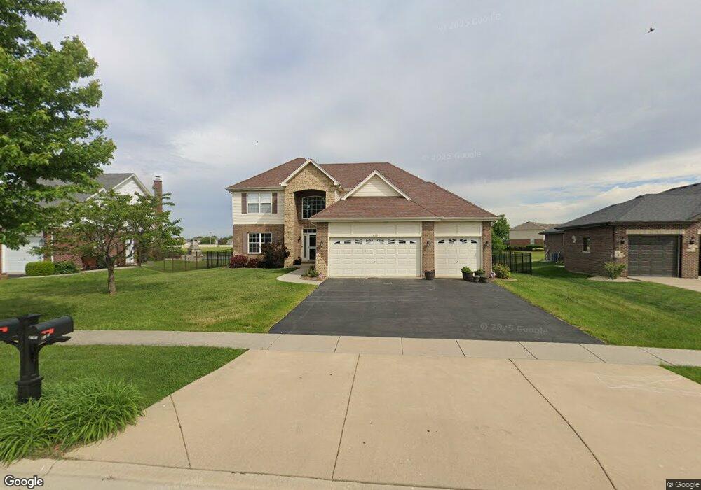
2819 Brett Dr Unit 2 New Lenox, IL 60451
Estimated Value: $516,634 - $619,000
4
Beds
3
Baths
--
Sq Ft
0.28
Acres
About This Home
This home is located at 2819 Brett Dr Unit 2, New Lenox, IL 60451 and is currently estimated at $560,409. 2819 Brett Dr Unit 2 is a home located in Will County with nearby schools including Nelson Prairie School, Lincoln Way West, and St. Jude School.
Ownership History
Date
Name
Owned For
Owner Type
Purchase Details
Closed on
Nov 11, 2010
Sold by
Siegler Neal
Bought by
Heher Thomas J
Current Estimated Value
Home Financials for this Owner
Home Financials are based on the most recent Mortgage that was taken out on this home.
Original Mortgage
$255,920
Outstanding Balance
$168,162
Interest Rate
4.19%
Mortgage Type
New Conventional
Estimated Equity
$392,247
Purchase Details
Closed on
Jun 4, 2008
Sold by
Standard Bank & Trust Co
Bought by
Siegler Neal
Home Financials for this Owner
Home Financials are based on the most recent Mortgage that was taken out on this home.
Original Mortgage
$353,400
Interest Rate
6.04%
Mortgage Type
Purchase Money Mortgage
Create a Home Valuation Report for This Property
The Home Valuation Report is an in-depth analysis detailing your home's value as well as a comparison with similar homes in the area
Home Values in the Area
Average Home Value in this Area
Purchase History
| Date | Buyer | Sale Price | Title Company |
|---|---|---|---|
| Heher Thomas J | $319,900 | Stewart Title Company | |
| Siegler Neal | $372,500 | Chicago Title Insurance Co |
Source: Public Records
Mortgage History
| Date | Status | Borrower | Loan Amount |
|---|---|---|---|
| Open | Heher Thomas J | $255,920 | |
| Previous Owner | Siegler Neal | $353,400 |
Source: Public Records
Tax History Compared to Growth
Tax History
| Year | Tax Paid | Tax Assessment Tax Assessment Total Assessment is a certain percentage of the fair market value that is determined by local assessors to be the total taxable value of land and additions on the property. | Land | Improvement |
|---|---|---|---|---|
| 2024 | $11,270 | $146,873 | $33,360 | $113,513 |
| 2023 | $11,270 | $133,886 | $30,410 | $103,476 |
| 2022 | $10,153 | $123,341 | $28,015 | $95,326 |
| 2021 | $9,640 | $115,998 | $26,347 | $89,651 |
| 2020 | $9,367 | $111,859 | $25,407 | $86,452 |
| 2019 | $8,966 | $108,390 | $24,619 | $83,771 |
| 2018 | $8,760 | $104,653 | $23,770 | $80,883 |
| 2017 | $8,325 | $101,645 | $23,087 | $78,558 |
| 2016 | $8,082 | $98,924 | $22,469 | $76,455 |
| 2015 | $7,786 | $95,810 | $21,762 | $74,048 |
| 2014 | $7,786 | $94,627 | $21,493 | $73,134 |
| 2013 | $7,786 | $95,903 | $21,783 | $74,120 |
Source: Public Records
Map
Nearby Homes
- 2763 Foxwood Dr Unit 2763
- 2788 Meadow Path
- 1108 Yamma Ridge
- 1205 Jennie Dr
- 1179 Yamma Ridge
- 1019 James Pass
- 2206 Daniel Lewis Dr
- 2305 Kerry Winde Dr
- 1914 Heatherway Ln Unit 27
- 14620 W Laraway Rd
- 1801 Stonebridge Dr
- 2341 Stone Creek Dr
- 2331 Stone Creek Dr
- 2321 Stone Creek Dr
- 2381 Stone Creek Dr
- 2301 Stone Creek Dr
- 2291 Stone Creek Dr
- 2391 Stone Creek Dr
- 2251 Stone Creek Dr
- 2401 Stone Creek Dr
- 2827 Brett Dr
- 2801 Brett Dr
- 2835 Brett Dr
- 2804 Brett Dr
- 2820 Brett Dr
- 2802 Foxwood Dr
- 2836 Brett Dr
- 2847 Brett Dr
- 2803 Foxwood Dr
- 2765 Foxwood Dr Unit 2765
- 2767 Foxwood Dr Unit 2767
- 2769 Foxwood Dr Unit 2769
- 2851 Brett Dr
- 2852 Brett Dr
- 2809 Foxwood Dr
- 920 Foxwood Ct Unit 920
- 922 Foxwood Ct Unit 922
- 918 Foxwood Ct Unit 918
- 924 Foxwood Ct Unit 924
- 952 Foxwood Ct Unit 952