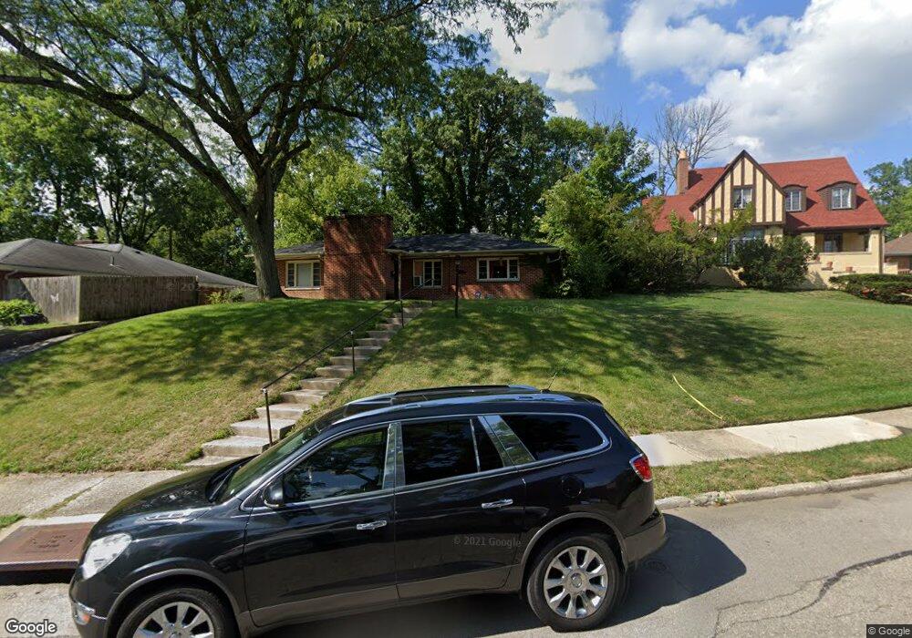
2819 Forest Grove Ave Dayton, OH 45406
College Hill NeighborhoodEstimated Value: $109,000 - $131,399
2
Beds
3
Baths
1,179
Sq Ft
$100/Sq Ft
Est. Value
About This Home
This home is located at 2819 Forest Grove Ave, Dayton, OH 45406 and is currently estimated at $117,350, approximately $99 per square foot. 2819 Forest Grove Ave is a home located in Montgomery County with nearby schools including Valerie Elementary School, Imagine Klepinger Road Community School, and Dayton Leadership Academies.
Ownership History
Date
Name
Owned For
Owner Type
Purchase Details
Closed on
Jan 13, 2009
Sold by
Mcghee Ival and Mcghee Ival A
Bought by
Aboda Management Llc
Current Estimated Value
Purchase Details
Closed on
Sep 13, 2007
Sold by
Us Bank Na
Bought by
Mcghee Ival A
Purchase Details
Closed on
Aug 20, 2007
Sold by
Daniel Brande J and Daniel Brande
Bought by
Us Bank Na
Purchase Details
Closed on
Aug 29, 2005
Sold by
Davis Anya L and Archie William L
Bought by
Daniel Brande J
Home Financials for this Owner
Home Financials are based on the most recent Mortgage that was taken out on this home.
Original Mortgage
$50,800
Interest Rate
10.85%
Mortgage Type
Fannie Mae Freddie Mac
Create a Home Valuation Report for This Property
The Home Valuation Report is an in-depth analysis detailing your home's value as well as a comparison with similar homes in the area
Home Values in the Area
Average Home Value in this Area
Purchase History
| Date | Buyer | Sale Price | Title Company |
|---|---|---|---|
| Aboda Management Llc | -- | Attorney | |
| Mcghee Ival A | $29,900 | Resource Title Of Cincinnati | |
| Us Bank Na | $38,000 | None Available | |
| Daniel Brande J | $63,500 | -- |
Source: Public Records
Mortgage History
| Date | Status | Borrower | Loan Amount |
|---|---|---|---|
| Previous Owner | Daniel Brande J | $50,800 |
Source: Public Records
Tax History Compared to Growth
Tax History
| Year | Tax Paid | Tax Assessment Tax Assessment Total Assessment is a certain percentage of the fair market value that is determined by local assessors to be the total taxable value of land and additions on the property. | Land | Improvement |
|---|---|---|---|---|
| 2024 | $1,603 | $27,720 | $5,040 | $22,680 |
| 2023 | $1,603 | $27,720 | $5,040 | $22,680 |
| 2022 | $1,583 | $21,160 | $3,850 | $17,310 |
| 2021 | $1,574 | $21,160 | $3,850 | $17,310 |
| 2020 | $1,571 | $21,160 | $3,850 | $17,310 |
| 2019 | $1,355 | $16,280 | $3,170 | $13,110 |
| 2018 | $1,357 | $16,280 | $3,170 | $13,110 |
| 2017 | $1,347 | $16,280 | $3,170 | $13,110 |
| 2016 | $1,563 | $18,560 | $3,850 | $14,710 |
| 2015 | $1,478 | $18,560 | $3,850 | $14,710 |
| 2014 | $1,478 | $18,560 | $3,850 | $14,710 |
| 2012 | -- | $23,760 | $4,830 | $18,930 |
Source: Public Records
Map
Nearby Homes
- 1944 Victoria Ave
- 1935 Philadelphia Dr
- 1984 Burroughs Dr
- 601 Otterbein Ave
- 2030 Burroughs Dr
- 1906 Kensington Dr
- 1910 Kensington Dr
- 2201 N Gettysburg Ave
- 1954 Kensington Dr
- 1656 Tennyson Ave
- 1628 Philadelphia Dr
- 409 Otterbein Ave
- 3231 Harvard Blvd
- 1941 Auburn Ave
- 1937 Auburn Ave
- 1931 Auburn Ave
- 1816 Wesleyan Rd
- 960 Sherwood Dr
- 2127 Kensington Dr
- 2031 Ravenwood Ave
- 2815 Forest Grove Ave
- 2825 Forest Grove Ave
- 1930 Victoria Ave
- 2803 Forest Grove Ave
- 1908 Tennyson Ave
- 2808 Forest Grove Ave
- 1936 Victoria Ave
- 1912 Tennyson Ave
- 1902 Tennyson Ave
- 1947 Philadelphia Dr
- 1933 Victoria Ave
- 2828 Forest Grove Ave
- 2001 Philadelphia Dr
- 1940 Victoria Ave
- 1856 Ruskin Rd
- 2834 Forest Grove Ave
- 1941 Victoria Ave
- 1918 Tennyson Ave
- 1851 Ruskin Rd
- 1846 Ruskin Rd