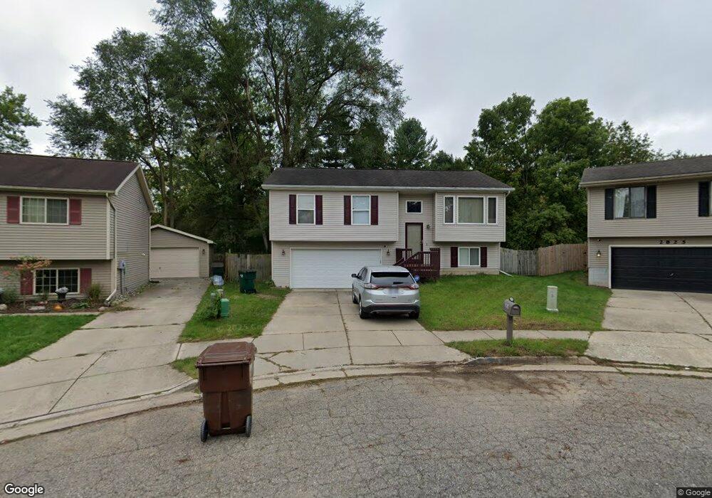
2819 Leyburn Ct Lansing, MI 48911
Pleasant Grove NeighborhoodEstimated Value: $167,000 - $182,000
--
Bed
1
Bath
1,300
Sq Ft
$134/Sq Ft
Est. Value
About This Home
This home is located at 2819 Leyburn Ct, Lansing, MI 48911 and is currently estimated at $173,721, approximately $133 per square foot. 2819 Leyburn Ct is a home located in Ingham County with nearby schools including Reo Elementary School, Attwood School, and J.W. Sexton High School.
Ownership History
Date
Name
Owned For
Owner Type
Purchase Details
Closed on
Feb 11, 2003
Sold by
Manno Frank and Manno Carolyn
Bought by
Reed Henry T and Reed Canvass L
Current Estimated Value
Home Financials for this Owner
Home Financials are based on the most recent Mortgage that was taken out on this home.
Original Mortgage
$125,400
Outstanding Balance
$51,457
Interest Rate
5.62%
Mortgage Type
Purchase Money Mortgage
Estimated Equity
$122,264
Purchase Details
Closed on
Jul 31, 2002
Sold by
Premer Mark and Premer Lota
Bought by
Manno Frank
Home Financials for this Owner
Home Financials are based on the most recent Mortgage that was taken out on this home.
Original Mortgage
$110,600
Interest Rate
5.62%
Mortgage Type
Purchase Money Mortgage
Create a Home Valuation Report for This Property
The Home Valuation Report is an in-depth analysis detailing your home's value as well as a comparison with similar homes in the area
Home Values in the Area
Average Home Value in this Area
Purchase History
| Date | Buyer | Sale Price | Title Company |
|---|---|---|---|
| Reed Henry T | $125,400 | Transnation Title | |
| Manno Frank | $116,432 | Bell Title Company |
Source: Public Records
Mortgage History
| Date | Status | Borrower | Loan Amount |
|---|---|---|---|
| Open | Reed Henry T | $125,400 | |
| Previous Owner | Manno Frank | $110,600 |
Source: Public Records
Tax History Compared to Growth
Tax History
| Year | Tax Paid | Tax Assessment Tax Assessment Total Assessment is a certain percentage of the fair market value that is determined by local assessors to be the total taxable value of land and additions on the property. | Land | Improvement |
|---|---|---|---|---|
| 2025 | $2,836 | $82,600 | $6,400 | $76,200 |
| 2024 | $22 | $68,800 | $6,400 | $62,400 |
| 2023 | $2,660 | $57,500 | $6,400 | $51,100 |
| 2022 | $2,398 | $52,400 | $4,500 | $47,900 |
| 2021 | $2,348 | $50,300 | $3,300 | $47,000 |
| 2020 | $2,334 | $48,400 | $3,300 | $45,100 |
| 2019 | $2,237 | $46,200 | $3,300 | $42,900 |
| 2018 | $2,097 | $39,800 | $3,300 | $36,500 |
| 2017 | $2,007 | $39,800 | $3,300 | $36,500 |
| 2016 | $1,920 | $37,200 | $3,300 | $33,900 |
| 2015 | $1,920 | $35,600 | $6,635 | $28,965 |
| 2014 | $1,920 | $33,900 | $8,586 | $25,314 |
Source: Public Records
Map
Nearby Homes
- 3115 Risdale Ave
- 4809 Ballard Rd
- 2816 Greenbelt Dr
- 4828 Ingham St
- 2311 Greenbelt Dr
- 4110 Richmond St
- 4628 Pleasant Grove Rd
- 4017 Richmond St
- 3006 Hillcrest St
- 4000 Churchill Ave
- 2416 Midwood St
- 3600 Ronald St
- 2029 Hillcrest St
- 3100 Glenbrook Dr
- 3424 S Catherine St
- 4620 Christiansen Rd
- 5100 Wexford Rd
- 1729 Reo Rd
- 3334 Ingham St
- 3336 Avalon St
- 2811 Leyburn Ct
- 2831 Leyburn Ct
- 4500 Ingham St
- 4430 Ingham St
- 4508 Ingham St
- 4512 Ingham St
- 2824 Leyburn Ct
- 2810 Leyburn Ct
- 2818 Leyburn Ct
- 2800 Leyburn Ct
- 4418 Ingham St
- 4524 Ingham St
- 4423 Ballard Rd
- 2825 Risdale Ave
- 2901 Risdale Ave
- 4503 Ingham St
- 2835 Risdale Ave
- 4501 Ballard Rd
- 4406 Ingham St
- 4511 Ingham St