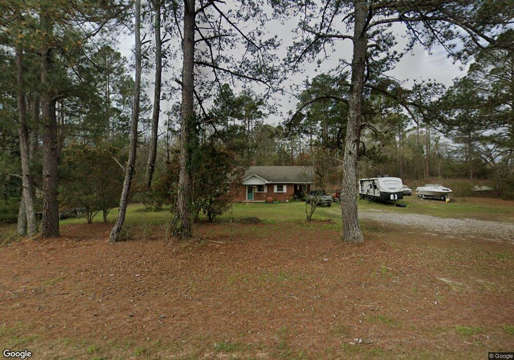
2819 Wrens Hwy Thomson, GA 30824
Estimated Value: $87,000 - $227,000
2
Beds
1
Bath
1,064
Sq Ft
$140/Sq Ft
Est. Value
About This Home
This home is located at 2819 Wrens Hwy, Thomson, GA 30824 and is currently estimated at $149,484, approximately $140 per square foot. 2819 Wrens Hwy is a home located in McDuffie County with nearby schools including Thomson High School.
Ownership History
Date
Name
Owned For
Owner Type
Purchase Details
Closed on
Nov 10, 2016
Sold by
Noggle William K
Bought by
Floyd Bobby L
Current Estimated Value
Purchase Details
Closed on
Jul 12, 2016
Bought by
Noggle William K
Purchase Details
Closed on
Dec 21, 2000
Sold by
Fulbright Heating & Air
Bought by
Fulbright Inc
Purchase Details
Closed on
Aug 18, 1995
Sold by
Hall Larry R
Bought by
Fulbright S Wayne
Purchase Details
Closed on
Nov 20, 1987
Bought by
Hall Larry R
Create a Home Valuation Report for This Property
The Home Valuation Report is an in-depth analysis detailing your home's value as well as a comparison with similar homes in the area
Home Values in the Area
Average Home Value in this Area
Purchase History
| Date | Buyer | Sale Price | Title Company |
|---|---|---|---|
| Floyd Bobby L | $68,000 | -- | |
| Noggle William K | $58,000 | -- | |
| Fulbright Inc | $56,500 | -- | |
| Fulbright Heating & Air | $34,500 | -- | |
| Fulbright S Wayne | $29,100 | -- | |
| Hall Larry R | $25,000 | -- |
Source: Public Records
Tax History Compared to Growth
Tax History
| Year | Tax Paid | Tax Assessment Tax Assessment Total Assessment is a certain percentage of the fair market value that is determined by local assessors to be the total taxable value of land and additions on the property. | Land | Improvement |
|---|---|---|---|---|
| 2025 | $997 | $40,856 | $4,974 | $35,882 |
| 2024 | $997 | $38,470 | $4,482 | $33,988 |
| 2023 | $954 | $37,066 | $4,482 | $32,584 |
| 2022 | $775 | $28,089 | $4,482 | $23,607 |
| 2021 | $636 | $22,644 | $4,351 | $18,293 |
| 2020 | $516 | $18,318 | $3,472 | $14,846 |
| 2019 | $522 | $18,318 | $3,472 | $14,846 |
| 2018 | $729 | $25,588 | $3,472 | $22,116 |
| 2017 | $703 | $25,588 | $3,472 | $22,116 |
| 2016 | $703 | $25,588 | $3,472 | $22,116 |
| 2015 | $696 | $27,783 | $5,668 | $22,116 |
| 2014 | $697 | $27,784 | $5,668 | $22,116 |
| 2013 | -- | $27,784 | $5,668 | $22,116 |
Source: Public Records
Map
Nearby Homes
- 789 George McDuffie Rd
- 1543 Wrens Hwy
- 000 Wrens Hwy
- 0 Mitchner Rd Unit 548843
- 2522 Ellington Airline Rd
- 0 Wrens Hwy Unit 10652460
- 0 Wrens Hwy Unit 549833
- 1761 Augusta Hwy
- 1008 Wrens Hwy
- 354 King St
- 1463 Lokey Dr
- 118 Langham St
- 67 Shadowmoor Cir
- 415 Stonewall Dr
- 306 Michael St
- 709 Pine Lane Dr
- 3368 Sandhill Rd
- 1280 Acadia Dr
- 1009 Berkley Ct
- 609 Hillcrest Dr
- 2818 Wrens Hwy
- 2828 Wrens Hwy
- 2790 Wrens Hwy
- 2864 Wrens Hwy
- 140 May Rd
- 2682 Quail Farm Rd
- 2656 Quail Farm Rd
- 2700 Quail Farm Rd
- 2804 Wrens Hwy
- 115 May Rd
- 2602 Quail Farm Rd
- 2720 Quail Farm Rd
- 2633 Quail Farm Rd
- 2724 Wrens Hwy
- 121 May Rd
- 212 May Rd
- 2708 Wrens Hwy
- 2857 Wrens Hwy
- 226 May Rd
- 2686 Wrens Hwy