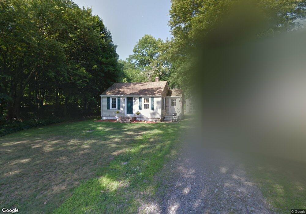
282 Cumberland Ave North Attleboro, MA 02760
North Attleboro NeighborhoodEstimated Value: $317,360 - $394,000
2
Beds
1
Bath
480
Sq Ft
$729/Sq Ft
Est. Value
About This Home
This home is located at 282 Cumberland Ave, North Attleboro, MA 02760 and is currently estimated at $349,840, approximately $728 per square foot. 282 Cumberland Ave is a home located in Bristol County with nearby schools including North Attleboro High School, Dayspring Christian Academy, and St Cecilia School.
Ownership History
Date
Name
Owned For
Owner Type
Purchase Details
Closed on
Mar 19, 2015
Sold by
Nerney Thomas J
Bought by
Nerney Donna E
Current Estimated Value
Purchase Details
Closed on
Jan 1, 1987
Bought by
Nerney Donna E
Create a Home Valuation Report for This Property
The Home Valuation Report is an in-depth analysis detailing your home's value as well as a comparison with similar homes in the area
Home Values in the Area
Average Home Value in this Area
Purchase History
| Date | Buyer | Sale Price | Title Company |
|---|---|---|---|
| Nerney Donna E | -- | -- | |
| Nerney Donna E | -- | -- |
Source: Public Records
Mortgage History
| Date | Status | Borrower | Loan Amount |
|---|---|---|---|
| Previous Owner | Nerney Donna E | $97,000 |
Source: Public Records
Tax History Compared to Growth
Tax History
| Year | Tax Paid | Tax Assessment Tax Assessment Total Assessment is a certain percentage of the fair market value that is determined by local assessors to be the total taxable value of land and additions on the property. | Land | Improvement |
|---|---|---|---|---|
| 2025 | $3,102 | $263,100 | $133,000 | $130,100 |
| 2024 | $2,966 | $257,000 | $133,000 | $124,000 |
| 2023 | $3,025 | $236,500 | $133,000 | $103,500 |
| 2022 | $2,955 | $212,100 | $133,000 | $79,100 |
| 2021 | $3,147 | $220,500 | $133,000 | $87,500 |
| 2020 | $3,031 | $211,200 | $133,000 | $78,200 |
| 2019 | $2,837 | $199,200 | $121,000 | $78,200 |
| 2018 | $3,289 | $191,200 | $121,000 | $70,200 |
| 2017 | $2,484 | $187,900 | $121,000 | $66,900 |
| 2016 | $2,529 | $191,300 | $134,400 | $56,900 |
| 2015 | $2,540 | $193,300 | $141,100 | $52,200 |
| 2014 | $2,410 | $182,000 | $130,400 | $51,600 |
Source: Public Records
Map
Nearby Homes
- 181 Paine Rd
- 31 Paine Rd
- 1 Frederick a Nittel Dr
- 155 May St
- 135 Cumberland Ave
- 0 Mendon Rd
- 27 Killarney Way
- 23 Cumberland Ave
- 740 Allen Ave
- 543 Newport Ave
- 517 Newport Ave
- 44 Powder Horn Way
- 338 Newport Ave
- 64 Highland Ave Unit A
- 64 Highland Ave Unit B
- 11 Howarth Ave
- 143 Millard Rd
- 457 Bryant St
- 73 Grandview Dr
- 154 Bear Hill Rd Unit 306
- 290 Cumberland Ave
- 278 Cumberland Ave
- 272 Cumberland Ave
- 296 Cumberland Ave
- 283 Cumberland Ave
- 287 Cumberland Ave
- 277 Cumberland Ave
- 293 Cumberland Ave
- 25 Norborough Dr
- 304 Cumberland Ave
- 24 Veteran's Way
- 301 Cumberland Ave
- 24 Norborough Dr
- 266 Cumberland Ave
- 271 Cumberland Ave
- 35 Norborough Dr
- 34 Norborough Dr
- 312 Cumberland Ave
- 45 Norborough Rd
- 45 Norborough Dr