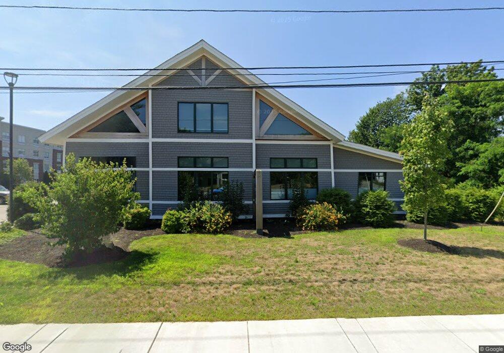
282 Elm St Amesbury, MA 01913
Estimated Value: $373,000
--
Bed
4
Baths
7,560
Sq Ft
$49/Sq Ft
Est. Value
About This Home
This home is located at 282 Elm St, Amesbury, MA 01913 and is currently priced at $373,000, approximately $49 per square foot. 282 Elm St is a home located in Essex County with nearby schools including Amesbury High School, Immaculate Conception School, and Amesbury Seventh-Day Adventist School.
Ownership History
Date
Name
Owned For
Owner Type
Purchase Details
Closed on
Apr 4, 2018
Sold by
Finard Amesbury Llc
Bought by
Pryor & Lyle Llc
Current Estimated Value
Purchase Details
Closed on
Aug 10, 1999
Sold by
Pratt Leon M and Pratt Susan E
Bought by
Finard Amesbury Llc and True Homestead Lp 1
Home Financials for this Owner
Home Financials are based on the most recent Mortgage that was taken out on this home.
Original Mortgage
$13,500,000
Interest Rate
7.54%
Mortgage Type
Purchase Money Mortgage
Create a Home Valuation Report for This Property
The Home Valuation Report is an in-depth analysis detailing your home's value as well as a comparison with similar homes in the area
Home Values in the Area
Average Home Value in this Area
Purchase History
| Date | Buyer | Sale Price | Title Company |
|---|---|---|---|
| Pryor & Lyle Llc | $529,500 | -- | |
| Finard Amesbury Llc | $350,000 | -- |
Source: Public Records
Mortgage History
| Date | Status | Borrower | Loan Amount |
|---|---|---|---|
| Previous Owner | Finard Amesbury Llc | $13,500,000 | |
| Previous Owner | Finard Amesbury Llc | $100,000 | |
| Previous Owner | Finard Amesbury Llc | $30,000 |
Source: Public Records
Tax History Compared to Growth
Tax History
| Year | Tax Paid | Tax Assessment Tax Assessment Total Assessment is a certain percentage of the fair market value that is determined by local assessors to be the total taxable value of land and additions on the property. | Land | Improvement |
|---|---|---|---|---|
| 2025 | $29,417 | $1,922,700 | $574,700 | $1,348,000 |
| 2024 | $29,804 | $1,905,600 | $543,400 | $1,362,200 |
| 2023 | $29,561 | $1,809,100 | $468,500 | $1,340,600 |
| 2022 | $31,769 | $1,795,900 | $468,500 | $1,327,400 |
| 2021 | $29,932 | $1,640,100 | $468,500 | $1,171,600 |
| 2020 | $28,380 | $1,651,900 | $468,500 | $1,183,400 |
| 2019 | $6,196 | $337,300 | $337,300 | $0 |
| 2018 | $5,826 | $306,800 | $306,800 | $0 |
| 2017 | $5,893 | $295,400 | $295,400 | $0 |
| 2016 | $5,624 | $277,300 | $277,300 | $0 |
| 2015 | $5,696 | $277,300 | $277,300 | $0 |
| 2014 | $5,815 | $277,300 | $277,300 | $0 |
Source: Public Records
Map
Nearby Homes
- 25 Clarks Rd Unit 307
- 2 Birchwood Ct Unit 101
- 3 Birchwood Ct Unit 102
- 434 Main St
- 435 Main St
- 473 Main St
- 486 Main St
- 204 Elm St
- 394 Main St
- 18 Hawkswood Estates
- 47 Macy St
- 179 Elm St
- 45 Macy St Unit 302C
- 15 Atlantic Ave
- 191 Elm St
- 356 Main St
- 161 Elm St Unit A
- 22 Huntington Ave
- 35 Merrimac St
- 6 Wells Ave Unit C