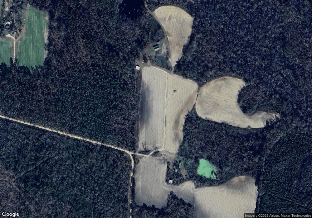
Estimated Value: $120,000 - $219,000
--
Bed
--
Bath
1,456
Sq Ft
$111/Sq Ft
Est. Value
About This Home
This home is located at 282 Gails Ln, Axson, GA 31624 and is currently estimated at $161,505, approximately $110 per square foot. 282 Gails Ln is a home with nearby schools including Pearson Elementary School, Willacoochee Elementary School, and Atkinson County High School.
Ownership History
Date
Name
Owned For
Owner Type
Purchase Details
Closed on
Feb 14, 2023
Sold by
Mullis Gail Minchew
Bought by
Fab Tec Inc
Current Estimated Value
Purchase Details
Closed on
Apr 8, 2011
Sold by
Mullis Gail Minchew
Bought by
Overstreet Limited Partnership
Purchase Details
Closed on
Nov 20, 2009
Sold by
Mullis Gail M
Bought by
Overstreet Limited Partnership
Purchase Details
Closed on
Apr 28, 2009
Sold by
Mullis Gail M
Bought by
Overstreet Limited Partnership
Purchase Details
Closed on
Jun 25, 2008
Sold by
Mullis Gail M
Bought by
Overstreet Limited Partnership
Purchase Details
Closed on
Nov 14, 2006
Sold by
Mullis Gail M
Bought by
Overstreet Limited Partnership
Purchase Details
Closed on
Sep 2, 2005
Sold by
Minchen Gail M
Bought by
Wright Bryan and Wright Sherri
Purchase Details
Closed on
Aug 4, 2005
Sold by
Cofield Abby M
Bought by
Mullis Gail M
Purchase Details
Closed on
Aug 1, 1996
Bought by
Cofield Abby M and Cofield Gail M
Purchase Details
Closed on
Oct 10, 1959
Bought by
Minchew A T
Create a Home Valuation Report for This Property
The Home Valuation Report is an in-depth analysis detailing your home's value as well as a comparison with similar homes in the area
Home Values in the Area
Average Home Value in this Area
Purchase History
| Date | Buyer | Sale Price | Title Company |
|---|---|---|---|
| Fab Tec Inc | $99,000 | -- | |
| Overstreet Limited Partnership | $14,295 | -- | |
| Overstreet Limited Partnership | $93,345 | -- | |
| Overstreet Limited Partnership | $57,480 | -- | |
| Overstreet Limited Partnership | $2,600 | -- | |
| Sw Overstreet Properties Llc | -- | -- | |
| Sw Overstreet Properties Llc | $51,820 | -- | |
| Overstreet Limited Partnership | $101,106 | -- | |
| Wright Bryan | $19,000 | -- | |
| Mullis Gail M | -- | -- | |
| Cofield Abby M | -- | -- | |
| Minchew A T | -- | -- |
Source: Public Records
Tax History Compared to Growth
Tax History
| Year | Tax Paid | Tax Assessment Tax Assessment Total Assessment is a certain percentage of the fair market value that is determined by local assessors to be the total taxable value of land and additions on the property. | Land | Improvement |
|---|---|---|---|---|
| 2024 | $1,052 | $36,404 | $3,420 | $32,984 |
| 2023 | $502 | $36,404 | $3,420 | $32,984 |
| 2022 | $1,048 | $36,404 | $3,420 | $32,984 |
| 2021 | $1,105 | $36,404 | $3,420 | $32,984 |
| 2020 | $1,106 | $36,404 | $3,420 | $32,984 |
| 2019 | $1,106 | $36,404 | $3,420 | $32,984 |
| 2018 | $1,177 | $36,404 | $3,420 | $32,984 |
| 2017 | $1,107 | $36,404 | $3,420 | $32,984 |
| 2016 | $1,107 | $36,404 | $3,420 | $32,984 |
| 2015 | -- | $36,403 | $3,420 | $32,984 |
| 2014 | -- | $36,404 | $3,420 | $32,984 |
Source: Public Records
Map
Nearby Homes
- 6860 Douglas Hwy
- Tbd Duncan Bridge Rd
- 149 Red Bluff Rd
- Tbd Albany Hwy
- 8802 Good Carter Rd
- 1398 Adventure Trail
- 227 Bear Trail
- 26 Acres Telmore-Dixie Union Rd
- 0 Grey Hawk Rd
- 309 Kemp Ave
- 1125 Barn Owl Ln
- 6176 Perch Creek Trail
- 503 N Mill St
- 00 Cogdell Hwy
- 1017 van Streat Hwy
- 525 Drake Dr
- S S River Rd
- 159 Jabbers Ln
- 421 Drake Dr
- Tract 2 Jim Meeks Rd
