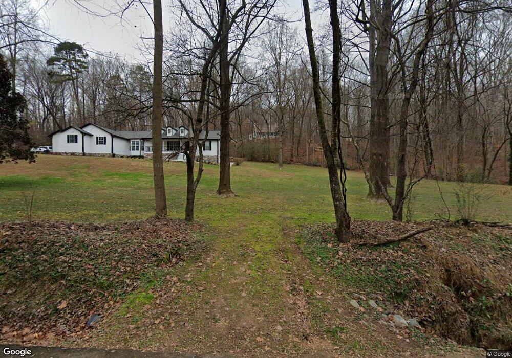
282 Heath Rd Dawsonville, GA 30534
Dawson County NeighborhoodEstimated Value: $425,000 - $510,000
3
Beds
2
Baths
1,536
Sq Ft
$301/Sq Ft
Est. Value
About This Home
This home is located at 282 Heath Rd, Dawsonville, GA 30534 and is currently estimated at $462,360, approximately $301 per square foot. 282 Heath Rd is a home located in Dawson County with nearby schools including Kilough Elementary School, Dawson County Junior High School, and Dawson County Middle School.
Ownership History
Date
Name
Owned For
Owner Type
Purchase Details
Closed on
Mar 20, 2015
Sold by
Milner Jacklyn L
Bought by
Milner Jacklyn L and Milner Curtis J
Current Estimated Value
Purchase Details
Closed on
Oct 14, 2011
Sold by
Henderson Joshua H
Bought by
Milner Jacklyn L
Purchase Details
Closed on
Sep 2, 2009
Sold by
Kinnard Emma Jean Jarrard
Bought by
Henderson Joshua H
Purchase Details
Closed on
Nov 13, 2007
Sold by
Not Provided
Bought by
Jarrard Henderson Joshua H and Jarrard Angelia D
Create a Home Valuation Report for This Property
The Home Valuation Report is an in-depth analysis detailing your home's value as well as a comparison with similar homes in the area
Home Values in the Area
Average Home Value in this Area
Purchase History
| Date | Buyer | Sale Price | Title Company |
|---|---|---|---|
| Milner Jacklyn L | -- | -- | |
| Milner Jacklyn L | $138,500 | -- | |
| Henderson Joshua H | -- | -- | |
| Henderson Joshua H | -- | -- | |
| Jarrard Henderson Joshua H | -- | -- |
Source: Public Records
Tax History Compared to Growth
Tax History
| Year | Tax Paid | Tax Assessment Tax Assessment Total Assessment is a certain percentage of the fair market value that is determined by local assessors to be the total taxable value of land and additions on the property. | Land | Improvement |
|---|---|---|---|---|
| 2024 | $2,432 | $149,576 | $26,640 | $122,936 |
| 2023 | $2,433 | $140,416 | $19,920 | $120,496 |
| 2022 | $2,137 | $99,768 | $15,560 | $84,208 |
| 2021 | $1,906 | $84,240 | $15,560 | $68,680 |
| 2020 | $1,842 | $77,840 | $11,520 | $66,320 |
| 2019 | $1,598 | $66,960 | $11,520 | $55,440 |
| 2018 | $1,601 | $66,960 | $11,520 | $55,440 |
| 2017 | $1,295 | $54,165 | $13,307 | $40,858 |
| 2016 | $1,247 | $52,124 | $13,307 | $38,817 |
| 2015 | $1,186 | $48,046 | $12,109 | $35,936 |
| 2014 | $1,123 | $44,077 | $12,109 | $31,968 |
| 2013 | -- | $38,931 | $12,109 | $26,822 |
Source: Public Records
Map
Nearby Homes
- 299 Landrum Rd
- 4 Fredricks Cove
- 135 Scarlet Oak Ln
- Lot 4 Fredricks Cove
- 189 Scarlet Oak Ln
- 184 Scarlet Oak Ln
- 380 Fredericks Cove
- 505 Mill Cove Dr
- 407 Mill Cove Dr
- 8070 Beachwood Dr
- 8083 Beachwood Dr
- 8079 Beachwood Dr
- 121 River Sound Alley
- 503 Night Fire Dr
- 147 Blue Heron Bluff
- 95 Ridgetop Ct
- 116 River Sound Alley
- 262 Heath Rd
- 354 Heath Rd
- 352 Heath Rd
- 202 Heath Rd
- 54 Heath Rd
- 406 Heath Rd
- 142 Heath Rd
- 507 John D Reeves Rd
- 121 Heath Rd
- 1 John D Reeves Rd
- 26 Heath Rd
- 45 Heath Rd
- 756 John D Reeves Rd
- 756 John D Reeves Rd
- 4470 Highway 400 N
- 4470 Georgia 400
- 0 John D Reeves Rd Unit 7360805
- 0 John D Reeves Rd Unit 3231435
- 0 John D Reeves Rd Unit 8564790
- 0 John D Reeves Rd Unit 8244560