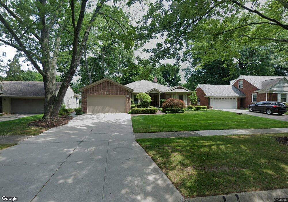
282 Lothrop Rd Grosse Pointe Farms, MI 48236
Estimated Value: $469,000 - $656,000
--
Bed
--
Bath
2,437
Sq Ft
$237/Sq Ft
Est. Value
About This Home
This home is located at 282 Lothrop Rd, Grosse Pointe Farms, MI 48236 and is currently estimated at $576,498, approximately $236 per square foot. 282 Lothrop Rd is a home located in Wayne County with nearby schools including Kerby Elementary School, Brownell Middle School, and Grosse Pointe South High School.
Ownership History
Date
Name
Owned For
Owner Type
Purchase Details
Closed on
May 11, 2023
Sold by
Benton Sherryl A
Bought by
Benton Sherryl A
Current Estimated Value
Purchase Details
Closed on
Jun 1, 2004
Sold by
Pflaum Andrew W and Clarkson Sarah A
Bought by
Benton Walter S
Purchase Details
Closed on
Aug 11, 2003
Sold by
Bay Hal and Lucille Bay Trust
Bought by
Pflaum Andrew W
Create a Home Valuation Report for This Property
The Home Valuation Report is an in-depth analysis detailing your home's value as well as a comparison with similar homes in the area
Home Values in the Area
Average Home Value in this Area
Purchase History
| Date | Buyer | Sale Price | Title Company |
|---|---|---|---|
| Benton Sherryl A | -- | None Listed On Document | |
| Benton Walter S | $386,750 | Members First Title Agency | |
| Pflaum Andrew W | $225,000 | Capital Title Ins Agency |
Source: Public Records
Tax History Compared to Growth
Tax History
| Year | Tax Paid | Tax Assessment Tax Assessment Total Assessment is a certain percentage of the fair market value that is determined by local assessors to be the total taxable value of land and additions on the property. | Land | Improvement |
|---|---|---|---|---|
| 2025 | $4,905 | $300,000 | $0 | $0 |
| 2024 | $4,905 | $278,600 | $0 | $0 |
| 2023 | $8,907 | $257,600 | $0 | $0 |
| 2022 | $4,493 | $236,400 | $0 | $0 |
| 2021 | $8,245 | $225,200 | $0 | $0 |
| 2019 | $8,107 | $213,700 | $0 | $0 |
| 2018 | $4,149 | $199,200 | $0 | $0 |
| 2017 | $7,199 | $194,600 | $0 | $0 |
| 2016 | $7,546 | $186,500 | $0 | $0 |
| 2015 | $14,947 | $166,400 | $0 | $0 |
| 2013 | $14,480 | $144,800 | $0 | $0 |
| 2012 | $3,777 | $142,000 | $39,300 | $102,700 |
Source: Public Records
Map
Nearby Homes
- 259 Mount Vernon Ave
- 302 Mount Vernon Ave
- 314 Mount Vernon Ave
- 218 Merriweather Rd
- 317 Mount Vernon Ave
- 194 Charlevoix Ave
- 216 Ridge Rd
- 343 Mount Vernon Ave
- 189 Cloverly Rd
- 257 Ridge Rd
- 380 Merriweather Rd
- 341 Mcmillan Rd
- 265 Williams Ave
- 276 Lewiston Rd
- 352 Mckinley Ave
- 273 Ridge Rd
- 351 Moselle Place
- 415 Lothrop Rd
- 130 Merriweather Rd
- 827 Fisher Rd
- 286 Lothrop Rd
- 278 Lothrop Rd
- 281 Stephens Rd
- 290 Lothrop Rd
- 275 Stephens Rd
- 285 Stephens Rd
- 271 Stephens Rd
- 291 Stephens Rd
- 270 Lothrop Rd
- 296 Lothrop Rd
- 281 Lothrop Rd
- 234 Beaupre Ave
- 279 Lothrop Rd
- 285 Lothrop Rd
- 275 Lothrop Rd
- 267 Stephens Rd
- 291 Lothrop Rd
- 280 Stephens Rd
- 295 Stephens Rd
- 271 Lothrop Rd