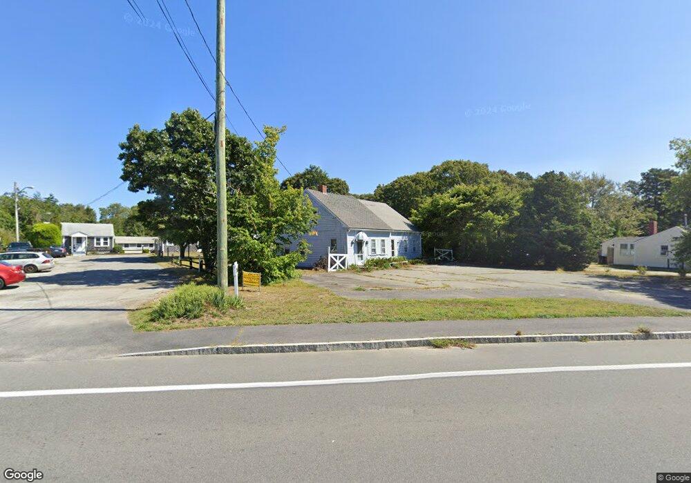
282 Main St Dennis Port, MA 02639
Dennis Port NeighborhoodEstimated Value: $487,000 - $551,000
2
Beds
1
Bath
864
Sq Ft
$612/Sq Ft
Est. Value
About This Home
This home is located at 282 Main St, Dennis Port, MA 02639 and is currently estimated at $528,924, approximately $612 per square foot. 282 Main St is a home located in Barnstable County with nearby schools including Dennis-Yarmouth Regional High School and St. Pius X. School.
Ownership History
Date
Name
Owned For
Owner Type
Purchase Details
Closed on
Aug 9, 2017
Sold by
Tanner Charles
Bought by
Tanner Adam
Current Estimated Value
Home Financials for this Owner
Home Financials are based on the most recent Mortgage that was taken out on this home.
Original Mortgage
$144,000
Outstanding Balance
$119,897
Interest Rate
3.88%
Mortgage Type
New Conventional
Estimated Equity
$409,027
Create a Home Valuation Report for This Property
The Home Valuation Report is an in-depth analysis detailing your home's value as well as a comparison with similar homes in the area
Home Values in the Area
Average Home Value in this Area
Purchase History
| Date | Buyer | Sale Price | Title Company |
|---|---|---|---|
| Tanner Adam | $144,000 | -- |
Source: Public Records
Mortgage History
| Date | Status | Borrower | Loan Amount |
|---|---|---|---|
| Open | Tanner Adam | $144,000 |
Source: Public Records
Tax History Compared to Growth
Tax History
| Year | Tax Paid | Tax Assessment Tax Assessment Total Assessment is a certain percentage of the fair market value that is determined by local assessors to be the total taxable value of land and additions on the property. | Land | Improvement |
|---|---|---|---|---|
| 2025 | $2,082 | $480,800 | $169,200 | $311,600 |
| 2024 | $1,968 | $448,300 | $172,300 | $276,000 |
| 2023 | $1,906 | $408,100 | $156,600 | $251,500 |
| 2022 | $1,935 | $345,600 | $156,700 | $188,900 |
| 2021 | $1,777 | $294,700 | $138,300 | $156,400 |
| 2020 | $1,715 | $281,100 | $138,300 | $142,800 |
| 2019 | $1,629 | $264,000 | $135,600 | $128,400 |
| 2018 | $1,566 | $247,000 | $129,100 | $117,900 |
| 2017 | $1,498 | $243,600 | $129,100 | $114,500 |
| 2016 | $1,487 | $227,700 | $143,400 | $84,300 |
| 2015 | $1,457 | $227,700 | $143,400 | $84,300 |
| 2014 | $1,345 | $211,800 | $114,700 | $97,100 |
Source: Public Records
Map
Nearby Homes
- 268 Main St
- 125 Main St Unit 3
- 4 Coffey Ln
- 12 Candlewood Ln Unit 2-9
- 12 Candlewood Ln Unit 1-6
- 10 Candlewood Ln Unit 2-1
- 104 Toms Path
- 78 Upper County Rd Unit A&B
- 78 Upper County Rd
- 104 Toms Path
- 71 Main St
- 24 Indian Trail
- 9 Country Ln
- 18 Holiday Ln
- 12 Cross St
- 20 Aunt Debbys Rd
- 47 Telegraph Rd Unit 1
- 95 Center St
- 22 Ferncliff Rd
- 102 Sea St
- 282 Main St
- 16 Main St
- 19 Main St
- 254 Main St Unit 1819
- 254 Main St Unit 2021
- 254 Main St Unit 8
- 254 Main St Unit 22
- 254 Main St
- 254 Main St Unit 20
- 254 Main St Unit 19
- 254 Main St Unit 16
- 254 Main St Unit 17
- 254 Main St Unit 21
- 254 Main St Unit 18
- 254 Main St Unit 23
- 280 Main St
- 322 Main St
- 267 Main St
- 261 Main St
- 279 Main St