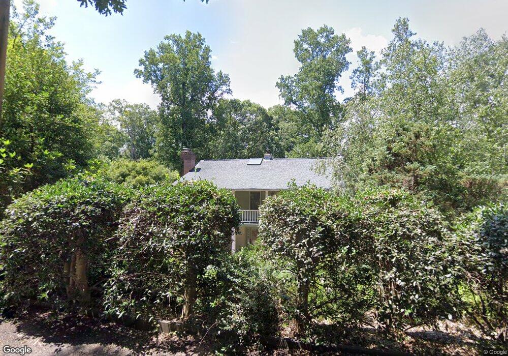
282 Pearson Dr Asheville, NC 28801
Montford NeighborhoodEstimated Value: $905,000 - $1,110,545
4
Beds
3
Baths
2,552
Sq Ft
$402/Sq Ft
Est. Value
About This Home
This home is located at 282 Pearson Dr, Asheville, NC 28801 and is currently estimated at $1,025,136, approximately $401 per square foot. 282 Pearson Dr is a home located in Buncombe County with nearby schools including Isaac Dickson Elementary, Hall Fletcher Elementary, and Ira B Jones Elementary.
Ownership History
Date
Name
Owned For
Owner Type
Purchase Details
Closed on
Nov 1, 2023
Sold by
Danley David Michael and Danley Alida Howard
Bought by
David Michael Danley And Alida Howard Woods R and Danley
Current Estimated Value
Purchase Details
Closed on
Apr 9, 2001
Sold by
Anglin John Terry
Bought by
Danley David M and Woods Alida H
Purchase Details
Closed on
Dec 23, 1997
Sold by
Nordeen Peter O
Bought by
Danley and Woods
Create a Home Valuation Report for This Property
The Home Valuation Report is an in-depth analysis detailing your home's value as well as a comparison with similar homes in the area
Home Values in the Area
Average Home Value in this Area
Purchase History
| Date | Buyer | Sale Price | Title Company |
|---|---|---|---|
| David Michael Danley And Alida Howard Woods R | -- | Chicago Title | |
| David Michael Danley And Alida Howard Woods R | -- | Chicago Title | |
| Danley David M | $18,000 | -- | |
| Danley | $251,000 | -- |
Source: Public Records
Tax History Compared to Growth
Tax History
| Year | Tax Paid | Tax Assessment Tax Assessment Total Assessment is a certain percentage of the fair market value that is determined by local assessors to be the total taxable value of land and additions on the property. | Land | Improvement |
|---|---|---|---|---|
| 2025 | $7,224 | $699,300 | $232,800 | $466,500 |
| 2024 | $7,224 | $699,300 | $232,800 | $466,500 |
| 2023 | $7,224 | $699,300 | $232,800 | $466,500 |
| 2022 | $6,973 | $699,300 | $0 | $0 |
| 2021 | $6,973 | $699,300 | $0 | $0 |
| 2020 | $5,944 | $551,400 | $0 | $0 |
| 2019 | $5,944 | $551,400 | $0 | $0 |
| 2018 | $5,944 | $551,400 | $0 | $0 |
| 2017 | $5,999 | $442,400 | $0 | $0 |
| 2016 | $5,437 | $442,400 | $0 | $0 |
| 2015 | $5,437 | $442,400 | $0 | $0 |
| 2014 | $5,371 | $442,400 | $0 | $0 |
Source: Public Records
Map
Nearby Homes
- 44 Watauga St
- 51, 51B Westover Dr
- 57 Rosewood Ave
- 231 Westover Dr
- 67 Westover Dr
- 21 Sylvan Ave
- 288 Montford Ave
- 26 Hibriten Dr
- 99999 Gray St
- 112 Pearson Dr
- 30 Gray St
- 46 Cumberland Cir
- 11 Cullowhee St
- 13 North St
- 100 West St
- 162 Courtland Place
- 177 Cumberland Ave
- 149 Courtland Ave Unit 5
- 19 Northview St
- 132 Houston St Unit B
- 270 Pearson Dr
- 254 Pearson Dr Unit 4
- 254 Pearson Dr
- 281 Pearson Dr
- 27 Tacoma Place
- 266 Pearson Dr
- 300 Pearson Dr
- 25 Tacoma Place
- 33 Tacoma St
- 31 Tacoma Place
- 23 Tacoma St Unit 2
- 265 Pearson Dr
- 39 Tacoma St
- 240 Pearson Dr
- 29 Tacoma St
- 301 Pearson Dr
- 45 Tacoma St
- 57 Tacoma Cir
- 53 Tacoma Cir
- 315 Pearson Dr