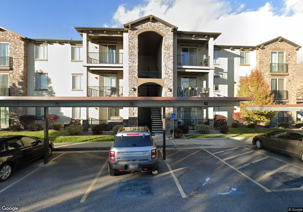
282 W 605 N Unit A Centerville, UT 84014
Estimated Value: $365,000 - $382,000
3
Beds
2
Baths
1,403
Sq Ft
$268/Sq Ft
Est. Value
About This Home
This home is located at 282 W 605 N Unit A, Centerville, UT 84014 and is currently estimated at $375,756, approximately $267 per square foot. 282 W 605 N Unit A is a home located in Davis County with nearby schools including Centerville Elementary, Centerville Jr High, and Viewmont High School.
Ownership History
Date
Name
Owned For
Owner Type
Purchase Details
Closed on
May 29, 2014
Sold by
Cityview Pineae Village 227 Lp
Bought by
Mcdonald Kelly H
Current Estimated Value
Home Financials for this Owner
Home Financials are based on the most recent Mortgage that was taken out on this home.
Original Mortgage
$142,450
Outstanding Balance
$108,238
Interest Rate
4.25%
Mortgage Type
FHA
Estimated Equity
$267,518
Create a Home Valuation Report for This Property
The Home Valuation Report is an in-depth analysis detailing your home's value as well as a comparison with similar homes in the area
Home Values in the Area
Average Home Value in this Area
Purchase History
| Date | Buyer | Sale Price | Title Company |
|---|---|---|---|
| Mcdonald Kelly H | -- | None Available |
Source: Public Records
Mortgage History
| Date | Status | Borrower | Loan Amount |
|---|---|---|---|
| Open | Mcdonald Kelly H | $142,450 |
Source: Public Records
Tax History Compared to Growth
Tax History
| Year | Tax Paid | Tax Assessment Tax Assessment Total Assessment is a certain percentage of the fair market value that is determined by local assessors to be the total taxable value of land and additions on the property. | Land | Improvement |
|---|---|---|---|---|
| 2025 | $2,110 | $201,850 | $0 | $201,850 |
| 2024 | $1,973 | $191,950 | $0 | $191,950 |
| 2023 | $2,082 | $366,000 | $0 | $366,000 |
| 2022 | $2,085 | $201,850 | $33,000 | $168,850 |
| 2021 | $1,751 | $264,000 | $60,000 | $204,000 |
| 2020 | $1,499 | $226,000 | $41,600 | $184,400 |
| 2019 | $1,413 | $208,000 | $40,000 | $168,000 |
| 2018 | $1,292 | $188,000 | $34,000 | $154,000 |
| 2016 | $998 | $80,685 | $13,750 | $66,935 |
| 2015 | $1,058 | $80,685 | $13,750 | $66,935 |
| 2014 | $708 | $55,218 | $14,685 | $40,533 |
| 2013 | -- | $26,500 | $26,500 | $0 |
Source: Public Records
Map
Nearby Homes
- 281 W 650 N Unit C
- 282 W 650 N
- 171 W 650 N
- 447 W 620 N Unit 106
- 781 Pheasantbrook Dr
- 509 Applewood Dr
- 67 W Pheasantbrook Dr
- 495 Creek View Rd
- 274 N 100 W
- 271 Brookfield Ln
- 232 N 100 W
- 128 W 200 N
- 638 N 800 W
- 429 W 1050 N
- 2 S 285 W
- 295 E 300 N
- 88 W 50 S Unit D-5
- 88 W 50 S Unit C-3
- 88 W 50 S Unit Q12
- 88 W 50 S Unit A4
- 282 W 605 N Unit G
- 282 W 605 N Unit C
- 282 W 605 N Unit F
- 282 W 605 N Unit L
- 282 W 605 N Unit D
- 282 W 605 N Unit K
- 282 W 605 N Unit H
- 282 W 605 N Unit I
- 282 W 605 N Unit J
- 281 W 650 N Unit 306 D
- 281 W 650 N Unit I
- 281 W 650 N Unit J
- 281 W 650 N Unit G
- 281 W 650 N Unit E
- 281 W 650 N Unit K
- 281 W 650 N Unit B
- 620 N 255 W
- 616 N 255 W
- 624 N 255 W
- 612 N 255 W