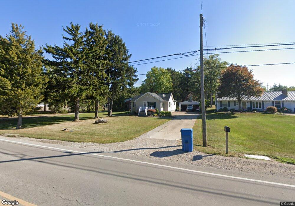
2820 Campbell St Sandusky, OH 44870
Estimated Value: $198,000 - $220,000
2
Beds
2
Baths
1,288
Sq Ft
$162/Sq Ft
Est. Value
About This Home
This home is located at 2820 Campbell St, Sandusky, OH 44870 and is currently estimated at $208,110, approximately $161 per square foot. 2820 Campbell St is a home located in Erie County with nearby schools including Furry Elementary School, Meadowlawn Elementary School, and Briar Middle School.
Ownership History
Date
Name
Owned For
Owner Type
Purchase Details
Closed on
Jun 23, 2015
Sold by
Miller Michael K and Miller Michael K
Bought by
Miller Michael K
Current Estimated Value
Purchase Details
Closed on
Apr 1, 2008
Sold by
Sackett Susan M and Miller Susan M
Bought by
Miller Michael K and Miller Michael
Purchase Details
Closed on
Jan 6, 1995
Sold by
Grealy Faye A
Bought by
Schaefer Anthony H
Home Financials for this Owner
Home Financials are based on the most recent Mortgage that was taken out on this home.
Original Mortgage
$45,000
Interest Rate
6.75%
Mortgage Type
New Conventional
Create a Home Valuation Report for This Property
The Home Valuation Report is an in-depth analysis detailing your home's value as well as a comparison with similar homes in the area
Home Values in the Area
Average Home Value in this Area
Purchase History
| Date | Buyer | Sale Price | Title Company |
|---|---|---|---|
| Miller Michael K | $90,000 | Attorney | |
| Miller Michael K | -- | None Available | |
| Schaefer Anthony H | $50,000 | -- |
Source: Public Records
Mortgage History
| Date | Status | Borrower | Loan Amount |
|---|---|---|---|
| Previous Owner | Schaefer Anthony H | $45,000 |
Source: Public Records
Tax History Compared to Growth
Tax History
| Year | Tax Paid | Tax Assessment Tax Assessment Total Assessment is a certain percentage of the fair market value that is determined by local assessors to be the total taxable value of land and additions on the property. | Land | Improvement |
|---|---|---|---|---|
| 2024 | $2,060 | $54,824 | $10,367 | $44,457 |
| 2023 | $2,060 | $46,613 | $8,638 | $37,975 |
| 2022 | $2,125 | $46,613 | $8,638 | $37,975 |
| 2021 | $2,612 | $46,620 | $8,640 | $37,980 |
| 2020 | $2,306 | $41,520 | $8,640 | $32,880 |
| 2019 | $2,373 | $41,520 | $8,640 | $32,880 |
| 2018 | $2,374 | $41,520 | $8,640 | $32,880 |
| 2017 | $2,151 | $36,600 | $7,780 | $28,820 |
| 2016 | $1,878 | $36,600 | $7,780 | $28,820 |
| 2015 | $1,845 | $36,600 | $7,780 | $28,820 |
| 2014 | $1,934 | $37,970 | $7,780 | $30,190 |
| 2013 | $1,803 | $37,970 | $7,780 | $30,190 |
Source: Public Records
Map
Nearby Homes
- 2920 Campbell St
- 3314 W Stoneway Dr
- 104 Stonyridge Dr Unit 1-A
- 332 W Parish St
- 315 50th St
- 2312 Hayes Ave
- 314 48th St
- 2130 Columbus Ave
- 3513 Spencer Ave
- 2038 Columbus Ave
- 313 42nd St
- 301 E Parish St
- 216 E Follett St
- 301 Schiller Ave
- 319 E Parish St
- 3216 Hayes Ave
- 3510 Ohio St
- 1405 W Perkins Ave
- 3321 Hayes Ave
- 0 U S 250 Unit 20250775
- 2902 Campbell St
- 2816 Campbell St
- 2906 Campbell St
- 2814 Campbell St
- 2910 Campbell St
- 517 Bell Ave
- 2810 Campbell St
- 2810 Campbell St
- 2810 Campbell St
- 605 Bell Ave
- 513 Bell Ave
- 2914 Campbell St
- 2802 Campbell St
- 509 Bell Ave
- 2806 Campbell St
- 608 Bell Ave
- 0 Deyo & Mason Rd Unit 20194471
- 14552 Sr 23
- 12 Runkle
- 1824 Cr 250