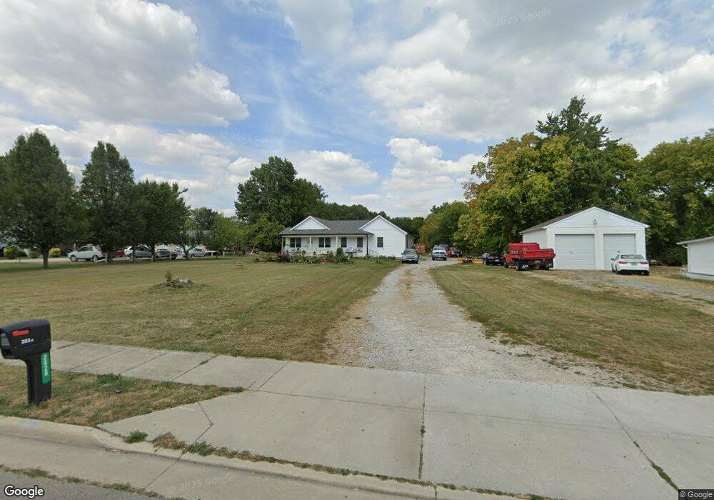
2820 Clime Rd Columbus, OH 43223
Brookshire NeighborhoodEstimated Value: $251,000 - $478,382
2
Beds
2
Baths
1,912
Sq Ft
$192/Sq Ft
Est. Value
About This Home
This home is located at 2820 Clime Rd, Columbus, OH 43223 and is currently estimated at $367,096, approximately $191 per square foot. 2820 Clime Rd is a home located in Franklin County with nearby schools including James A Harmon Elementary School, Franklin Woods Intermediate School, and Finland Middle School.
Ownership History
Date
Name
Owned For
Owner Type
Purchase Details
Closed on
Apr 4, 2019
Sold by
Cunningham Jesse Lee and The Estate Of Jesse C Cunningh
Bought by
Perry Donald and Perry Judy
Current Estimated Value
Purchase Details
Closed on
Jun 14, 2007
Sold by
Cunningham Jesse C
Bought by
Franklin County Commissioners
Purchase Details
Closed on
Aug 27, 2000
Sold by
Cunningham Jesse C and Cunningham Dorothy M
Bought by
Cunningham Jesse C
Purchase Details
Closed on
Jan 19, 1990
Bought by
Cunningham Jesse C
Create a Home Valuation Report for This Property
The Home Valuation Report is an in-depth analysis detailing your home's value as well as a comparison with similar homes in the area
Home Values in the Area
Average Home Value in this Area
Purchase History
| Date | Buyer | Sale Price | Title Company |
|---|---|---|---|
| Perry Donald | $100,000 | None Available | |
| Franklin County Commissioners | $4,878 | None Available | |
| Cunningham Jesse C | -- | -- | |
| Cunningham Jesse C | $40,000 | -- |
Source: Public Records
Tax History
| Year | Tax Paid | Tax Assessment Tax Assessment Total Assessment is a certain percentage of the fair market value that is determined by local assessors to be the total taxable value of land and additions on the property. | Land | Improvement |
|---|---|---|---|---|
| 2025 | $10,161 | $69,310 | $50,300 | $19,010 |
| 2024 | $10,161 | $69,310 | $50,300 | $19,010 |
| 2023 | $4,007 | $78,365 | $50,295 | $28,070 |
| 2022 | $3,557 | $32,450 | $24,570 | $7,880 |
| 2021 | $2,291 | $32,450 | $24,570 | $7,880 |
| 2020 | $2,287 | $32,450 | $24,570 | $7,880 |
| 2019 | $2,780 | $35,430 | $20,480 | $14,950 |
| 2018 | $1,385 | $35,430 | $20,480 | $14,950 |
| 2017 | $2,417 | $35,430 | $20,480 | $14,950 |
| 2016 | $2,080 | $25,130 | $11,970 | $13,160 |
| 2015 | $966 | $25,130 | $11,970 | $13,160 |
| 2014 | $1,933 | $25,130 | $11,970 | $13,160 |
| 2013 | $1,055 | $27,930 | $13,300 | $14,630 |
Source: Public Records
Map
Nearby Homes
- 1360 Hafton Woods Dr
- 1335 Hafton Woods Dr
- 2856 Chesfield Dr
- 2937 Rundell Dr
- 1638 Tall Meadows Dr
- 3116 Musket Ridge Dr
- 0 Glencreek Rd
- 2800 Alkire Rd
- 2112 Sondra Ln
- 1168 Racine Ave
- 1147 Parma Ave
- 2600 Plainview Ave
- 0 S Central Ave
- 1641 Greenville Rd
- 1295 Woodbrook Ln Unit 223
- 1258 Woodbrook Cir W Unit 199
- 1605 Greenville Rd
- 2515 Lindbergh Dr
- 2255 Harrisburg Pike
- 2375 Woodbrook Cir S Unit 167
Your Personal Tour Guide
Ask me questions while you tour the home.