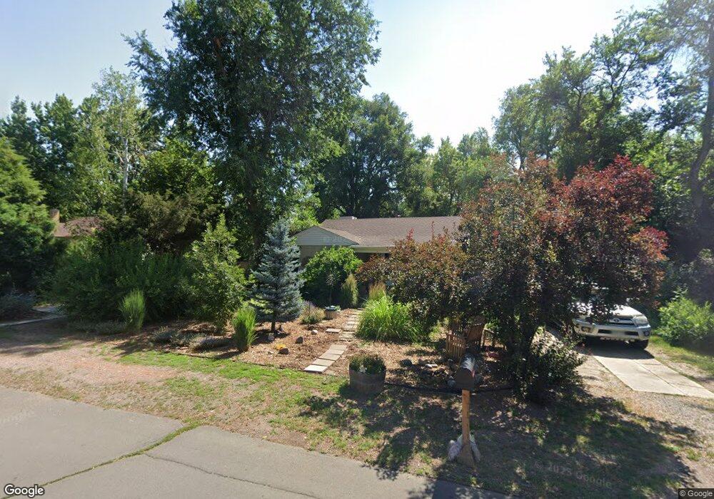
2820 Quay St Wheat Ridge, CO 80033
Barths NeighborhoodEstimated Value: $629,000 - $778,000
3
Beds
2
Baths
2,000
Sq Ft
$361/Sq Ft
Est. Value
About This Home
This home is located at 2820 Quay St, Wheat Ridge, CO 80033 and is currently estimated at $721,014, approximately $360 per square foot. 2820 Quay St is a home located in Jefferson County with nearby schools including Lumberg Elementary School, Jefferson High School, and Beth Eden Baptist School.
Ownership History
Date
Name
Owned For
Owner Type
Purchase Details
Closed on
Sep 28, 2001
Sold by
Campbell Christine H
Bought by
Campbell Christine H and Jackson Kristine C
Current Estimated Value
Home Financials for this Owner
Home Financials are based on the most recent Mortgage that was taken out on this home.
Original Mortgage
$41,000
Interest Rate
6.88%
Mortgage Type
Credit Line Revolving
Purchase Details
Closed on
Nov 17, 2000
Sold by
Campbell Christine
Bought by
Campbell Christine H
Home Financials for this Owner
Home Financials are based on the most recent Mortgage that was taken out on this home.
Original Mortgage
$225,000
Outstanding Balance
$88,036
Interest Rate
8.75%
Estimated Equity
$632,978
Purchase Details
Closed on
May 5, 2000
Sold by
Jackson Kristine
Bought by
Campbell Christine
Home Financials for this Owner
Home Financials are based on the most recent Mortgage that was taken out on this home.
Original Mortgage
$52,000
Interest Rate
8.13%
Mortgage Type
Stand Alone Second
Purchase Details
Closed on
Apr 14, 1999
Sold by
Campbell Christine
Bought by
Campbell Christine and Jackson Kristine
Purchase Details
Closed on
Nov 30, 1998
Sold by
Bingham Joseph R and Bingham Kristy L
Bought by
Campbell Christine
Home Financials for this Owner
Home Financials are based on the most recent Mortgage that was taken out on this home.
Original Mortgage
$159,120
Interest Rate
6.69%
Mortgage Type
VA
Purchase Details
Closed on
Dec 28, 1995
Sold by
Bingham Edward R and Bingham Lois S
Bought by
Bingham Joseph R and Bingham Kristy L
Create a Home Valuation Report for This Property
The Home Valuation Report is an in-depth analysis detailing your home's value as well as a comparison with similar homes in the area
Home Values in the Area
Average Home Value in this Area
Purchase History
| Date | Buyer | Sale Price | Title Company |
|---|---|---|---|
| Campbell Christine H | -- | Land Title Guarantee Company | |
| Campbell Christine H | -- | -- | |
| Campbell Christine | -- | -- | |
| Campbell Christine | -- | -- | |
| Campbell Christine | $159,000 | North American Title Co | |
| Bingham Joseph R | $108,900 | -- |
Source: Public Records
Mortgage History
| Date | Status | Borrower | Loan Amount |
|---|---|---|---|
| Closed | Campbell Christine H | $41,000 | |
| Open | Campbell Christine H | $225,000 | |
| Closed | Campbell Christine | $52,000 | |
| Previous Owner | Campbell Christine | $159,120 |
Source: Public Records
Tax History Compared to Growth
Tax History
| Year | Tax Paid | Tax Assessment Tax Assessment Total Assessment is a certain percentage of the fair market value that is determined by local assessors to be the total taxable value of land and additions on the property. | Land | Improvement |
|---|---|---|---|---|
| 2024 | $3,767 | $43,079 | $17,562 | $25,517 |
| 2023 | $3,767 | $43,079 | $17,562 | $25,517 |
| 2022 | $2,963 | $33,282 | $17,340 | $15,942 |
| 2021 | $3,004 | $34,240 | $17,839 | $16,401 |
| 2020 | $2,746 | $31,453 | $16,209 | $15,244 |
| 2019 | $2,709 | $31,453 | $16,209 | $15,244 |
| 2018 | $2,618 | $29,383 | $10,365 | $19,018 |
| 2017 | $2,364 | $29,383 | $10,365 | $19,018 |
| 2016 | $1,999 | $23,251 | $6,280 | $16,971 |
| 2015 | $1,759 | $23,251 | $6,280 | $16,971 |
| 2014 | $1,759 | $19,191 | $5,731 | $13,460 |
Source: Public Records
Map
Nearby Homes
- 2591 - 2597 Pierce St
- 2565 Pierce St
- 2605 Reed Ct
- 6795 W 31st Ave
- 2777 Kendall St
- 2419 Otis St
- 6500 W 32nd Ave
- 2570 Jay St
- 6000 W 29th Ave
- 2210 Marshall St
- 2890 N Harlan St Unit 102
- 7625 W 23rd Place
- 3342 Marshall St
- 2598 Harlan St Unit 1
- 7650 W 24th Ave
- 2110 Vance St
- 2590 Gray St
- 7051 W 20th Ave
- 7000 W 20th Ave Unit 106
- 3535 High Ct
- 2830 Quay St
- 2800 Quay St
- 2765 Pierce St
- 2765 Pierce St Unit 2765 Pierce Garden 1
- 2780 Quay St
- 2785 Pierce St
- 2751 Pierce St
- 2836 Quay St
- 2815 Quay St
- 2825 Quay St
- 2803 Quay St
- 2801 Pierce St
- 6901 W 27th Ave
- 2720 Quay St
- 2837 Quay St
- 2705 Pierce St
- 2840 Quay St
- 2829 Pierce St
- 2700 Quay St
- 2855 Quay St