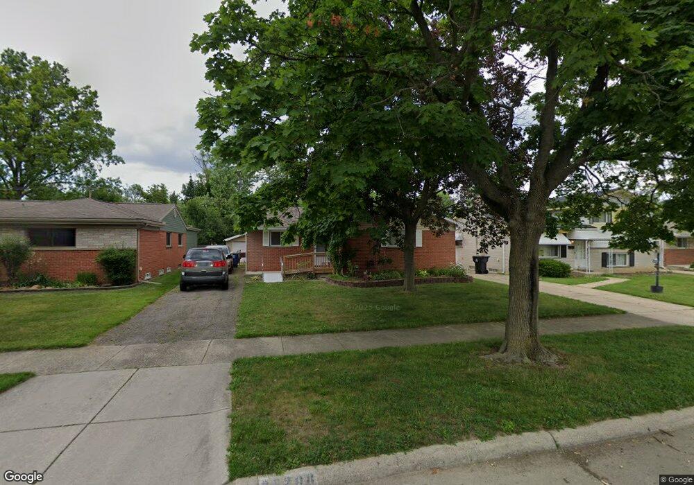
28208 Mackenzie Dr Westland, MI 48185
Estimated Value: $241,000 - $274,000
--
Bed
2
Baths
1,077
Sq Ft
$235/Sq Ft
Est. Value
About This Home
This home is located at 28208 Mackenzie Dr, Westland, MI 48185 and is currently estimated at $253,254, approximately $235 per square foot. 28208 Mackenzie Dr is a home located in Wayne County with nearby schools including Cleveland Elementary School, Cooper Upper Elementary School, and Emerson Middle School.
Ownership History
Date
Name
Owned For
Owner Type
Purchase Details
Closed on
Aug 30, 2005
Sold by
Holcomb Kimberly
Bought by
Peterson Patricia
Current Estimated Value
Purchase Details
Closed on
Mar 2, 2004
Sold by
Chase Manhattan Mortgage Corp
Bought by
Citibank Na
Purchase Details
Closed on
Feb 18, 2004
Sold by
Allen Michael L
Bought by
Chase Manhattan Mortgage Corp
Purchase Details
Closed on
Nov 12, 1996
Sold by
Smit Phillip C and Smit Luann M
Bought by
Leonard Bale
Create a Home Valuation Report for This Property
The Home Valuation Report is an in-depth analysis detailing your home's value as well as a comparison with similar homes in the area
Home Values in the Area
Average Home Value in this Area
Purchase History
| Date | Buyer | Sale Price | Title Company |
|---|---|---|---|
| Peterson Patricia | $162,000 | E Title Agency Inc | |
| Citibank Na | -- | -- | |
| Chase Manhattan Mortgage Corp | $131,486 | -- | |
| Leonard Bale | $89,000 | -- |
Source: Public Records
Tax History Compared to Growth
Tax History
| Year | Tax Paid | Tax Assessment Tax Assessment Total Assessment is a certain percentage of the fair market value that is determined by local assessors to be the total taxable value of land and additions on the property. | Land | Improvement |
|---|---|---|---|---|
| 2025 | $2,031 | $96,300 | $0 | $0 |
| 2024 | $2,031 | $89,700 | $0 | $0 |
| 2023 | $2,402 | $81,300 | $0 | $0 |
| 2022 | $3,163 | $73,200 | $0 | $0 |
| 2021 | $3,179 | $69,800 | $0 | $0 |
| 2020 | $2,898 | $66,200 | $0 | $0 |
| 2019 | $2,899 | $65,500 | $0 | $0 |
| 2018 | $2,011 | $57,600 | $0 | $0 |
| 2017 | $1,249 | $56,100 | $0 | $0 |
| 2016 | $3,037 | $52,400 | $0 | $0 |
| 2015 | $3,914 | $46,060 | $0 | $0 |
| 2013 | $3,792 | $39,590 | $0 | $0 |
| 2012 | $2,513 | $39,890 | $0 | $0 |
Source: Public Records
Map
Nearby Homes
- 27753 Trailbrooke Cir
- 8565 Cardwell St
- 8916 Deering St
- 8537 Mercedes St
- 29000 Joy Rd
- 29102 Manchester St
- 8139 Bristol St Unit 170
- 29047 Manchester St Unit 83
- 29156 Manchester St
- 29248 Manchester St
- 7641 N Inkster Rd
- 29256 Brody Ave
- 27047 Clairview Dr
- 9137 San Jose
- 27023 Clairview Dr
- 26790 Joy Rd Unit 7
- 0000 N Middlebelt Rd
- 7401 Floral St
- 9066 Newport Way Unit 11
- 9065 Newport Way Unit 19
- 28220 Mackenzie Dr
- 28154 Mackenzie Dr
- 28232 Mackenzie Dr
- 28142 Mackenzie Dr
- 28300 Mackenzie Dr
- 28130 Mackenzie Dr
- 28209 Mackenzie Dr
- 28221 Mackenzie Dr
- 28151 Mackenzie Dr
- 28118 Mackenzie Dr
- 28312 Mackenzie Dr
- 28233 Mackenzie Dr
- 28139 Mackenzie Dr
- 28125 Mackenzie Dr
- 28106 Mackenzie Dr
- 28350 Mackenzie Dr
- 28342 Mackenzie Dr
- 8551 Gilman St
- 28117 Mackenzie Dr
- V/L Gilman