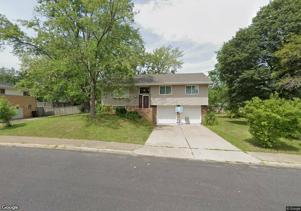
2821 N Millbrook Dr Peoria, IL 61604
Wardcliffe NeighborhoodEstimated Value: $184,000 - $219,000
3
Beds
3
Baths
1,232
Sq Ft
$159/Sq Ft
Est. Value
About This Home
This home is located at 2821 N Millbrook Dr, Peoria, IL 61604 and is currently estimated at $195,838, approximately $158 per square foot. 2821 N Millbrook Dr is a home located in Peoria County with nearby schools including Dr Maude A Sanders Primary School, Sterling Middle School, and Peoria High School.
Ownership History
Date
Name
Owned For
Owner Type
Purchase Details
Closed on
Sep 21, 2001
Sold by
Farris Eugene J and Farris Carolee A
Bought by
Smith Juanita
Current Estimated Value
Home Financials for this Owner
Home Financials are based on the most recent Mortgage that was taken out on this home.
Original Mortgage
$97,500
Interest Rate
3.46%
Mortgage Type
New Conventional
Create a Home Valuation Report for This Property
The Home Valuation Report is an in-depth analysis detailing your home's value as well as a comparison with similar homes in the area
Home Values in the Area
Average Home Value in this Area
Purchase History
| Date | Buyer | Sale Price | Title Company |
|---|---|---|---|
| Smith Juanita | $117,500 | Attorney Only | |
| Smith Juanita | $117,500 | -- |
Source: Public Records
Mortgage History
| Date | Status | Borrower | Loan Amount |
|---|---|---|---|
| Previous Owner | Smith Juanita | $97,500 |
Source: Public Records
Tax History Compared to Growth
Tax History
| Year | Tax Paid | Tax Assessment Tax Assessment Total Assessment is a certain percentage of the fair market value that is determined by local assessors to be the total taxable value of land and additions on the property. | Land | Improvement |
|---|---|---|---|---|
| 2024 | $2,719 | $49,850 | $9,380 | $40,470 |
| 2023 | $2,828 | $45,740 | $8,610 | $37,130 |
| 2022 | $2,900 | $41,060 | $8,310 | $32,750 |
| 2021 | $2,794 | $39,100 | $7,910 | $31,190 |
| 2020 | $3,278 | $38,710 | $7,830 | $30,880 |
| 2019 | $3,337 | $39,500 | $7,990 | $31,510 |
| 2018 | $3,374 | $40,640 | $8,070 | $32,570 |
| 2017 | $3,379 | $41,050 | $8,150 | $32,900 |
| 2016 | $1,855 | $25,920 | $8,150 | $17,770 |
| 2015 | $3,135 | $25,410 | $7,990 | $17,420 |
| 2014 | $3,142 | $40,060 | $8,000 | $32,060 |
| 2013 | -- | $40,550 | $8,100 | $32,450 |
Source: Public Records
Map
Nearby Homes
- 2635 N Kingston Dr
- 2905 W Kingston Ct
- 2627 N Kingston Dr
- 3114 N Elmcroft Terrace
- 2602 N Woodhaven Dr
- 3005 N Molleck Dr
- 2523 N Rockwood Dr
- 2407 N Northcrest Dr
- 2318 N Northcrest Dr
- 3311 W Richwoods Blvd
- 3444 W Dorchester Ridge Unit c
- 2230 N Idaho St
- 2315 W Hudson St
- 2318 W Albany Ave
- 2909 N Mission Rd
- 2525 N Victoria Ave
- 2214 W Arrowhead Ln
- 3423 N El Vista Ave
- 2221 W Tripp Ave
- 2703 N Golf Dr
- 2825 N Millbrook Dr
- 2813 N Millbrook Dr
- 3010 W Gilbert Ave
- 2810 N Kingston Dr
- 2822 N Kingston Dr
- 2824 N Millbrook Dr
- 2811 N Millbrook Dr
- 2814 N Millbrook Dr
- 2830 N Kingston Dr
- 2804 N Kingston Dr
- 2808 N Millbrook Dr
- 2803 N Millbrook Dr
- 3011 W Gilbert Ave
- 3011 W Gilbert Ave Unit M
- 3003 W Gilbert Ave
- 2734 N Kingston Dr
- 2937 W Gilbert Ave
- 3015 W Gilbert Ave
- 2815 N Kingston Dr
- 2819 N Kingston Dr