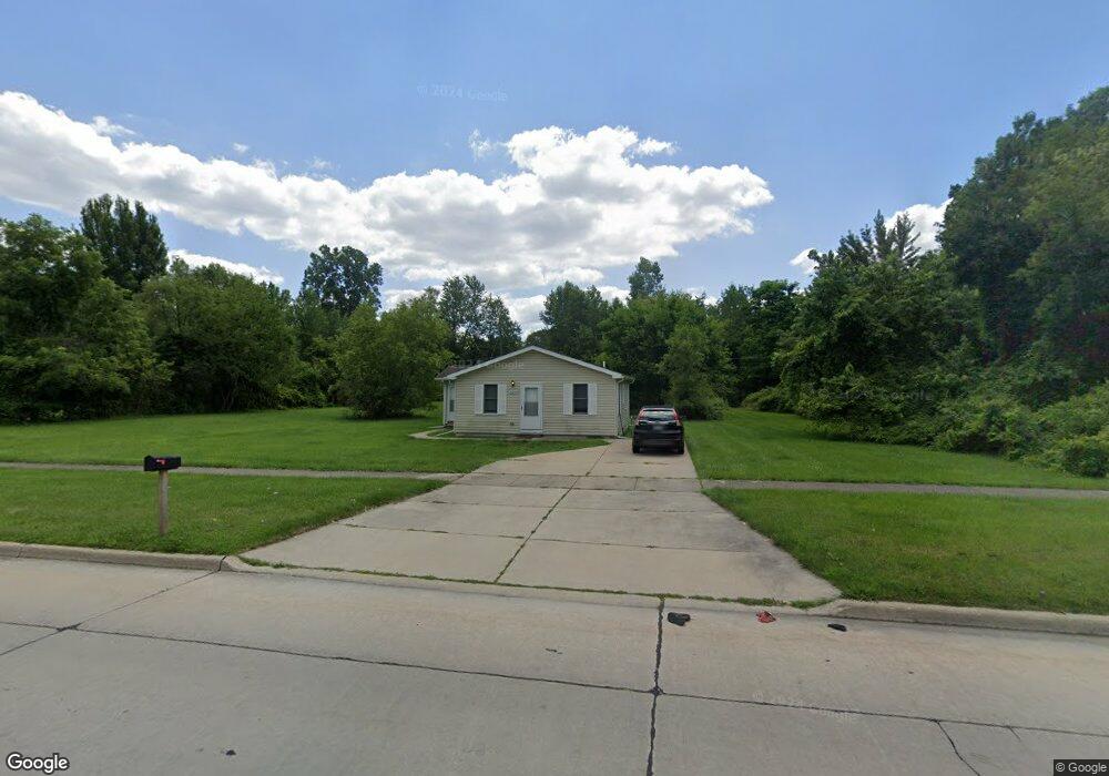
28235 Annapolis Rd Westland, MI 48186
Estimated Value: $75,000 - $132,882
2
Beds
1
Bath
820
Sq Ft
$133/Sq Ft
Est. Value
About This Home
This home is located at 28235 Annapolis Rd, Westland, MI 48186 and is currently estimated at $109,221, approximately $133 per square foot. 28235 Annapolis Rd is a home located in Wayne County with nearby schools including Taylor Parks Elementary School, Hoover Middle School, and Taylor High School.
Ownership History
Date
Name
Owned For
Owner Type
Purchase Details
Closed on
Jun 15, 2017
Sold by
Bellvista Capital
Bought by
Wetland View Llc
Current Estimated Value
Purchase Details
Closed on
Nov 7, 2013
Sold by
Wayne County Treasurer
Bought by
Bellvista Capital
Purchase Details
Closed on
Sep 26, 2000
Sold by
Federal National Mtg Ass
Bought by
Born Cary
Purchase Details
Closed on
Dec 29, 1999
Sold by
Chase Manhattan Mtg Corp
Bought by
Federal National Mortgage Association
Purchase Details
Closed on
Nov 24, 1999
Sold by
Dombro Janice Dombrowski
Bought by
Chase Manhattan Mtg Corp
Create a Home Valuation Report for This Property
The Home Valuation Report is an in-depth analysis detailing your home's value as well as a comparison with similar homes in the area
Home Values in the Area
Average Home Value in this Area
Purchase History
| Date | Buyer | Sale Price | Title Company |
|---|---|---|---|
| Wetland View Llc | -- | None Available | |
| Bellvista Capital | $7,600 | None Available | |
| Born Cary | -- | -- | |
| Federal National Mortgage Association | -- | -- | |
| Chase Manhattan Mtg Corp | $34,239 | -- |
Source: Public Records
Tax History Compared to Growth
Tax History
| Year | Tax Paid | Tax Assessment Tax Assessment Total Assessment is a certain percentage of the fair market value that is determined by local assessors to be the total taxable value of land and additions on the property. | Land | Improvement |
|---|---|---|---|---|
| 2025 | $1,039 | $44,300 | $0 | $0 |
| 2024 | $1,039 | $43,500 | $0 | $0 |
| 2023 | $1,042 | $35,600 | $0 | $0 |
| 2022 | $1,145 | $30,100 | $0 | $0 |
| 2021 | $1,089 | $25,400 | $0 | $0 |
| 2020 | $1,074 | $19,800 | $0 | $0 |
| 2019 | $1,033 | $17,200 | $0 | $0 |
| 2018 | $861 | $16,800 | $0 | $0 |
| 2017 | $300 | $15,700 | $0 | $0 |
| 2016 | $968 | $15,900 | $0 | $0 |
| 2015 | $1,529 | $15,490 | $0 | $0 |
| 2013 | $1,569 | $15,920 | $0 | $0 |
| 2012 | $3,472 | $16,210 | $0 | $0 |
Source: Public Records
Map
Nearby Homes
- 4315 Isabelle St
- POWERS Powers St
- 4120 Ash St
- 4080 Isabelle St
- 27523 Powers St
- 4133 Moore St
- 28919 Powers St
- 3925 Spruce St
- 29026 York St
- 4054 Moore St
- 29038 York St
- 29006 Eton St
- 28951 Powers St
- 29119 York St
- 29025 Powers St
- Vacant Spruce St
- 28222 Carlysle St
- 29114 Richard St
- 27285 Colgate St
- 4705 S Middlebelt Rd
- 28220 Annapolis St
- 28220 Annapolis St
- 28220 Annapolis St
- 28220 Annapolis St
- 28242 Annapolis St
- 28310 Annapolis St
- 28335 Annapolis Rd
- 28328 Annapolis St
- 28160 Annapolis St
- 4488 Ash St
- 4567 Walnut St
- 4570 Walnut St
- 4562 Walnut St
- 28226 Eton St
- 4550 Walnut St
- 4521 Harrison St
- 28103 Annapolis Rd
- 00000 McDonald St
- 4469 Ash St
- 4432 Walnut St