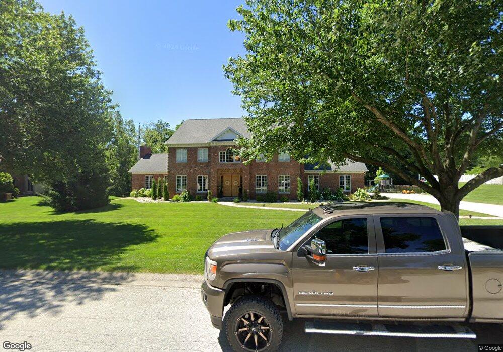
2824 Carnoustie Ln Quincy, IL 62301
Estimated Value: $301,000 - $818,897
--
Bed
--
Bath
--
Sq Ft
0.56
Acres
About This Home
This home is located at 2824 Carnoustie Ln, Quincy, IL 62301 and is currently estimated at $560,632. 2824 Carnoustie Ln is a home located in Adams County with nearby schools including Denman Elementary School, Quincy Junior High School, and Quincy Senior High School.
Ownership History
Date
Name
Owned For
Owner Type
Purchase Details
Closed on
Dec 31, 2021
Sold by
Lisa Smith Oakley Family Trust
Bought by
Allison Walker Hall Trust and Dustin Daniel Hall Trust
Current Estimated Value
Purchase Details
Closed on
Jan 13, 2021
Sold by
Lisa Smith Oakley Revocable Trust
Bought by
Lisa Smith Oakley Family Trust
Purchase Details
Closed on
Oct 14, 2019
Sold by
Oakley Ralph M and Smith Lisa Smith
Bought by
Lisa Smith Oakley Revocable Tr
Create a Home Valuation Report for This Property
The Home Valuation Report is an in-depth analysis detailing your home's value as well as a comparison with similar homes in the area
Home Values in the Area
Average Home Value in this Area
Purchase History
| Date | Buyer | Sale Price | Title Company |
|---|---|---|---|
| Allison Walker Hall Trust | $684,250 | Schmiedeskamp Robertson Neu & | |
| Lisa Smith Oakley Family Trust | -- | Scholz Loos Palmer Siebers & D | |
| Lisa Smith Oakley Revocable Tr | -- | Scholz Loos Palmer Siebers & D |
Source: Public Records
Tax History Compared to Growth
Tax History
| Year | Tax Paid | Tax Assessment Tax Assessment Total Assessment is a certain percentage of the fair market value that is determined by local assessors to be the total taxable value of land and additions on the property. | Land | Improvement |
|---|---|---|---|---|
| 2024 | $12,794 | $202,200 | $32,360 | $169,840 |
| 2023 | $12,014 | $187,590 | $30,020 | $157,570 |
| 2022 | $11,335 | $175,150 | $28,030 | $147,120 |
| 2021 | $11,414 | $171,630 | $27,470 | $144,160 |
| 2020 | $11,189 | $168,280 | $26,930 | $141,350 |
| 2019 | $10,974 | $166,470 | $26,640 | $139,830 |
| 2018 | $10,639 | $159,750 | $42,490 | $117,260 |
| 2017 | $10,370 | $158,170 | $42,070 | $116,100 |
| 2016 | $10,171 | $151,740 | $40,360 | $111,380 |
| 2015 | $9,748,480 | $151,740 | $40,360 | $111,380 |
| 2012 | $11,881 | $177,460 | $20,370 | $157,090 |
Source: Public Records
Map
Nearby Homes
- 2834 Carnoustie Ln
- 2808 Carnoustie Ln
- 2829 Cabot Rd
- 2835 Cabot Rd
- 2825 Carnoustie Ln
- 2823 Cabot Rd
- 2835 Carnoustie Ln
- 2815 Carnoustie Ln
- 2839 Cabot Rd
- 2907 Carnoustie Ln
- 2805 Carnoustie Ln
- 2819 Cabot Rd
- 2714 Carnoustie Ln
- 2830 Cabot Rd
- 2722 Monroe St
- 2903 Cabot Rd
- 2801 Cabot Rd
- 2721 Ken Ray Dr
- 2721 Carnoustie Ln
- 1201 Fundy Rd