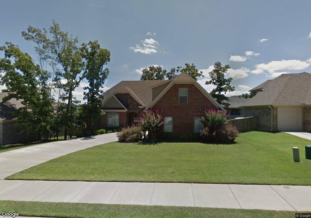
2824 Maelstrom Cir Sherwood, AR 72120
Estimated Value: $359,405 - $390,000
--
Bed
--
Bath
2,567
Sq Ft
$145/Sq Ft
Est. Value
About This Home
This home is located at 2824 Maelstrom Cir, Sherwood, AR 72120 and is currently estimated at $372,101, approximately $144 per square foot. 2824 Maelstrom Cir is a home with nearby schools including Sylvan Hills Elementary School, Sylvan Hills Middle School, and Sylvan Hills High School.
Ownership History
Date
Name
Owned For
Owner Type
Purchase Details
Closed on
Sep 18, 2025
Sold by
Weatherford Sam E and Weatherford Beth A
Bought by
Sam Weatherford And Beth Ann Weatherford Revo and Weatherford
Current Estimated Value
Purchase Details
Closed on
Jul 1, 2015
Sold by
Deere Stewart
Bought by
Weatherford Sam E and Weatherford Beth A
Home Financials for this Owner
Home Financials are based on the most recent Mortgage that was taken out on this home.
Original Mortgage
$157,200
Interest Rate
3.91%
Mortgage Type
New Conventional
Purchase Details
Closed on
Apr 15, 2010
Sold by
Deere Steven G
Bought by
Deere Stewart
Purchase Details
Closed on
Jul 13, 2009
Sold by
Mckimmey Byron
Bought by
Deere Steven G
Purchase Details
Closed on
Jul 9, 2009
Sold by
Jbbs Llc
Bought by
Mckimmey Byron
Create a Home Valuation Report for This Property
The Home Valuation Report is an in-depth analysis detailing your home's value as well as a comparison with similar homes in the area
Home Values in the Area
Average Home Value in this Area
Purchase History
| Date | Buyer | Sale Price | Title Company |
|---|---|---|---|
| Sam Weatherford And Beth Ann Weatherford Revo | -- | None Listed On Document | |
| Weatherford Sam E | $262,000 | Attorney | |
| Deere Stewart | -- | None Available | |
| Deere Steven G | -- | None Available | |
| Mckimmey Byron | -- | None Available |
Source: Public Records
Mortgage History
| Date | Status | Borrower | Loan Amount |
|---|---|---|---|
| Previous Owner | Weatherford Sam E | $157,200 |
Source: Public Records
Tax History Compared to Growth
Tax History
| Year | Tax Paid | Tax Assessment Tax Assessment Total Assessment is a certain percentage of the fair market value that is determined by local assessors to be the total taxable value of land and additions on the property. | Land | Improvement |
|---|---|---|---|---|
| 2025 | $2,727 | $60,680 | $7,200 | $53,480 |
| 2024 | $2,727 | $60,680 | $7,200 | $53,480 |
| 2023 | $2,727 | $60,680 | $7,200 | $53,480 |
| 2022 | $3,034 | $60,680 | $7,200 | $53,480 |
| 2021 | $2,970 | $52,350 | $7,700 | $44,650 |
| 2020 | $2,961 | $52,350 | $7,700 | $44,650 |
| 2019 | $2,961 | $52,350 | $7,700 | $44,650 |
| 2018 | $2,961 | $52,350 | $7,700 | $44,650 |
| 2017 | $2,961 | $52,350 | $7,700 | $44,650 |
| 2016 | $2,882 | $55,310 | $7,800 | $47,510 |
| 2015 | -- | $55,310 | $7,800 | $47,510 |
| 2014 | -- | $55,310 | $7,800 | $47,510 |
Source: Public Records
Map
Nearby Homes
- 9716 Wild Mountain Dr
- 2949 Maelstrom Cir
- Lot 4 Johnson Dr
- 00 Johnson Dr
- Lot 2 Johnson Dr
- Lot 6 Johnson Dr
- Lot 5 Johnson Dr
- Lot 1 Johnson Dr
- 3032 Overcup Dr
- 2117 Ingleside Dr
- 111 Pamela Ln
- 109 Pamela Ln
- 2032 Miramonte Dr
- 9580 Robin Ln
- 8909 Overcup Acres Cove
- 66 Oakbrooke Dr
- 9460 Robin Ln
- 8824 Ridgeview Cove
- 16 Patty Ln
- 3216 Clearwater Ct
- 2832 Maelstrom Cir
- 2816 Maelstrom Cir
- 0 Maelstrom Dr Unit 10309097
- 9724 Wild Mountain Dr
- 2808 Maelstrom Cir
- 9732 Wild Mountain Dr
- 2833 Maelstrom Cir
- 2825 Maelstrom Cir
- 2825 Maelstrom Cir
- 2841 Maelstrom Cir
- 9708 Wild Mountain Dr
- 2849 Maelstrom Cir
- 2800 Maelstrom Cir
- 2817 Maelstrom Cir
- 2863 Maelstrom Cir
- 2857 Maelstrom Cir
- 2725 Serenade Dr
- 2879 Maelstrom Cir
- Lot 309 Maelstrom Cir
- 9725 Wild Mountain Dr