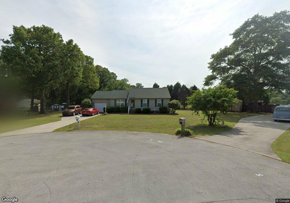
2825 Cornell Ct La Grange, NC 28551
Estimated Value: $194,000 - $232,000
3
Beds
2
Baths
1,128
Sq Ft
$183/Sq Ft
Est. Value
About This Home
This home is located at 2825 Cornell Ct, La Grange, NC 28551 and is currently estimated at $206,039, approximately $182 per square foot. 2825 Cornell Ct is a home located in Lenoir County with nearby schools including Banks Elementary School, E.B. Frink Middle School, and North Lenoir High School.
Ownership History
Date
Name
Owned For
Owner Type
Purchase Details
Closed on
Mar 18, 2005
Sold by
Wells Glenn D and Wells Sonya C
Bought by
Dunn Napolean and Dunn Corona
Current Estimated Value
Home Financials for this Owner
Home Financials are based on the most recent Mortgage that was taken out on this home.
Original Mortgage
$99,000
Outstanding Balance
$57,877
Interest Rate
8%
Mortgage Type
Adjustable Rate Mortgage/ARM
Estimated Equity
$148,162
Create a Home Valuation Report for This Property
The Home Valuation Report is an in-depth analysis detailing your home's value as well as a comparison with similar homes in the area
Home Values in the Area
Average Home Value in this Area
Purchase History
| Date | Buyer | Sale Price | Title Company |
|---|---|---|---|
| Dunn Napolean | $99,000 | None Available |
Source: Public Records
Mortgage History
| Date | Status | Borrower | Loan Amount |
|---|---|---|---|
| Open | Dunn Napolean | $99,000 |
Source: Public Records
Tax History Compared to Growth
Tax History
| Year | Tax Paid | Tax Assessment Tax Assessment Total Assessment is a certain percentage of the fair market value that is determined by local assessors to be the total taxable value of land and additions on the property. | Land | Improvement |
|---|---|---|---|---|
| 2025 | $1,250 | $160,152 | $23,392 | $136,760 |
| 2024 | $987 | $99,434 | $14,000 | $85,434 |
| 2023 | $987 | $99,434 | $14,000 | $85,434 |
| 2022 | $987 | $99,434 | $14,000 | $85,434 |
| 2021 | $985 | $99,434 | $14,000 | $85,434 |
| 2020 | $985 | $99,434 | $14,000 | $85,434 |
| 2019 | $987 | $99,434 | $14,000 | $85,434 |
| 2018 | $972 | $99,434 | $14,000 | $85,434 |
| 2017 | $971 | $99,434 | $14,000 | $85,434 |
| 2014 | $992 | $103,205 | $14,000 | $89,205 |
| 2013 | -- | $103,205 | $14,000 | $89,205 |
| 2011 | -- | $103,205 | $14,000 | $89,205 |
Source: Public Records
Map
Nearby Homes
- 2526 Moulton Dr
- 2445 Tammy Dr
- 3711 Drew Farmer Rd
- 3684 Drew Farmer Rd
- 3178 Alton Phillips Rd
- 3696 Drew Farmer Rd
- 3725 Huntcliff Dr
- 3740 Huntcliff Dr
- 3766 Huntcliff Dr
- 3730 Huntcliff Dr
- 3803 Huntcliff Dr
- 2321 Fred Everett Rd
- 3128 Kelly Rd
- 3379 Danfield Dr
- 3395 Danfield Dr
- 2886 Fox Run Cir
- 3494 Danfield Dr
- 2912 Fox Run Cir
- 2712 Stokes Cir
- 3145 Lakewood Dr Unit 3155
- 2817 Cornell Ct
- 2413 Stratford Dr
- 2829 Cornell Ct
- 2807 Cornell Ct
- 2828 Cornell Ct
- 2824 Cornell Ct
- 2816 Cornell Ct
- 2405 Stratford Dr
- 2806 Cornell Ct
- 2523 Bradford Ct
- 2529 Bradford Ct
- 2515 Bradford Ct
- 4536 Wellington Dr
- 2401 Stratford Dr
- 4537 Wellington Dr
- 2507 Bradford Ct
- 2444 Stratford Dr
- 3325 Stone Hedge Place
- 2468 Stratford Dr
- 2532 Bradford Ct