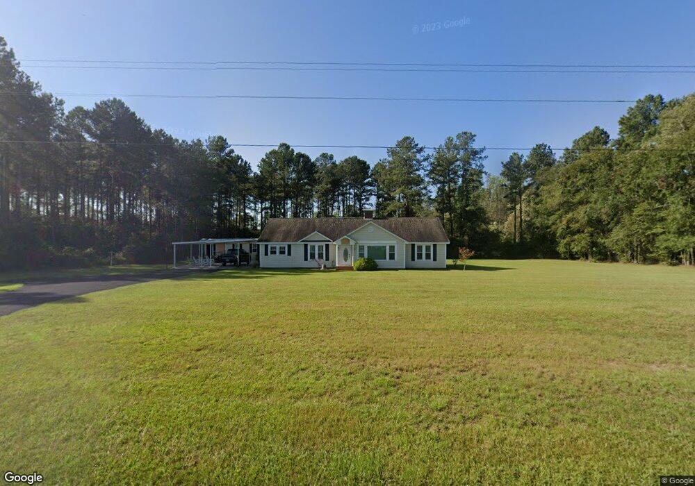
2825 Ga Highway 32 Mershon, GA 31551
Estimated Value: $167,000 - $227,000
--
Bed
1
Bath
2,094
Sq Ft
$95/Sq Ft
Est. Value
About This Home
This home is located at 2825 Ga Highway 32, Mershon, GA 31551 and is currently estimated at $199,617, approximately $95 per square foot. 2825 Ga Highway 32 is a home located in Pierce County with nearby schools including Pierce County High School.
Ownership History
Date
Name
Owned For
Owner Type
Purchase Details
Closed on
Mar 15, 2007
Sold by
Thomas Beverly K
Bought by
Crosby Franklin and Crosby Patricia
Current Estimated Value
Home Financials for this Owner
Home Financials are based on the most recent Mortgage that was taken out on this home.
Original Mortgage
$80,920
Outstanding Balance
$48,519
Interest Rate
6.27%
Mortgage Type
New Conventional
Estimated Equity
$151,098
Purchase Details
Closed on
Feb 6, 2007
Sold by
Kimmons Lucille Byrd
Bought by
Thomas Beverly K and Kimmons Herbert M
Home Financials for this Owner
Home Financials are based on the most recent Mortgage that was taken out on this home.
Original Mortgage
$80,920
Outstanding Balance
$48,519
Interest Rate
6.27%
Mortgage Type
New Conventional
Estimated Equity
$151,098
Create a Home Valuation Report for This Property
The Home Valuation Report is an in-depth analysis detailing your home's value as well as a comparison with similar homes in the area
Home Values in the Area
Average Home Value in this Area
Purchase History
| Date | Buyer | Sale Price | Title Company |
|---|---|---|---|
| Crosby Franklin | $50,000 | -- | |
| Thomas Beverly K | -- | -- |
Source: Public Records
Mortgage History
| Date | Status | Borrower | Loan Amount |
|---|---|---|---|
| Open | Crosby Franklin | $80,920 |
Source: Public Records
Tax History Compared to Growth
Tax History
| Year | Tax Paid | Tax Assessment Tax Assessment Total Assessment is a certain percentage of the fair market value that is determined by local assessors to be the total taxable value of land and additions on the property. | Land | Improvement |
|---|---|---|---|---|
| 2025 | $1,338 | $61,072 | $3,248 | $57,824 |
| 2024 | $1,338 | $59,096 | $3,248 | $55,848 |
| 2023 | $1,291 | $57,116 | $3,248 | $53,868 |
| 2022 | $831 | $32,757 | $2,394 | $30,363 |
| 2021 | $783 | $31,531 | $2,394 | $29,137 |
| 2020 | $762 | $30,306 | $2,394 | $27,912 |
| 2019 | $767 | $30,306 | $2,394 | $27,912 |
| 2018 | $729 | $28,966 | $2,280 | $26,686 |
| 2017 | $769 | $28,011 | $2,280 | $25,731 |
| 2016 | $709 | $28,011 | $2,280 | $25,731 |
| 2015 | $414 | $28,010 | $2,280 | $25,731 |
| 2014 | $414 | $28,011 | $2,280 | $25,731 |
| 2013 | $414 | $28,010 | $2,280 | $25,730 |
Source: Public Records
Map
Nearby Homes
- 2203 N Hwy 121 Hwy
- TRACT 2 Pine Cone Trail
- TRACT 3 Pine Cone Trail
- TRACT 11 Pine Cone Trail
- 0 Pine Cone Trail
- TRACT 5 Pine Cone Trail
- TRACT 7 Pine Cone Trail
- TRACT 9 Pine Cone Trail
- 0 Crump Rd
- 0 Ga Hwy 32
- 0 Metts-Overstreet Rd
- 0 Ward Boyette Rd
- 3675 Troy Rd
- 2115 Mill Creek Rd
- 2114 Mill Creek Rd
- 3190 Radio Station Rd
- 0 Oak Hill Rd Unit 17325553
- 3936 Folks Cir
- 4159 Folks Dr
- 6005 Chancey Rd
- 2876 Ga Highway 32
- 1762 June Rd
- 3481 Camellia Ln
- 2984 Ga Highway 32
- 1604 Boyette Rd
- 4449 Johnson Bypass
- 2645 Ga Highway 32
- 2658 Ga Highway 32
- 2628 Ga Highway 32
- 2618 Ga Highway 32
- 1605 Mershon Rd
- 1701 Mershon Rd
- 2586 Ga Highway 32 E
- 1766 Mershon Rd
- 1755 Mershon Rd
- 1796 Mershon Rd
- 2581 Georgia 32
- 1771 Mershon Rd
- 3600 Carnes Rd
- 1825 Mershon Rd