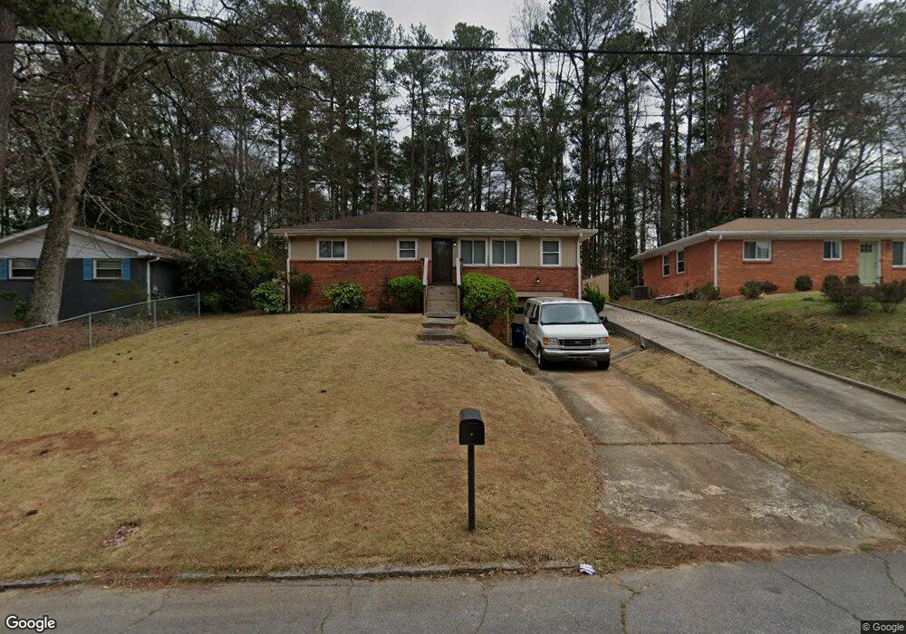
2826 Lancaster Dr Atlanta, GA 30344
Estimated Value: $188,043 - $265,000
3
Beds
1
Bath
1,125
Sq Ft
$191/Sq Ft
Est. Value
About This Home
This home is located at 2826 Lancaster Dr, Atlanta, GA 30344 and is currently estimated at $215,261, approximately $191 per square foot. 2826 Lancaster Dr is a home located in Fulton County with nearby schools including Conley Hills Elementary School, Paul D. West Middle School, and Tri-Cities High School.
Ownership History
Date
Name
Owned For
Owner Type
Purchase Details
Closed on
Feb 20, 2024
Sold by
Banks Taryn L
Bought by
Banks Taryn L and Lattimore Stephen O
Current Estimated Value
Purchase Details
Closed on
May 8, 2020
Sold by
Wingo Taryn
Bought by
Banks Taryn L
Home Financials for this Owner
Home Financials are based on the most recent Mortgage that was taken out on this home.
Original Mortgage
$110,000
Interest Rate
3.5%
Mortgage Type
New Conventional
Create a Home Valuation Report for This Property
The Home Valuation Report is an in-depth analysis detailing your home's value as well as a comparison with similar homes in the area
Home Values in the Area
Average Home Value in this Area
Purchase History
| Date | Buyer | Sale Price | Title Company |
|---|---|---|---|
| Banks Taryn L | -- | -- | |
| Banks Taryn L | -- | -- |
Source: Public Records
Mortgage History
| Date | Status | Borrower | Loan Amount |
|---|---|---|---|
| Previous Owner | Banks Taryn L | $110,000 |
Source: Public Records
Tax History Compared to Growth
Tax History
| Year | Tax Paid | Tax Assessment Tax Assessment Total Assessment is a certain percentage of the fair market value that is determined by local assessors to be the total taxable value of land and additions on the property. | Land | Improvement |
|---|---|---|---|---|
| 2025 | $110 | $93,920 | $29,440 | $64,480 |
| 2023 | $110 | $46,000 | $11,840 | $34,160 |
| 2022 | $1,139 | $50,920 | $11,840 | $39,080 |
| 2021 | $1,302 | $43,960 | $8,960 | $35,000 |
| 2020 | $385 | $40,960 | $11,480 | $29,480 |
| 2019 | $110 | $35,960 | $10,840 | $25,120 |
| 2018 | $336 | $20,640 | $4,960 | $15,680 |
| 2017 | $157 | $10,320 | $3,760 | $6,560 |
| 2016 | $156 | $10,320 | $3,760 | $6,560 |
| 2015 | $267 | $10,320 | $3,760 | $6,560 |
| 2014 | $158 | $10,320 | $3,760 | $6,560 |
Source: Public Records
Map
Nearby Homes
- 2792 Plantation Dr
- 2355 Ben Hill Rd
- 2764 Riggs Dr
- 2413 Ben Hill Rd
- 2302 Montrose Dr
- 2363 Dabney Terrace
- 2830 Luther Dr
- 2330 Dorsey Ave
- 2667 Plantation Dr
- 3006 Remington St
- 2878 Delowe Dr
- 2842 Delowe Dr
- 3034 Barksdale Cir
- 0 Riggs Dr Unit 10600937
- 0 Riggs Dr Unit 7646715
- 3029 Mckenzie Rd
- 2772 S Clark Dr
- 3046 Dobbs Way
- 2907 Cloverhurst Dr
- 2608 Westchester Dr
- 2830 Lancaster Dr
- 2822 Lancaster Dr
- 2834 Lancaster Dr
- 2818 Lancaster Dr
- 2242 Dorsey Ave
- 2815 Lancaster Dr
- 2821 Lancaster Dr Unit 5
- 2234 Dorsey Ave
- 2825 Lancaster Dr Unit 2825
- 2825 Lancaster Dr
- 2825 Lancaster Dr Unit 1
- 2835 Lancaster Dr
- 2250 Dorsey Ave
- 2228 Dorsey Ave Unit 5
- 2254 Dorsey Ave
- 2839 Lancaster Dr Unit 5
- 2224 Dorsey Ave Unit 5
- 2260 Dorsey Ave
- 2313 Ben Hill Rd
- 2843 Lancaster Dr