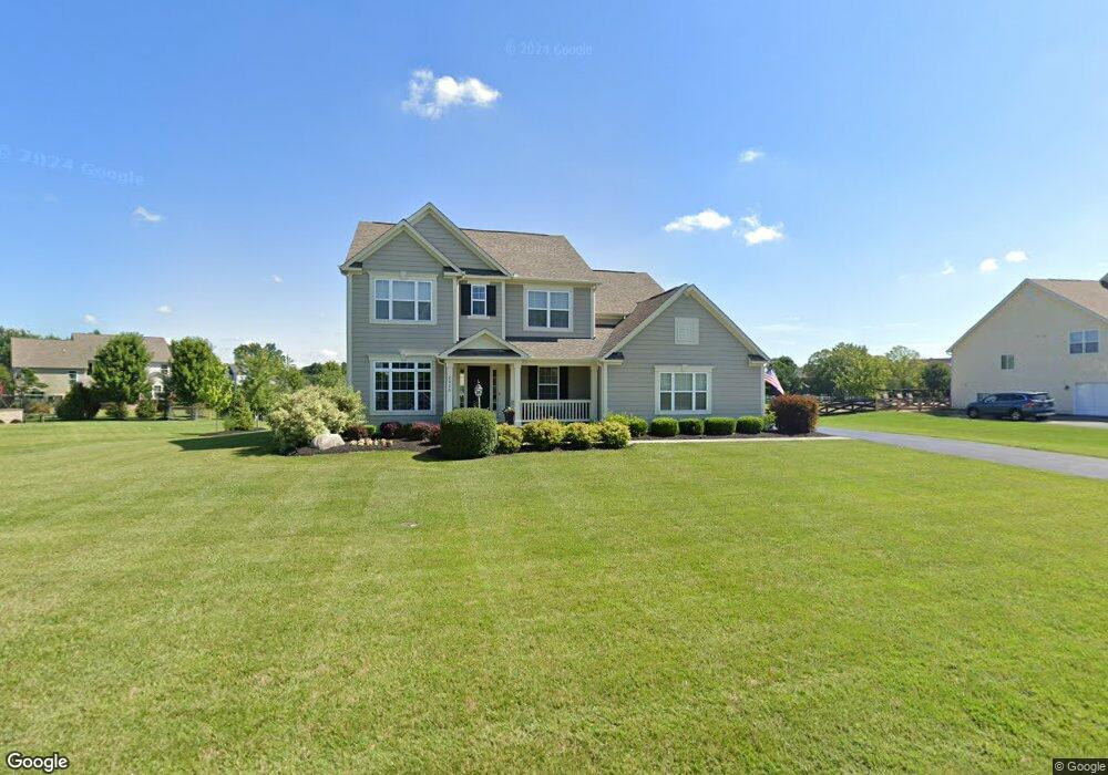
2828 Derby Dr Powell, OH 43065
Liberty Township NeighborhoodEstimated Value: $836,000 - $909,245
4
Beds
3
Baths
3,658
Sq Ft
$237/Sq Ft
Est. Value
About This Home
This home is located at 2828 Derby Dr, Powell, OH 43065 and is currently estimated at $865,811, approximately $236 per square foot. 2828 Derby Dr is a home with nearby schools including Tyler Run Elementary School, Olentangy Liberty Middle School, and Olentangy Liberty High School.
Ownership History
Date
Name
Owned For
Owner Type
Purchase Details
Closed on
Jun 24, 2014
Sold by
Rockford Homes Inc
Bought by
Perlman Robert J and Perlman Kelly A
Current Estimated Value
Home Financials for this Owner
Home Financials are based on the most recent Mortgage that was taken out on this home.
Original Mortgage
$416,116
Outstanding Balance
$316,269
Interest Rate
4.18%
Mortgage Type
New Conventional
Estimated Equity
$549,543
Purchase Details
Closed on
Mar 12, 2013
Sold by
Jewett Road Associates Llc
Bought by
Rockford Homes Inc
Create a Home Valuation Report for This Property
The Home Valuation Report is an in-depth analysis detailing your home's value as well as a comparison with similar homes in the area
Home Values in the Area
Average Home Value in this Area
Purchase History
| Date | Buyer | Sale Price | Title Company |
|---|---|---|---|
| Perlman Robert J | $439,000 | Title First Agency Inc | |
| Rockford Homes Inc | -- | Columbia Title Agency |
Source: Public Records
Mortgage History
| Date | Status | Borrower | Loan Amount |
|---|---|---|---|
| Open | Perlman Robert J | $416,116 |
Source: Public Records
Tax History Compared to Growth
Tax History
| Year | Tax Paid | Tax Assessment Tax Assessment Total Assessment is a certain percentage of the fair market value that is determined by local assessors to be the total taxable value of land and additions on the property. | Land | Improvement |
|---|---|---|---|---|
| 2024 | $13,650 | $256,550 | $46,900 | $209,650 |
| 2023 | $13,322 | $249,310 | $46,900 | $202,410 |
| 2022 | $11,232 | $166,180 | $31,500 | $134,680 |
| 2021 | $10,793 | $158,690 | $31,500 | $127,190 |
| 2020 | $10,843 | $158,690 | $31,500 | $127,190 |
| 2019 | $10,171 | $154,980 | $31,500 | $123,480 |
| 2018 | $10,217 | $154,980 | $31,500 | $123,480 |
| 2017 | $10,113 | $145,600 | $26,250 | $119,350 |
| 2016 | $10,218 | $145,600 | $26,250 | $119,350 |
| 2015 | $9,259 | $145,600 | $26,250 | $119,350 |
| 2014 | $1,733 | $23,630 | $23,630 | $0 |
| 2013 | $409 | $6,130 | $6,130 | $0 |
Source: Public Records
Map
Nearby Homes
- 2961 Lexington Dr
- 1992 Edmunds Ct
- 8796 Yates Point Ct
- 8803 Yates Point Ct
- 8741 Jamey Ct
- 10586 Churchill Dr
- 55 Timber Oak Ct
- 2013 Summit Row Blvd
- 8594 Broadacre Dr
- 8292 Breckenridge Way
- 2168 Summit Row Blvd
- 1949 Hamrock Dr
- 2300 Benning Dr
- 1967 Woodlands Place
- 274 Stamford Dr
- 2228 Gnarled Pine Dr
- 630 Woods Hollow Ln
- 1741 Strathshire Hall Place
- 2105 Liberty St
- 2020 Liberty St
- 2804 Derby Dr
- 2858 Derby Dr
- 2813 Derby Dr
- 2659 Unbridled Ct
- 2839 Derby Dr
- 2788 Derby Dr
- 2691 Unbridled Ct
- 2789 Derby Dr
- 2863 Derby Dr
- 2729 Unbridled Ct
- 2656 Unbridled Ct
- 2762 Derby Dr
- 2881 Derby Dr
- 2765 Derby Dr
- 2636 Clubhouse Cir
- 10525 Patriot Ct
- 10531 Patriot Ct
- 2620 Clubhouse Cir
- 2771 Unbridled Ct
- 2700 Unbridled Ct