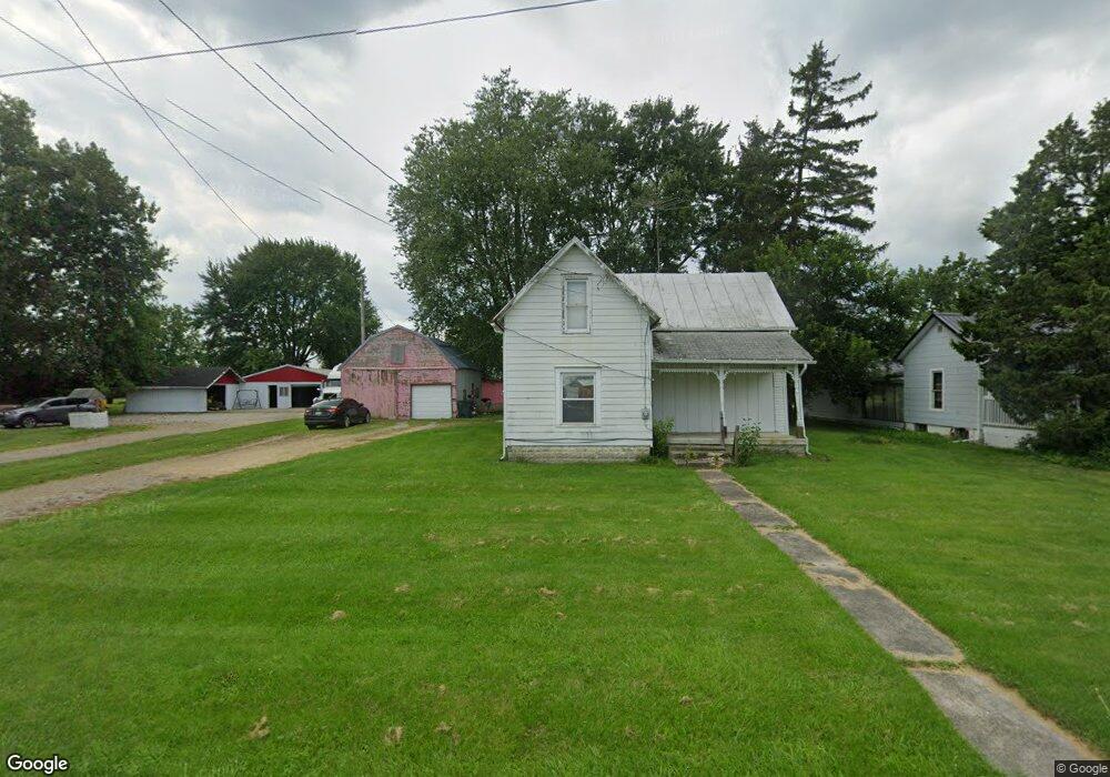
28289 State Route 739 West Mansfield, OH 43358
Estimated Value: $159,000 - $199,899
3
Beds
1
Bath
1,409
Sq Ft
$125/Sq Ft
Est. Value
About This Home
This home is located at 28289 State Route 739, West Mansfield, OH 43358 and is currently estimated at $176,725, approximately $125 per square foot. 28289 State Route 739 is a home located in Union County with nearby schools including North Union Elementary School, North Union Middle School, and North Union High School.
Ownership History
Date
Name
Owned For
Owner Type
Purchase Details
Closed on
Mar 28, 2024
Sold by
Sproull Steve E
Bought by
Fryman Karri M
Current Estimated Value
Home Financials for this Owner
Home Financials are based on the most recent Mortgage that was taken out on this home.
Original Mortgage
$152,000
Outstanding Balance
$149,737
Interest Rate
6.9%
Mortgage Type
New Conventional
Estimated Equity
$26,988
Purchase Details
Closed on
Nov 23, 2005
Sold by
Smith Toby W and Smith Dawn E
Bought by
Sproull Steve E
Home Financials for this Owner
Home Financials are based on the most recent Mortgage that was taken out on this home.
Original Mortgage
$80,901
Interest Rate
6.36%
Mortgage Type
Fannie Mae Freddie Mac
Purchase Details
Closed on
Dec 11, 1996
Sold by
Troy A Deardurff
Bought by
Toby W Smith
Home Financials for this Owner
Home Financials are based on the most recent Mortgage that was taken out on this home.
Original Mortgage
$56,800
Interest Rate
7.85%
Mortgage Type
New Conventional
Create a Home Valuation Report for This Property
The Home Valuation Report is an in-depth analysis detailing your home's value as well as a comparison with similar homes in the area
Home Values in the Area
Average Home Value in this Area
Purchase History
| Date | Buyer | Sale Price | Title Company |
|---|---|---|---|
| Fryman Karri M | $160,000 | First Ohio Title | |
| Sproull Steve E | $90,900 | -- | |
| Toby W Smith | $71,000 | -- |
Source: Public Records
Mortgage History
| Date | Status | Borrower | Loan Amount |
|---|---|---|---|
| Open | Fryman Karri M | $152,000 | |
| Previous Owner | Sproull Steve E | $80,901 | |
| Previous Owner | Toby W Smith | $56,800 |
Source: Public Records
Tax History Compared to Growth
Tax History
| Year | Tax Paid | Tax Assessment Tax Assessment Total Assessment is a certain percentage of the fair market value that is determined by local assessors to be the total taxable value of land and additions on the property. | Land | Improvement |
|---|---|---|---|---|
| 2024 | $1,701 | $40,080 | $5,810 | $34,270 |
| 2023 | $1,701 | $40,080 | $5,810 | $34,270 |
| 2022 | $1,677 | $40,080 | $5,810 | $34,270 |
| 2021 | $1,292 | $28,380 | $4,470 | $23,910 |
| 2020 | $1,205 | $28,380 | $4,470 | $23,910 |
| 2019 | $1,212 | $28,380 | $4,470 | $23,910 |
| 2018 | $831 | $19,170 | $3,580 | $15,590 |
| 2017 | $826 | $19,170 | $3,580 | $15,590 |
| 2016 | $836 | $19,170 | $3,580 | $15,590 |
| 2015 | $568 | $12,530 | $3,580 | $8,950 |
| 2014 | $545 | $12,530 | $3,580 | $8,950 |
| 2013 | $554 | $12,530 | $3,580 | $8,950 |
Source: Public Records
Map
Nearby Homes
- 28370 State Route 739
- 21800 State Route 47
- 25875 Ohio 31
- 19250 Powder Lick Rd
- 30650 State Route 739
- 18055 Miller Rd
- 31434 State Route 31
- 31535 State Route 31
- 25400 Storms Rd
- 23863 Drake Skidmore Rd
- 23750 Drake-Skidmore Rd
- 0 Ohio 31
- 32220 State Route 31
- 25883 Lunda Rd
- 0 Powder Lick Rd Unit 1016484
- 184 E Mann St
- 21630 Main St
- 605 W Center St
- 23156 State Route 739
- 24097 Lunda Rd
- 28299 State Route 739
- 28269 State Route 739
- 20623 Ohio 47
- 20623 State Route 47
- 28249 Ohio 739
- 20655 State Route 47
- 28246 State Route 739
- 28353 State Route 739
- 20632 State Route 47
- 28350 State Route 739
- 20642 State Route 47
- 20665 State Route 47
- 28375 State Route 739
- 20523 State Route 47
- 20675 Ohio 47
- 20675 State Route 47
- 20666 State Route 47
- 20689 State Route 47
- 20680 State Route 47