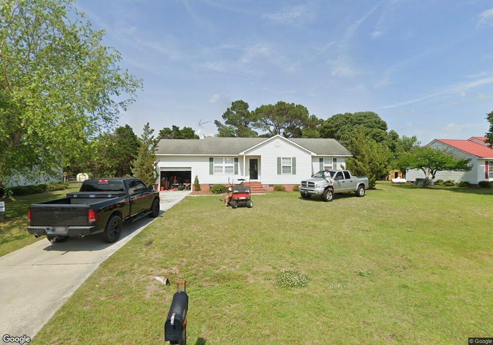
2829 Abby Ct Kinston, NC 28504
Estimated Value: $161,000 - $204,000
3
Beds
2
Baths
1,112
Sq Ft
$164/Sq Ft
Est. Value
About This Home
This home is located at 2829 Abby Ct, Kinston, NC 28504 and is currently estimated at $181,837, approximately $163 per square foot. 2829 Abby Ct is a home located in Lenoir County with nearby schools including Banks Elementary School, E.B. Frink Middle School, and North Lenoir High School.
Ownership History
Date
Name
Owned For
Owner Type
Purchase Details
Closed on
Nov 23, 2009
Sold by
Lbh Real Estate Llc
Bought by
Harrelson Ginger S
Current Estimated Value
Home Financials for this Owner
Home Financials are based on the most recent Mortgage that was taken out on this home.
Original Mortgage
$118,000
Outstanding Balance
$76,734
Interest Rate
4.92%
Mortgage Type
New Conventional
Estimated Equity
$105,103
Purchase Details
Closed on
Oct 6, 2008
Sold by
Hodges Marcus A and Hodges Belinda K
Bought by
Lbh Reak Estate Llc
Home Financials for this Owner
Home Financials are based on the most recent Mortgage that was taken out on this home.
Original Mortgage
$95,000
Interest Rate
5.96%
Mortgage Type
Purchase Money Mortgage
Create a Home Valuation Report for This Property
The Home Valuation Report is an in-depth analysis detailing your home's value as well as a comparison with similar homes in the area
Home Values in the Area
Average Home Value in this Area
Purchase History
| Date | Buyer | Sale Price | Title Company |
|---|---|---|---|
| Harrelson Ginger S | $118,000 | -- | |
| Lbh Reak Estate Llc | $95,000 | None Available |
Source: Public Records
Mortgage History
| Date | Status | Borrower | Loan Amount |
|---|---|---|---|
| Open | Harrelson Ginger S | $118,000 | |
| Previous Owner | Lbh Reak Estate Llc | $95,000 |
Source: Public Records
Tax History
| Year | Tax Paid | Tax Assessment Tax Assessment Total Assessment is a certain percentage of the fair market value that is determined by local assessors to be the total taxable value of land and additions on the property. | Land | Improvement |
|---|---|---|---|---|
| 2025 | $1,070 | $135,220 | $15,228 | $119,992 |
| 2024 | $896 | $89,349 | $15,000 | $74,349 |
| 2023 | $896 | $89,349 | $15,000 | $74,349 |
| 2022 | $896 | $89,349 | $15,000 | $74,349 |
| 2021 | $894 | $89,349 | $15,000 | $74,349 |
| 2020 | $894 | $89,349 | $15,000 | $74,349 |
| 2019 | $896 | $89,349 | $15,000 | $74,349 |
| 2018 | $883 | $89,349 | $15,000 | $74,349 |
| 2017 | $881 | $89,349 | $15,000 | $74,349 |
| 2014 | $953 | $98,759 | $15,000 | $83,759 |
| 2013 | -- | $98,759 | $15,000 | $83,759 |
| 2011 | -- | $98,759 | $15,000 | $83,759 |
Source: Public Records
Map
Nearby Homes
- 3145 Lakewood Dr Unit 3155
- 2585 Cabin Branch Rd
- 3205 Deanswood Dr
- 3128 Kelly Rd
- 3118 Kelly Rd
- 4569 Hunter Creek Dr
- 2204 Staley Ct
- 2806 Cornell Ct
- 2634 Forrest Dr
- 2443 Creekside Rd
- 2857 Branchwood Dr
- 2917 Laurel Ridge Ln
- Lot 1 Alton Phillips Rd
- 11 Brookwood Rd
- 2111 Hunt Hill Place
- 2671 Brookwood Rd
- 2193 Dogwood Ln
- 2131 Brinson St
- 3178 Alton Phillips Rd
- 3670 Drew Farmer Rd
Your Personal Tour Guide
Ask me questions while you tour the home.