
Seller's Agent in 2013
Lisa Vieweg
Vieweg RE/Better Homes & Gardens Real Estate-Service First
(217) 972-7282
2 in this area
44 Total Sales

Estimated Value: $202,497 - $255,000
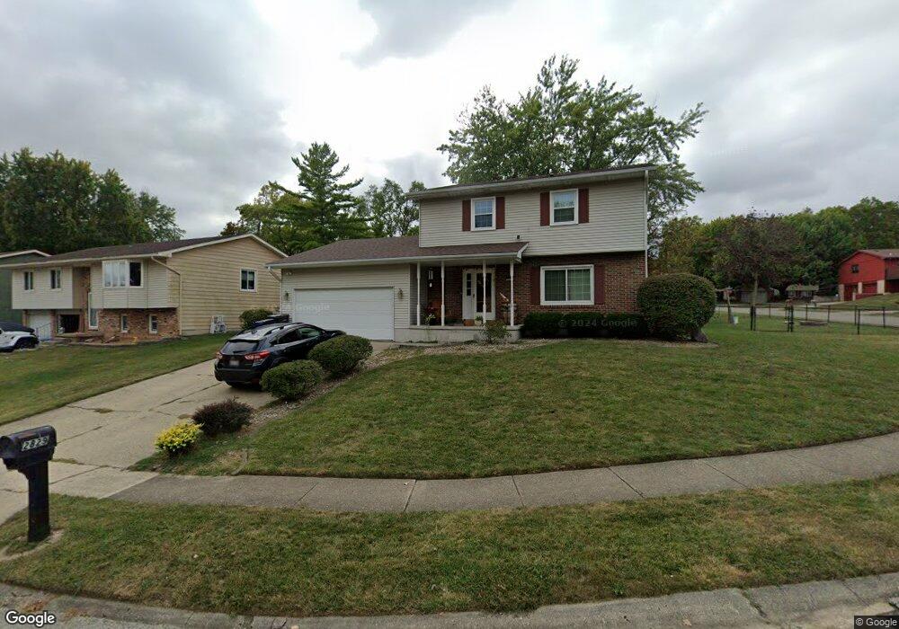
Don't do anything but move in! Mt. Zion Schools with great neighborhood too! This 2 story has had a roof put on 09, A/C & Furnace 06, and more... Catch a little view of lake across the street especially when leaves are off trees.... The finished basement has a bar with fridge and area for table along with plenty of entertaining opportunities. Won't Last...Come See Quickly!!!
Last Agent to Sell the Property
Vieweg RE/Better Homes & Gardens Real Estate-Service First License #475133005 Listed on: 06/12/2013
| Date | Buyer | Sale Price | Title Company |
|---|---|---|---|
| Mullins Erie | $152,000 | None Available | |
| -- | $145,000 | -- |
| Date | Status | Borrower | Loan Amount |
|---|---|---|---|
| Open | Mullins Erie | $134,100 |
| Date | Event | Price | List to Sale | Price per Sq Ft |
|---|---|---|---|---|
| 08/09/2013 08/09/13 | Sold | $152,000 | -4.9% | $87 / Sq Ft |
| 06/30/2013 06/30/13 | Pending | -- | -- | -- |
| 06/12/2013 06/12/13 | For Sale | $159,900 | -- | $91 / Sq Ft |
| Year | Tax Paid | Tax Assessment Tax Assessment Total Assessment is a certain percentage of the fair market value that is determined by local assessors to be the total taxable value of land and additions on the property. | Land | Improvement |
|---|---|---|---|---|
| 2024 | $4,259 | $55,146 | $7,916 | $47,230 |
| 2023 | $4,263 | $53,194 | $7,636 | $45,558 |
| 2022 | $3,983 | $49,223 | $7,066 | $42,157 |
| 2021 | $3,802 | $45,970 | $6,599 | $39,371 |
| 2020 | $3,652 | $43,837 | $6,293 | $37,544 |
| 2019 | $3,652 | $43,837 | $6,293 | $37,544 |
| 2018 | $3,648 | $44,136 | $7,134 | $37,002 |
| 2017 | $3,760 | $45,314 | $7,324 | $37,990 |
| 2016 | $3,839 | $45,777 | $7,399 | $38,378 |
| 2015 | $3,701 | $44,967 | $7,268 | $37,699 |
| 2014 | $3,495 | $44,522 | $7,196 | $37,326 |
| 2013 | $3,667 | $46,194 | $7,466 | $38,728 |
Seller's Agent in 2013
Lisa Vieweg
Vieweg RE/Better Homes & Gardens Real Estate-Service First
(217) 972-7282
2 in this area
44 Total Sales
R
Buyer's Agent in 2013
Robert Sparks
Brinkoetter REALTORS®
(217) 201-0235
1 in this area
85 Total Sales
Source: Central Illinois Board of REALTORS®
MLS Number: 5191487
APN: 04-12-26-476-007
Ask me questions while you tour the home.