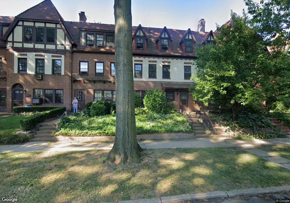
283 Burns St Forest Hills, NY 11375
Forest Hills NeighborhoodEstimated Value: $1,523,181 - $1,866,000
--
Bed
--
Bath
2,160
Sq Ft
$786/Sq Ft
Est. Value
About This Home
This home is located at 283 Burns St, Forest Hills, NY 11375 and is currently estimated at $1,696,795, approximately $785 per square foot. 283 Burns St is a home located in Queens County with nearby schools including Ps 101 School In The Gardens, J.H.S. 190 Russell Sage, and Queens Metropolitan High School.
Ownership History
Date
Name
Owned For
Owner Type
Purchase Details
Closed on
May 9, 2003
Sold by
Lu William and Ohashi Kazuko Cathy
Bought by
Neale Peters Lane Barbara C and Neale Peters Lane William C
Current Estimated Value
Purchase Details
Closed on
Mar 9, 1999
Sold by
Budde Shawn M and Budde Eileen M
Bought by
Lu William and Ohashi Kazuko Cathy
Home Financials for this Owner
Home Financials are based on the most recent Mortgage that was taken out on this home.
Original Mortgage
$348,000
Interest Rate
7.09%
Purchase Details
Closed on
Jul 17, 1997
Sold by
Christoforatos Demo and Christoforatos Nicoletta
Bought by
Budde Shawn M and Budde Eileen M
Home Financials for this Owner
Home Financials are based on the most recent Mortgage that was taken out on this home.
Original Mortgage
$339,000
Interest Rate
6.5%
Mortgage Type
Assumption
Create a Home Valuation Report for This Property
The Home Valuation Report is an in-depth analysis detailing your home's value as well as a comparison with similar homes in the area
Home Values in the Area
Average Home Value in this Area
Purchase History
| Date | Buyer | Sale Price | Title Company |
|---|---|---|---|
| Neale Peters Lane Barbara C | $775,000 | -- | |
| Lu William | $435,000 | Commonwealth Land Title Ins | |
| Budde Shawn M | $410,000 | First American Title Ins Co |
Source: Public Records
Mortgage History
| Date | Status | Borrower | Loan Amount |
|---|---|---|---|
| Previous Owner | Lu William | $348,000 | |
| Previous Owner | Budde Shawn M | $339,000 | |
| Closed | Neale Peters Lane Barbara C | $0 |
Source: Public Records
Tax History Compared to Growth
Tax History
| Year | Tax Paid | Tax Assessment Tax Assessment Total Assessment is a certain percentage of the fair market value that is determined by local assessors to be the total taxable value of land and additions on the property. | Land | Improvement |
|---|---|---|---|---|
| 2025 | $12,413 | $64,495 | $10,504 | $53,991 |
| 2024 | $12,425 | $63,204 | $10,201 | $53,003 |
| 2023 | $11,722 | $59,764 | $9,816 | $49,948 |
| 2022 | $11,043 | $99,360 | $16,260 | $83,100 |
| 2021 | $11,015 | $96,840 | $16,260 | $80,580 |
| 2020 | $11,080 | $106,440 | $16,260 | $90,180 |
| 2019 | $10,725 | $91,140 | $16,260 | $74,880 |
| 2018 | $9,855 | $49,803 | $8,467 | $41,336 |
| 2017 | $9,341 | $47,294 | $8,527 | $38,767 |
| 2016 | $8,644 | $47,294 | $8,527 | $38,767 |
| 2015 | $5,161 | $44,788 | $9,629 | $35,159 |
| 2014 | $5,161 | $43,892 | $11,282 | $32,610 |
Source: Public Records
Map
Nearby Homes
- 306 Burns St
- 76-66 Austin St Unit 4B
- 76-66 Austin St Unit 1
- 76-66 Austin St Unit 3
- 75-40 Austin St Unit 6Bl
- 75-40 Austin St Unit 2Ar
- 111-14 76th Ave Unit 114
- 77- 20 Austin St Unit 5A
- 77-16 Austin St Unit 5L
- 7716 Austin St Unit 2K
- 75-02 Austin St Unit 2J
- 7502 Austin St Unit 1L
- 111-39 76th Rd Unit D1
- 111-39 76th Rd Unit B7
- 111-39 76th Rd Unit E-2
- 111-39 76th Rd Unit D7
- 111-50 75th Rd Unit A54
- 11141 77th Ave
- 408 Burns St
- 16 Upshaw Rd
- 285 Burns St
- 281 Burns St
- 287 Burns St
- 279 Burns St
- 289 Burns St Unit 3Fl
- 291 Burns St
- 291 Burns St Unit 2
- 277 Burns St
- 293 Burns St
- 275 Burns St
- 98 Beechknoll Rd
- 98 Beechknoll Rd Unit House
- 295 Burns St
- 273 Burns St Unit 3rd Fl
- 273 Burns St
- 273 Burns St Unit 1Fl
- 273 Burns St Unit 3Fl
- 104 Beechknoll Rd
- 92 Beechknoll Rd