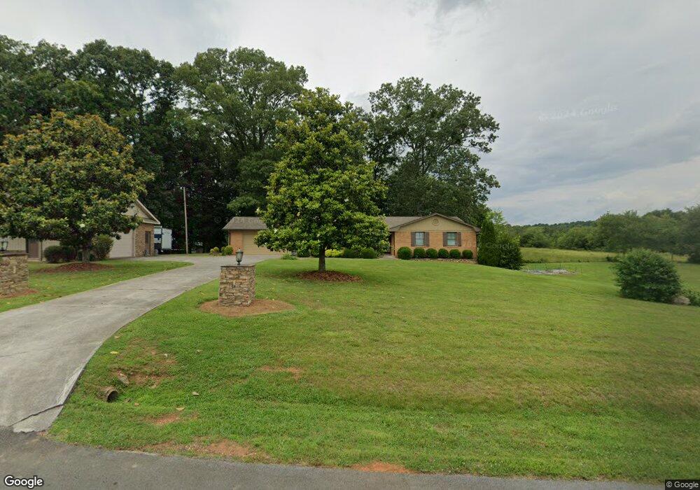
283 Countryside Dr SW Calhoun, GA 30701
Estimated Value: $448,529 - $529,000
3
Beds
2
Baths
3,412
Sq Ft
$142/Sq Ft
Est. Value
About This Home
This home is located at 283 Countryside Dr SW, Calhoun, GA 30701 and is currently estimated at $483,132, approximately $141 per square foot. 283 Countryside Dr SW is a home located in Gordon County with nearby schools including Swain Elementary School, Ashworth Middle School, and Gordon Central High School.
Ownership History
Date
Name
Owned For
Owner Type
Purchase Details
Closed on
Sep 7, 2020
Sold by
Hasselbrack Jennifer Elaine
Bought by
Ingersoll Jennifer E and Ingersoll James Carlyle
Current Estimated Value
Purchase Details
Closed on
Apr 30, 2020
Sold by
Chadwick Joseph C
Bought by
Hasselbrack Jennifer Elaine
Home Financials for this Owner
Home Financials are based on the most recent Mortgage that was taken out on this home.
Original Mortgage
$282,564
Interest Rate
3.3%
Mortgage Type
New Conventional
Purchase Details
Closed on
Apr 26, 2005
Sold by
Glennie Martha E
Bought by
Chadwick Joseph C and Chadwick Andrienne C
Home Financials for this Owner
Home Financials are based on the most recent Mortgage that was taken out on this home.
Original Mortgage
$161,648
Interest Rate
5.98%
Mortgage Type
New Conventional
Purchase Details
Closed on
Feb 28, 1974
Bought by
Glennie J Forrest
Create a Home Valuation Report for This Property
The Home Valuation Report is an in-depth analysis detailing your home's value as well as a comparison with similar homes in the area
Home Values in the Area
Average Home Value in this Area
Purchase History
| Date | Buyer | Sale Price | Title Company |
|---|---|---|---|
| Ingersoll Jennifer E | -- | -- | |
| Hasselbrack Jennifer Elaine | $315,000 | -- | |
| Chadwick Joseph C | $165,000 | -- | |
| Glennie J Forrest | -- | -- |
Source: Public Records
Mortgage History
| Date | Status | Borrower | Loan Amount |
|---|---|---|---|
| Previous Owner | Hasselbrack Jennifer Elaine | $282,564 | |
| Previous Owner | Chadwick Joseph C | $161,648 |
Source: Public Records
Tax History Compared to Growth
Tax History
| Year | Tax Paid | Tax Assessment Tax Assessment Total Assessment is a certain percentage of the fair market value that is determined by local assessors to be the total taxable value of land and additions on the property. | Land | Improvement |
|---|---|---|---|---|
| 2024 | $3,787 | $149,040 | $12,800 | $136,240 |
| 2023 | $3,539 | $139,280 | $12,800 | $126,480 |
| 2022 | $3,525 | $130,480 | $12,800 | $117,680 |
| 2021 | $3,056 | $109,080 | $12,800 | $96,280 |
| 2020 | $2,396 | $85,640 | $10,600 | $75,040 |
| 2019 | $2,409 | $85,640 | $10,600 | $75,040 |
| 2018 | $2,259 | $80,440 | $10,600 | $69,840 |
Source: Public Records
Map
Nearby Homes
- 110 Darby Rd SW
- 211 Darby Rd SW
- 261 Liberty Ln SW
- L2 Taylor Bridge Rd SW
- 0 Reeves Station Rd SW Unit 10548197
- 0 Reeves Station Rd SW Unit 7601645
- 271 Old Belwood Rd SE
- 19 Dublin Way NW
- 490 McDaniel Station Rd SW
- 506 McDaniel Station Rd SW
- 458 McDaniel Station Rd SW
- 474 McDaniel Station Rd SW
- 365 Riverboat Dr
- 1943 Rome Rd SW
- 238 Lighthouse Cove SW
- 269 Riverboat Dr
- Woodridge Plan at The Landing at Miller’s Ferry
- Kensington Plan at The Landing at Miller’s Ferry
- Northwyck Plan at The Landing at Miller’s Ferry
- Richmond Plan at The Landing at Miller’s Ferry
- 298 Countryside Dr SW
- 264 Countryside Dr SW
- 00 Darby Rd SW
- 0 Darby Rd SW
- 0 Darby Rd SW Unit 7176524
- 0 Darby Rd SW Unit 7438149
- 0 Darby Rd SW Unit 9061095
- 0 Darby Rd SW Unit 8936785
- 0 Darby Rd SW Unit 8355499
- 0 Darby Rd SW Unit 8300625
- 0 Darby Rd SW Unit 8642149
- 327 Countryside Dr SW
- 326 Countryside Dr SW
- 774 Bray Rd SW
- 0 Countryside Dr SW Unit 8601344
- 234 Countryside Dr SW
- 229 Countryside Dr SW
- 842 Bray Rd SW
- 205 Countryside Dr SW
- 194 Countryside Dr SW