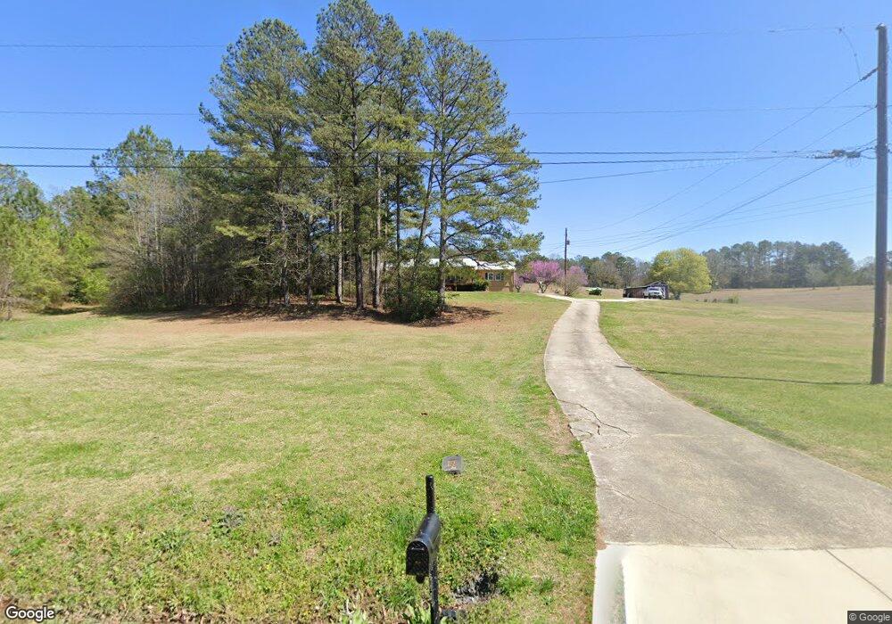
283 Hutto Rd Cedartown, GA 30125
Estimated Value: $254,000 - $314,238
3
Beds
2
Baths
2,056
Sq Ft
$138/Sq Ft
Est. Value
About This Home
This home is located at 283 Hutto Rd, Cedartown, GA 30125 and is currently estimated at $283,310, approximately $137 per square foot. 283 Hutto Rd is a home located in Polk County with nearby schools including Cedar Christian School and Vineyard Harvester Christian Academy.
Ownership History
Date
Name
Owned For
Owner Type
Purchase Details
Closed on
Feb 27, 2009
Sold by
Speight Ronald L
Bought by
Pilgrim Jeffery David and Pilgrim Jill C
Current Estimated Value
Home Financials for this Owner
Home Financials are based on the most recent Mortgage that was taken out on this home.
Original Mortgage
$127,645
Outstanding Balance
$81,208
Interest Rate
5.14%
Mortgage Type
FHA
Estimated Equity
$202,102
Purchase Details
Closed on
Dec 4, 2007
Sold by
Speight Sandra W
Bought by
Speight Ronald L
Purchase Details
Closed on
Apr 22, 1987
Sold by
Jolly John D
Bought by
Speight Ronald L
Create a Home Valuation Report for This Property
The Home Valuation Report is an in-depth analysis detailing your home's value as well as a comparison with similar homes in the area
Home Values in the Area
Average Home Value in this Area
Purchase History
| Date | Buyer | Sale Price | Title Company |
|---|---|---|---|
| Pilgrim Jeffery David | $130,000 | -- | |
| Speight Ronald L | -- | -- | |
| Speight Ronald L | -- | -- |
Source: Public Records
Mortgage History
| Date | Status | Borrower | Loan Amount |
|---|---|---|---|
| Open | Pilgrim Jeffery David | $127,645 |
Source: Public Records
Tax History Compared to Growth
Tax History
| Year | Tax Paid | Tax Assessment Tax Assessment Total Assessment is a certain percentage of the fair market value that is determined by local assessors to be the total taxable value of land and additions on the property. | Land | Improvement |
|---|---|---|---|---|
| 2024 | $2,024 | $98,814 | $6,714 | $92,100 |
| 2023 | $1,497 | $65,059 | $6,714 | $58,345 |
| 2022 | $1,243 | $54,376 | $4,476 | $49,900 |
| 2021 | $1,259 | $54,376 | $4,476 | $49,900 |
| 2020 | $1,262 | $54,376 | $4,476 | $49,900 |
| 2019 | $1,143 | $44,578 | $4,476 | $40,102 |
| 2018 | $1,141 | $43,424 | $4,476 | $38,948 |
| 2017 | $1,127 | $43,424 | $4,476 | $38,948 |
| 2016 | $1,138 | $43,803 | $4,855 | $38,948 |
| 2015 | $1,160 | $44,484 | $4,855 | $39,629 |
| 2014 | $1,168 | $44,484 | $4,855 | $39,629 |
Source: Public Records
Map
Nearby Homes
- 200 Kelly Rd
- 728 Hutto Rd
- 256 Cuzzort Rd
- 387 Lindsey Chapel Rd
- 209 Ridgewood Rd
- 202 Ridgewood Rd
- 94 Wimberly Hill Loop
- 618 Valley Rd
- 0 Coaling Rd Unit 9221-D 10352096
- 0 Coaling Rd Unit 9221-C 10352086
- 0 Coaling Rd Unit 9221 10352063
- 0 Coaling Rd Unit 9221-B 10352079
- 10 Woodglen Dr
- 645 Valley Rd
- 660 Valley Rd
- 0 Blanche Rd Unit 10609468
- 0 Blanche Rd Unit 7652978
- 662 Hillside Dr
- 1522 Collard Valley Rd
- 1101 East Ave