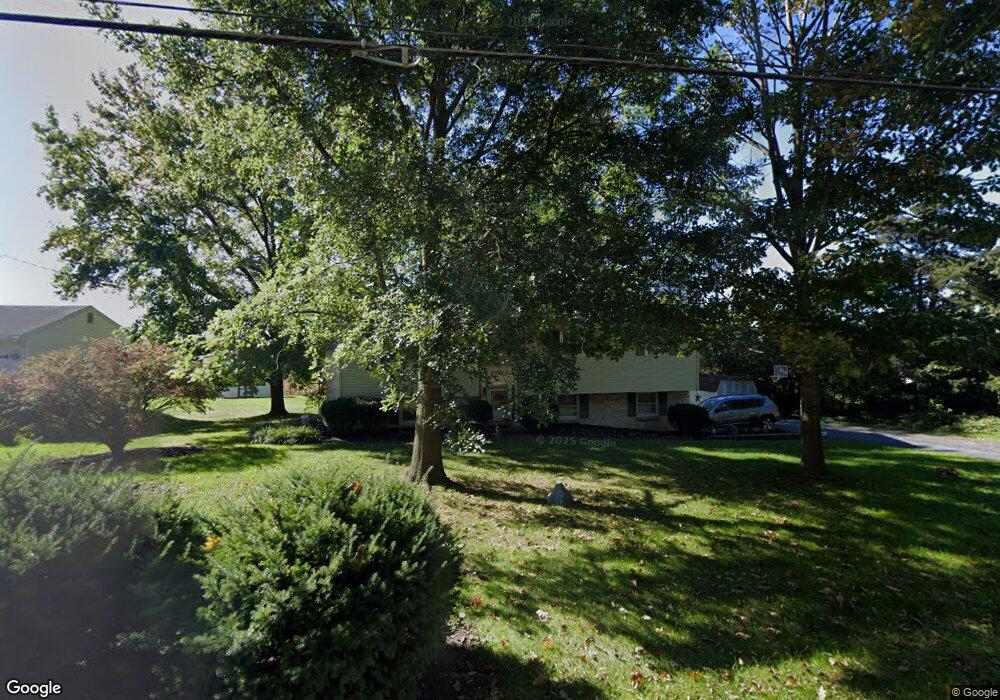
283 Snyder Rd Mount Joy, PA 17552
Estimated Value: $260,000 - $376,000
3
Beds
2
Baths
1,332
Sq Ft
$248/Sq Ft
Est. Value
About This Home
This home is located at 283 Snyder Rd, Mount Joy, PA 17552 and is currently estimated at $329,777, approximately $247 per square foot. 283 Snyder Rd is a home located in Lancaster County with nearby schools including Donegal Intermediate School, Donegal High School, and KELLY SCHOOL.
Ownership History
Date
Name
Owned For
Owner Type
Purchase Details
Closed on
Nov 14, 2017
Sold by
Miller Anne E
Bought by
Miller Joshua M
Current Estimated Value
Home Financials for this Owner
Home Financials are based on the most recent Mortgage that was taken out on this home.
Original Mortgage
$150,400
Outstanding Balance
$126,028
Interest Rate
3.85%
Mortgage Type
New Conventional
Estimated Equity
$203,749
Purchase Details
Closed on
Oct 21, 2008
Sold by
Davis Gregg and Davis Laura M
Bought by
Miller Ann E
Home Financials for this Owner
Home Financials are based on the most recent Mortgage that was taken out on this home.
Original Mortgage
$20,000
Interest Rate
6.08%
Mortgage Type
Purchase Money Mortgage
Create a Home Valuation Report for This Property
The Home Valuation Report is an in-depth analysis detailing your home's value as well as a comparison with similar homes in the area
Home Values in the Area
Average Home Value in this Area
Purchase History
| Date | Buyer | Sale Price | Title Company |
|---|---|---|---|
| Miller Joshua M | $188,000 | None Available | |
| Miller Ann E | $176,000 | None Available |
Source: Public Records
Mortgage History
| Date | Status | Borrower | Loan Amount |
|---|---|---|---|
| Open | Miller Joshua M | $150,400 | |
| Previous Owner | Miller Ann E | $20,000 |
Source: Public Records
Tax History Compared to Growth
Tax History
| Year | Tax Paid | Tax Assessment Tax Assessment Total Assessment is a certain percentage of the fair market value that is determined by local assessors to be the total taxable value of land and additions on the property. | Land | Improvement |
|---|---|---|---|---|
| 2025 | $4,380 | $171,600 | $48,300 | $123,300 |
| 2024 | $4,380 | $171,600 | $48,300 | $123,300 |
| 2023 | $4,364 | $171,600 | $48,300 | $123,300 |
| 2022 | $4,245 | $171,600 | $48,300 | $123,300 |
| 2021 | $4,079 | $171,600 | $48,300 | $123,300 |
| 2020 | $4,079 | $171,600 | $48,300 | $123,300 |
| 2019 | $4,077 | $171,600 | $48,300 | $123,300 |
| 2018 | $2,989 | $171,600 | $48,300 | $123,300 |
| 2017 | $4,174 | $144,200 | $40,500 | $103,700 |
| 2016 | $4,102 | $144,200 | $40,500 | $103,700 |
| 2015 | $863 | $144,200 | $40,500 | $103,700 |
| 2014 | $3,046 | $144,200 | $40,500 | $103,700 |
Source: Public Records
Map
Nearby Homes
- 1140 Alden St
- Carter Plan at Florin Hill - Single Family
- Dundee Plan at Florin Hill - Single Family
- Marlow Plan at Florin Hill - Single Family
- Elgin Plan at Florin Hill - Single Family
- Andover Plan at Florin Hill - Single Family
- Anders Plan at Florin Hill - Single Family
- Darby Plan at Florin Hill - Single Family
- Arundel Plan at Florin Hill - Single Family
- Bromley Plan at Florin Hill - Single Family
- Helston Plan at Florin Hill - Single Family
- 202 Alden St Unit 198
- 1138 Alden St
- 104 Merchant Ave Unit ANDOVER
- 104 Merchant Ave Unit MARLOW
- 104 Merchant Ave Unit ELGIN
- 104 Merchant Ave Unit DUNDEE
- 104 Merchant Ave Unit ANDERS
- 104 Merchant Ave Unit ARUNDEL
- 104 Merchant Ave Unit CARTER
- 271 Snyder Rd
- 299 Snyder Rd
- 245 Snyder Rd
- 231 Snyder Rd
- 1205 Wissler Ln
- 1211 Wissler Ln
- 000 Snyder Rd
- 1217 Wissler Ln
- 1223 Wissler Ln
- 1229 Wissler Ln
- 1206 Wissler Ln
- 1212 Wissler Ln
- 1235 Wissler Ln
- 1218 Wissler Ln
- 1224 Wissler Ln
- 1241 Wissler Ln
- 175 Snyder Rd
- 180 Snyder Rd
- 1247 Wissler Ln
- 1230 Wissler Ln